
Muktinath - a sacred Hindu shrine
Feb 12, 2009 21:48:09 GMT
Post by spindrift on Feb 12, 2009 21:48:09 GMT
Twice I have trekked up to Muktinath (3,800m) from the ancient hamlet of Kagbeni (2,800m). Kagbeni is a village where three routes meet; one coming down from the Thorung La pass on the Annapurna Circuit, one going straight on into the kingdom of Lo Manthang and one going up the pilgrims' route to Muktinath.
Seven years ago when I first trekked in the area, there was no sign of motorized traffic and the paths were narrow but now a fragile road has been scraped into the steep hillsides which is liable to be washed away in the next monsoon and 4WDs and tractors rumble past disturbing the peaceful landscape. A landing site has been levelled for helicopters coming with pilgrims from India and Kathmandu. They stay an hour or so, look around and leave for safer, lower altitudes.
Before the road was built there was only one way for pilgrims to reach this holy shrine - by foot. The road ends when it reaches Muktinath village.
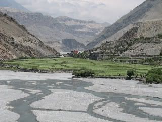
Let us begin our journey as we approach Kagbeni which is built just above the Kali Gandhaki river...
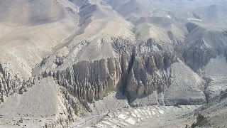
As we climb higher and look across the valleys, this view is typical of the landscapes around us.
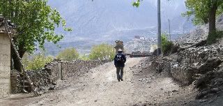
It's quite a struggle to walk uphill on our first trekking day...here is a picture of my friend. It is May and green leaves are on the trees; they won't last long - summers are short at this height.
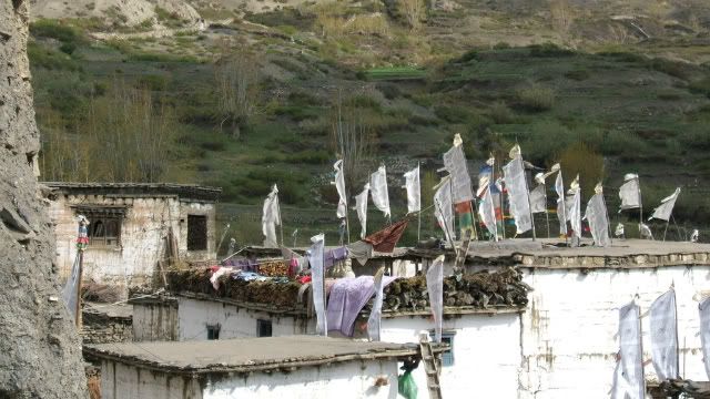
On our way, we pass the village of Jarkot
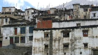
Here is a view of the roofs at Jarkot. These are Tibetan houses, for Tibet is not far way, and wood is collected and arranged in piles on the edges of the roofs, possibly to show everyone how rich the inhabitants are. This is relative in our terms but wood up at high altitudes is as precious as gold!
We stop for chai (tea) at any little hovel by the wayside and have a choice of either Tibetan tea which is made with the addition of rancid yak butter, or ordinary milk tea which is always sweetened with sugar that gives us extra strength to keep on climbing.
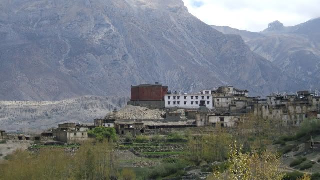
Far ahead we see the little hamlet of Muktinath..
(I have left some of the pictures larger - but still reduced - to better show the extraordinary landscape).
To be continued...
Seven years ago when I first trekked in the area, there was no sign of motorized traffic and the paths were narrow but now a fragile road has been scraped into the steep hillsides which is liable to be washed away in the next monsoon and 4WDs and tractors rumble past disturbing the peaceful landscape. A landing site has been levelled for helicopters coming with pilgrims from India and Kathmandu. They stay an hour or so, look around and leave for safer, lower altitudes.
Before the road was built there was only one way for pilgrims to reach this holy shrine - by foot. The road ends when it reaches Muktinath village.
Let us begin our journey as we approach Kagbeni which is built just above the Kali Gandhaki river...
As we climb higher and look across the valleys, this view is typical of the landscapes around us.
It's quite a struggle to walk uphill on our first trekking day...here is a picture of my friend. It is May and green leaves are on the trees; they won't last long - summers are short at this height.
On our way, we pass the village of Jarkot
Here is a view of the roofs at Jarkot. These are Tibetan houses, for Tibet is not far way, and wood is collected and arranged in piles on the edges of the roofs, possibly to show everyone how rich the inhabitants are. This is relative in our terms but wood up at high altitudes is as precious as gold!
We stop for chai (tea) at any little hovel by the wayside and have a choice of either Tibetan tea which is made with the addition of rancid yak butter, or ordinary milk tea which is always sweetened with sugar that gives us extra strength to keep on climbing.
Far ahead we see the little hamlet of Muktinath..
(I have left some of the pictures larger - but still reduced - to better show the extraordinary landscape).
To be continued...


