|
|
Post by mossie on Aug 28, 2015 14:18:14 GMT
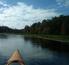
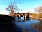
Orford is now a quiet little village being rapidly colonised by the nouveau riche. Once upon a time it was a thriving port, but has long been almost completely cut off from the sea by Orfordness, which is a long spit of land caused by the tidal drift of the shingle down the east coast. It has almost formed an island which is large enough to have held a WWI aerodrome, and, because of its remoteness,was leapt on by the government as a site for experimental work. The boffins who devised our radar were first exiled here and in later years the triggers for our nuclear weapons were developed. However the town had long had a military heritage, Henry II had a castle built around 1170 to keep a check on the Bigods who had built a large castle at nearby Framlingham. England at this time was really collection of feuding barons who were not really beholden to upstart kings. This is all a prelude to the Magna Carta in the next century which need not concern us here. 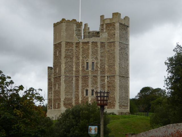 Some old ships cannon have been hauled out of the sea and positioned in front  It is many years since we explored this place with our children so I braved to worn stone stairways to have a look. 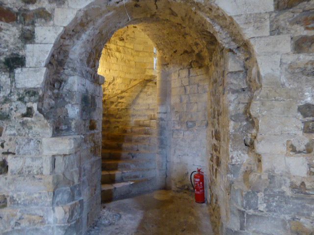 Actually I find it harder going down these old stairways 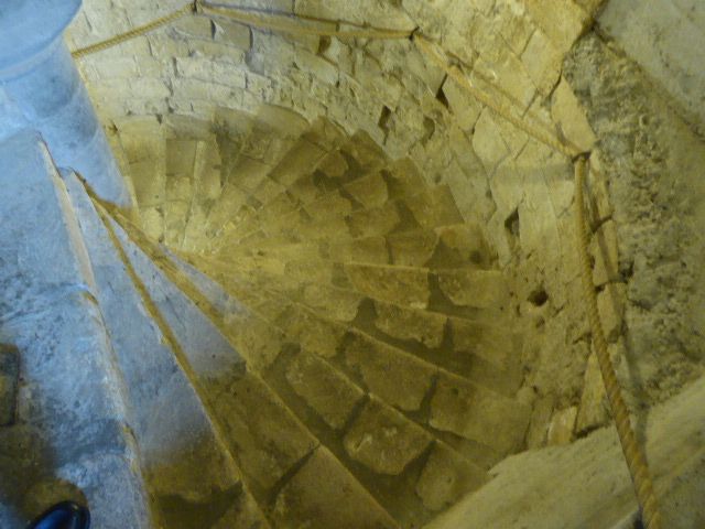 There is not a lot inside, collection of ancient bronze age stuff and this round table similar to King Arthurs for knights to be briefed at at to feast from 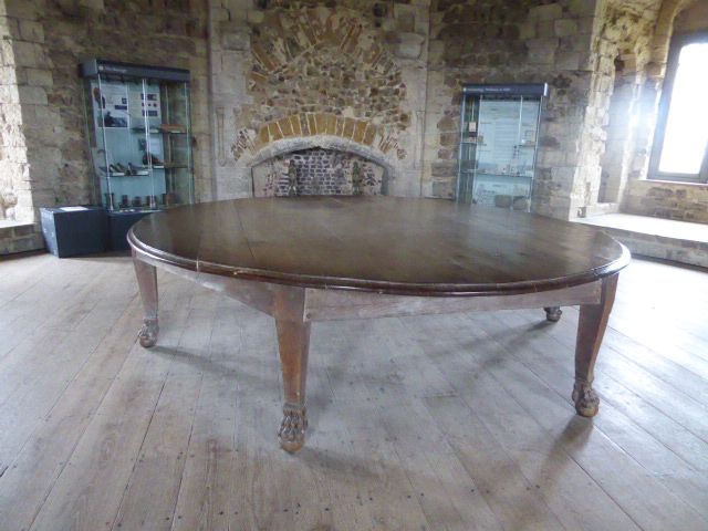 From the top is good view of the little town, and out to Orfordness across the river formed by the shifting coastline. 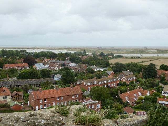 And out to the church, which is my next call 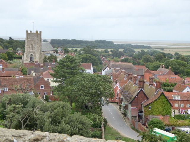 Cup of tea first |
|
|
|
Post by mossie on Aug 28, 2015 15:43:50 GMT
So, through the village to the church 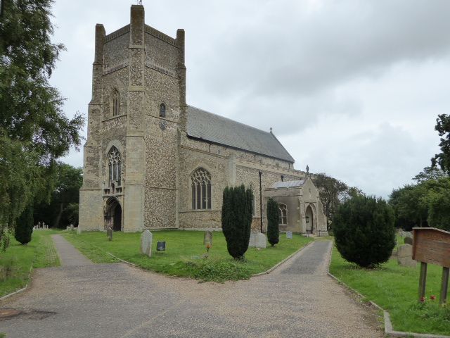 It was built about 1170, but then ruined possibly by one of the great storms experienced soon afterwards, and rebuilt from about 1120. Substantial remains of the original Norman building are still attached to the east end of the church. 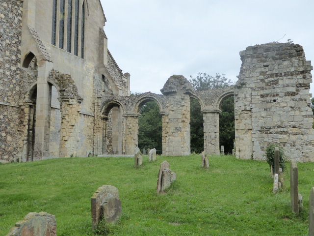 The Norman origins are obvious by the round arches 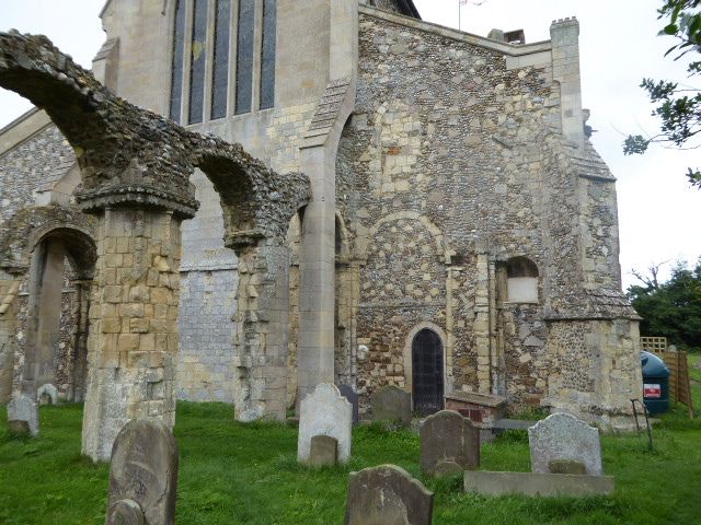 And here the new was grafted on 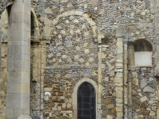 Inside is a good old font, not sure what the collection of toys represents, but guess there was a children's service. 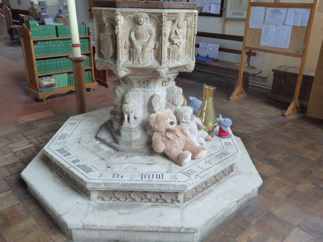 Round the font are representations of a lion and the Orford Merman 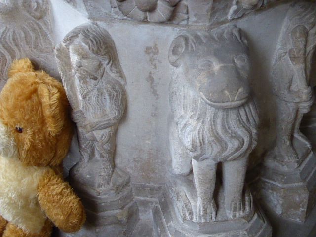 The Merman was reputedly caught in a net by local fisherman and confined in the castle. He refused to give his name even under torture, but ate anything offered to him. The river was closed by nets to allow him to swim but not escape, but he astonished to locals by easily swimming under the nets, but then returning, where he became a local curiosity. Eventually the novelty wore off and he was released back into the sea and swam away. I find it hard to keep a straight face but this was all reported in contemporary documents and promoted as gospel Elsewhere there is nice brass lectern 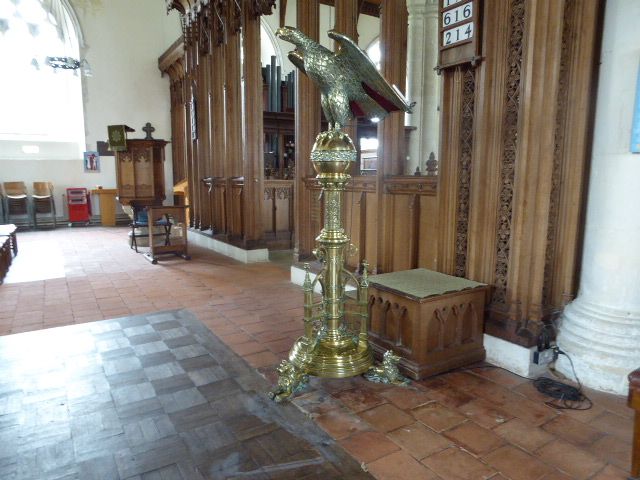 And a statuette of Noah releasing the dove in recognition of the premiere in this church of Benjamin Brittens, Noahes Fludde, a weird opera which is beyond me. 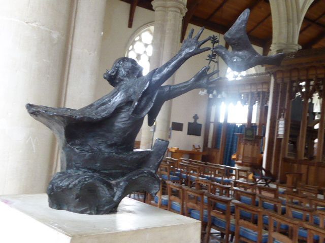 There is also a plaque let into the floor to commemorate the event. Britten was a local who was responsible for creating the opera house at Snape near by, he lived in Aldeborough just up the coast. 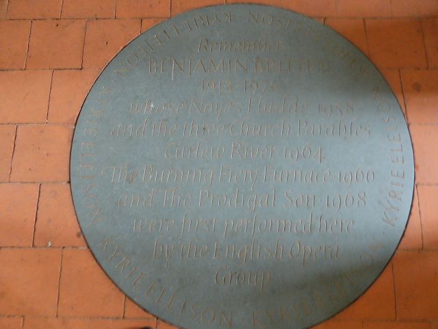 A view of the nave 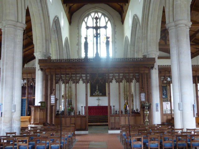 A walk round the back and then down to the quay 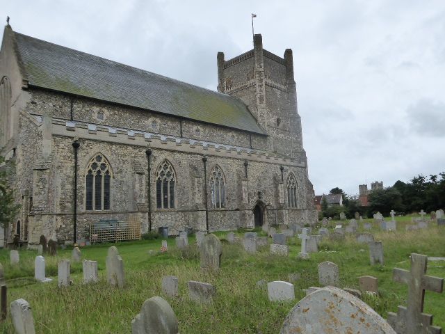 The quay has a landing stage for the ferry across to Orfordness and is home to a few pleasure and small fishing boats, whose produce can be pushed from huts there. 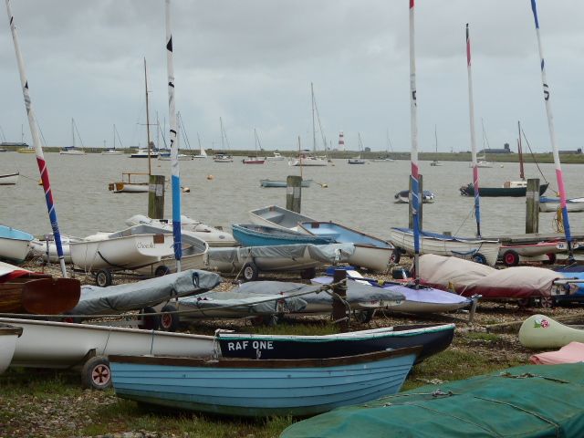 I remember using this quay when we were required to resurface some of the roads on Orfordness and the Ministry had an old tank landing craft to ferry our lorry loads of asphalt across. these strange cupolas were to contain any problems from devices being tested there and also housed men to plot the fall of small practise bombs on the RAF bombing range  Perhaps this gives a better idea 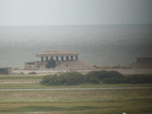 Otherwise Orford is a sleepy place with many fishermans cottages, now expensive and desirable holiday homes. 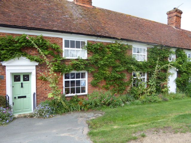 Notice how this row has been modified to join smaller places together to increase acommodation to suit modern tastes 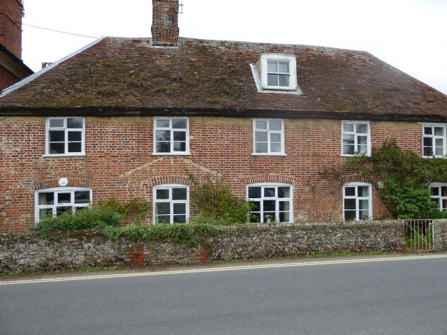 and there we had better leave Orford to sleep in peace |
|
|
|
Post by patricklondon on Aug 28, 2015 17:27:52 GMT
One of those "I must go there" places that I never get round to visiting (slap wrist time!). Pity you didn't enjoy Noye's Fludde. It's based on a mediaeval mystery play, with a lot of community participation, especially for children, and a lot less arch than some of his other things for children. Along with the Ceremony of Carols, it's about his most accessible work. My blog | My photos | My video clips"too literate to be spam" |
|
|
|
Post by bixaorellana on Aug 28, 2015 20:01:39 GMT
I do hope it gets to sleep in peace & not get discovered & artificially revived in peace.
Wonderful look at an ancient place, Mossie. The view from the tower is particularly interesting, as it illustrates the original tactical importance of the tower and also what you told us about the silting in & being cut off from the sea.
I recently had occasion to ascend and descend one of those coiled stone staircases: ditto what you said about descending.
Your visits to these small towns are most enjoyable. Are they mostly within an hour or two driving time from where you live?
|
|
|
|
Post by htmb on Aug 28, 2015 20:20:25 GMT
Very nice and quite interesting, Mossie.
The brass lectern in the church appears to be almost exactly the same as one of the Episcopal churches here.
Was the merman supposed to have a tail or regular legs?
|
|
|
|
Post by mossie on Aug 29, 2015 7:47:02 GMT
I made a typo writing about the church. It was built about 1170, and rebuilt about 1220, and much modified in later years, but the Norman heritage is still obvious in places.
These little places are under an hours drive from home.
And yes, the merman had legs. These tales get embroidered over time, especially in the good old days when superstition and suspicion was rife.
|
|
|
|
Post by bixaorellana on Aug 29, 2015 17:00:30 GMT
It's obvious to me that the merman was a time traveler from at least the 20th century, dressed in a wet suit which helped him withstand torture. Probably he was decompressed too rapidly when brought up in the net and simply couldn't remember his name. Ah, the old days: "Here's a stranger -- let's torture him!"
|
|
|
|
Post by nycgirl on Sept 1, 2015 12:50:11 GMT
Orford looks like a quaint little place. I like the view of it from the top of the old fort.
|
|
|
|
Post by Deleted on Sept 10, 2015 5:43:18 GMT
A lot of very nice photos of a place that looks almost too tidy, so I can see the attraction for the nouveaux riches -- a nice little blend of historical places and plenty of comfortable houses in which to live! And of course being on the coast is a plus.
Most of the boats in the bay still look modest, but I expect that the fishing boats will soon be replaced by yachts.
|
|
|
|
Post by mossie on Sept 22, 2015 18:47:55 GMT
I have at last done what should have been with the original post, copied a map of the area. Orford lays centre right and the shingle spit of Orfordness snakes down the left side. This shows how the River Alde was abruptly cut off by the shifting coastline, and how Orford lost its good sea approach, rendering the port unusable except by small boats. Note the fan shaped lines at the widest part of the Ness. This shows where the top secret U.S. radar Cobra Mist, was laid out. This was intended to track Russian Aircraft and missiles at very long range and to see over the horizon. Unfortunately sea returns blotted out the hoped for target returns. AT the centre left is the airfield called Benwaters and near the bottom left is Woodbridge. These formed a large U.S. base which housed part of their nuclear deterrent. The runway at Woodbridge was three times normal width having been built during the war as an emergency landing field for aircraft with damage or short of fuel returning from raids over the continent. Bentwaters was also built during the war and housed a USAF fighter group, escorting their bombers in raids on the continent. The name Bentwaters came because of the winding Butley River nearby. Anyhow, here is the map 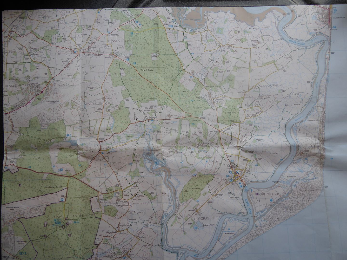 |
|
|
|
Post by bixaorellana on Sept 22, 2015 21:21:08 GMT
Do the green parts of the map indicate marshland?
Mossie, did you ever visit this area or others you cover in decades past? If so, it would be interesting to hear how they've changed.
|
|
|
|
Post by mossie on Sept 23, 2015 18:48:56 GMT
The green areas are woods, the marshland is close to the big river with a lot of thin blue drainage ditches.
|
|
|
|
Post by mossie on Sept 23, 2015 19:13:17 GMT
To continue, I went to Aldeburgh this morning and found this rather neglected explanatory sign on the beach. It shows how Orfordness developed over the centuries 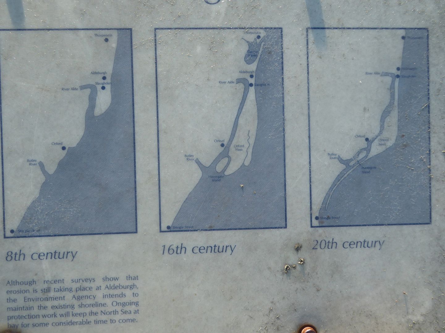 I had started down at the place where the River Alde used to join the sea, until the shingle spit cut it off. On the extreme left is the open sea, while on the right is the River Alde, now a pleasure boat haven. 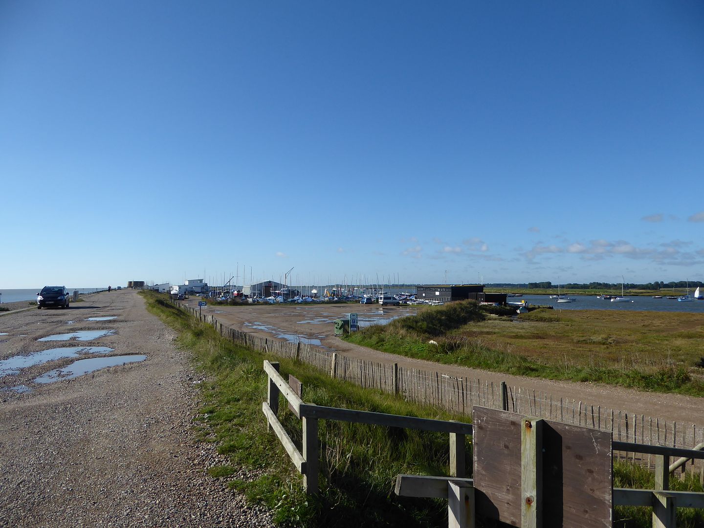 Here are the big boys toys 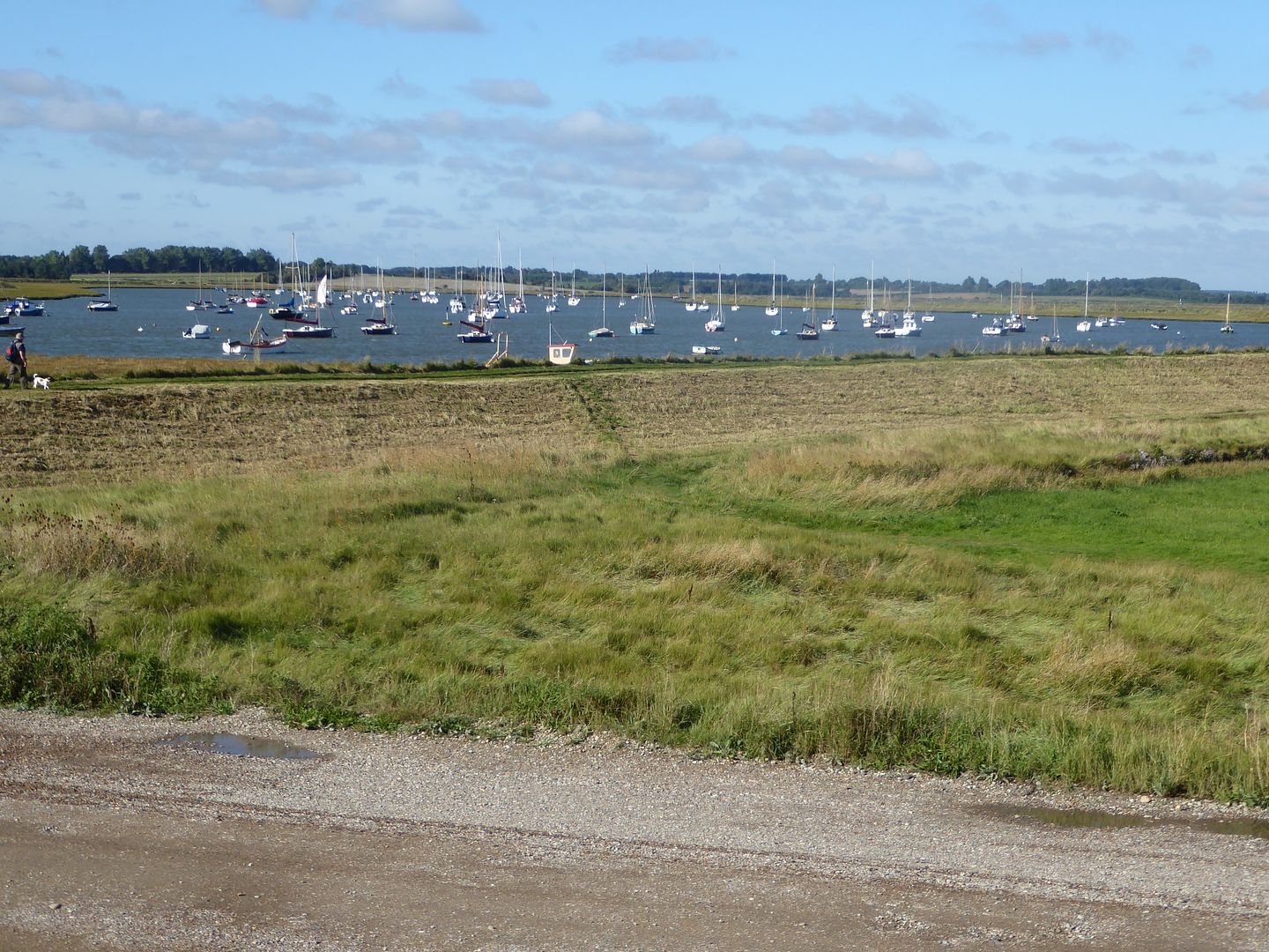 Now walking up to Aldeburgh the old lighthouse, the posh Brudenell Hotel and a fancy block of flats come into view 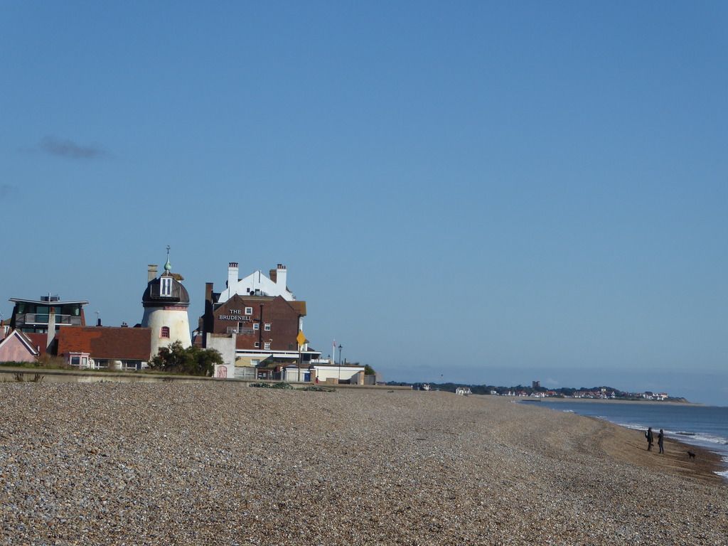 Now I get to the centre of the town 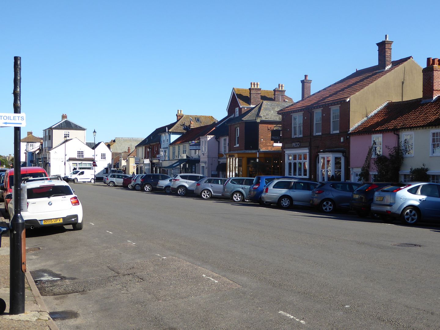 It is well served by "fish and chip" shops 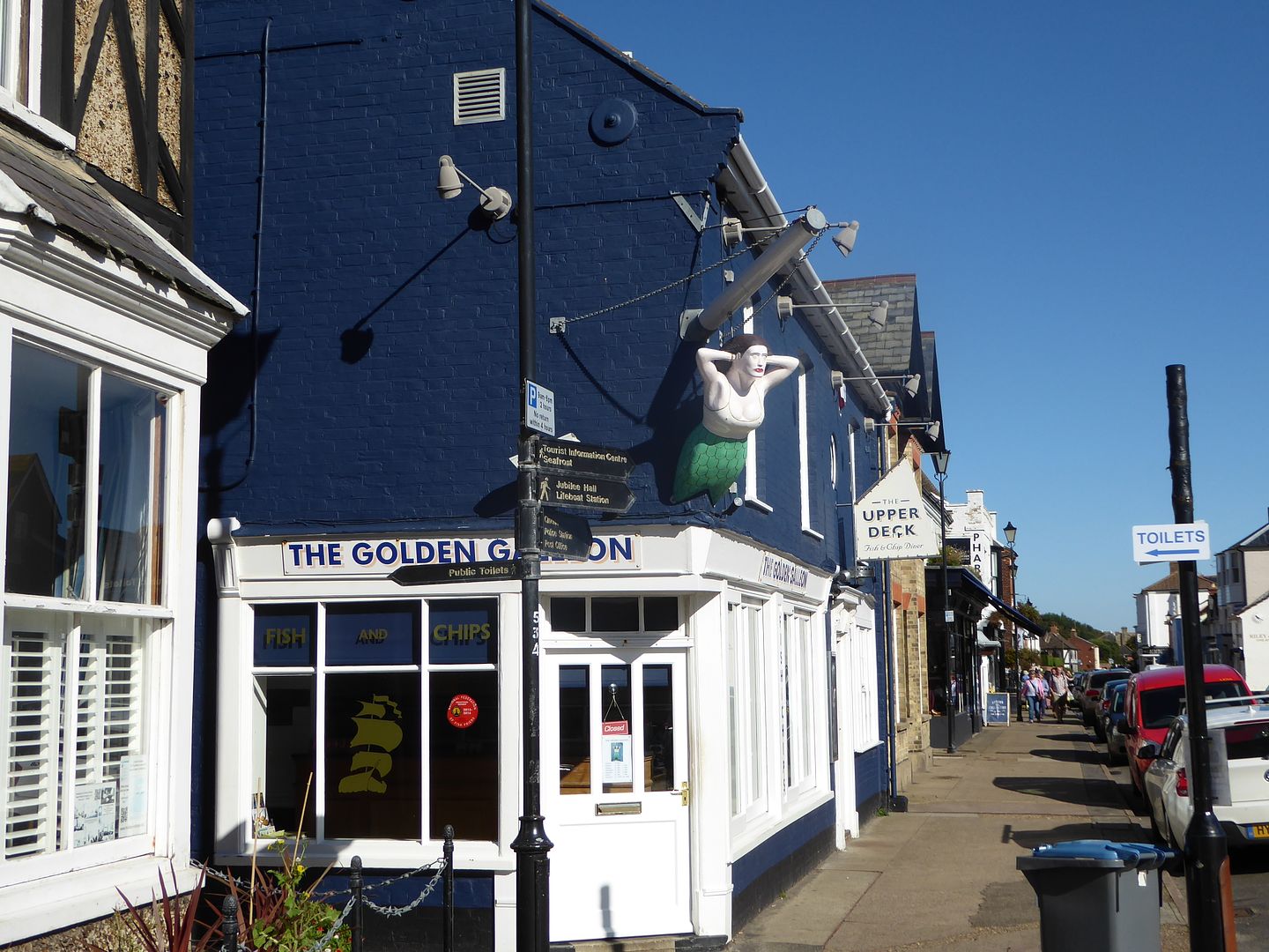 But this one is the grandaddy, having been nominated as the best fish and chip shop in England. They are of course served by relatives who operate fishing boats off the beach only yards from their doors Here is a colourful example  And some more  And more, with the nuclear power station at Sizewell, sizzling away in the background 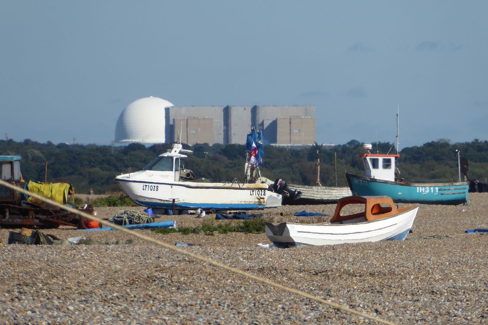 It is easy to buy a good selection of fish from huts along the beach 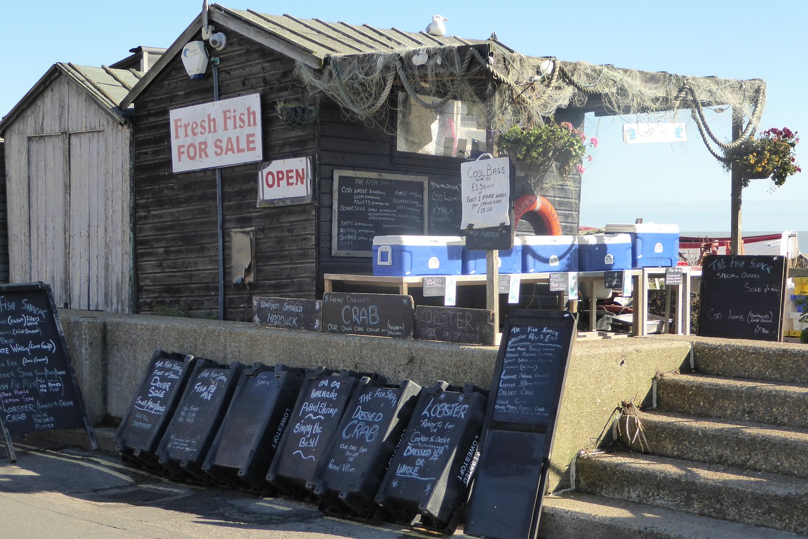 We had an old boy when I was young who used to come up from our local fishing port selling from his van "Fresh coached today, ma'am" he would shout out 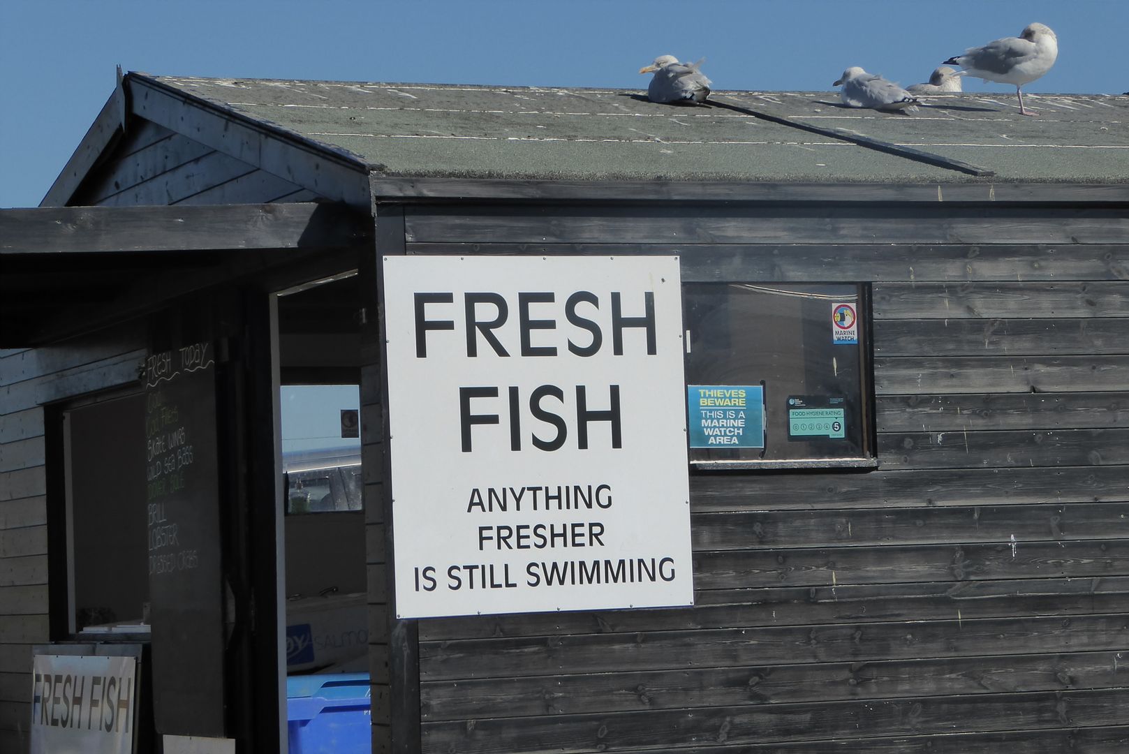 They even smoke them there, in preference to cigarettes 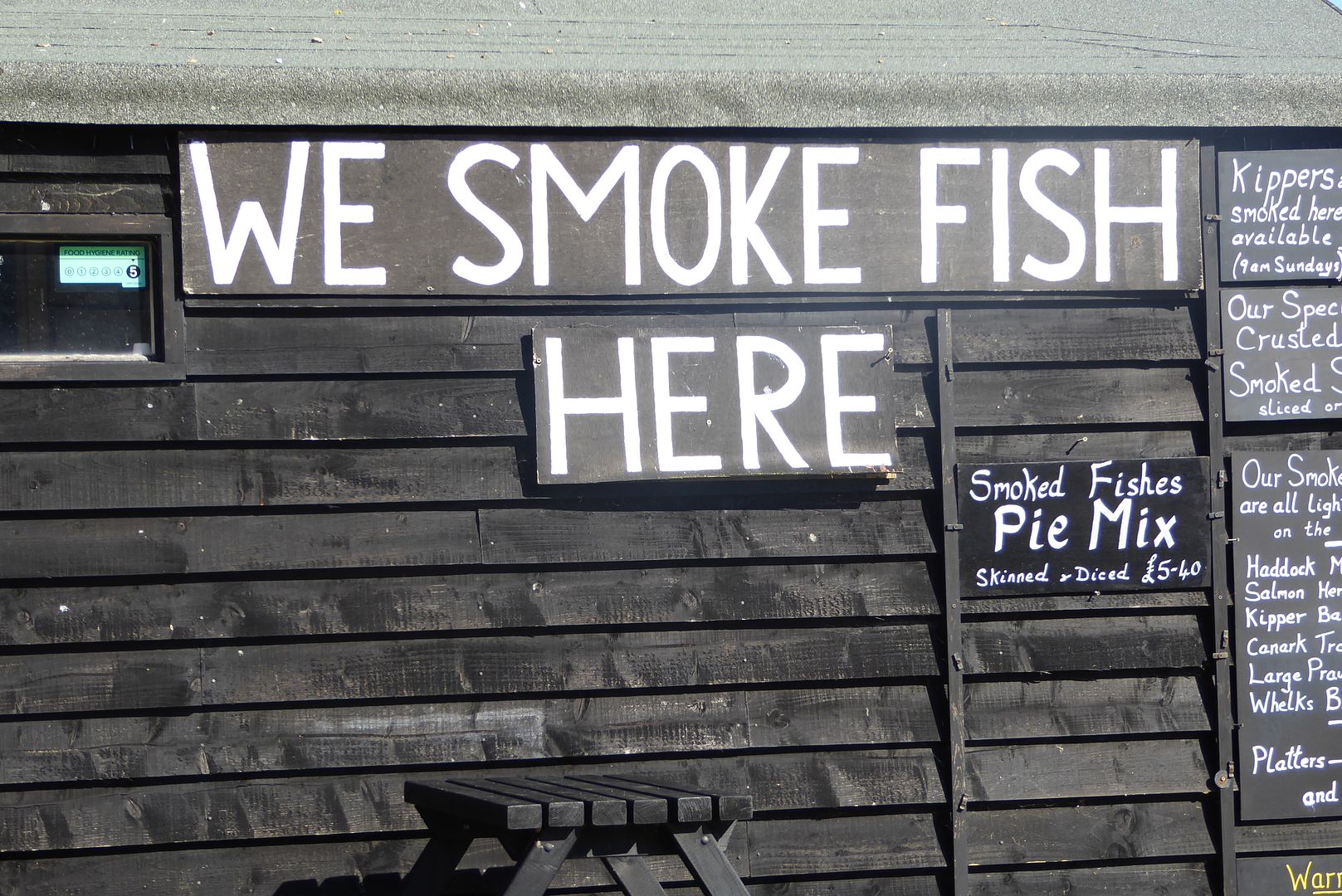 I'll give you rest now , but there will be more to follow, not fishy. |
|
|
|
Post by mossie on Sept 23, 2015 19:19:02 GMT
Sorry for repeating a snap, this new improved? Any port won't let me change it. Here is the one I intended 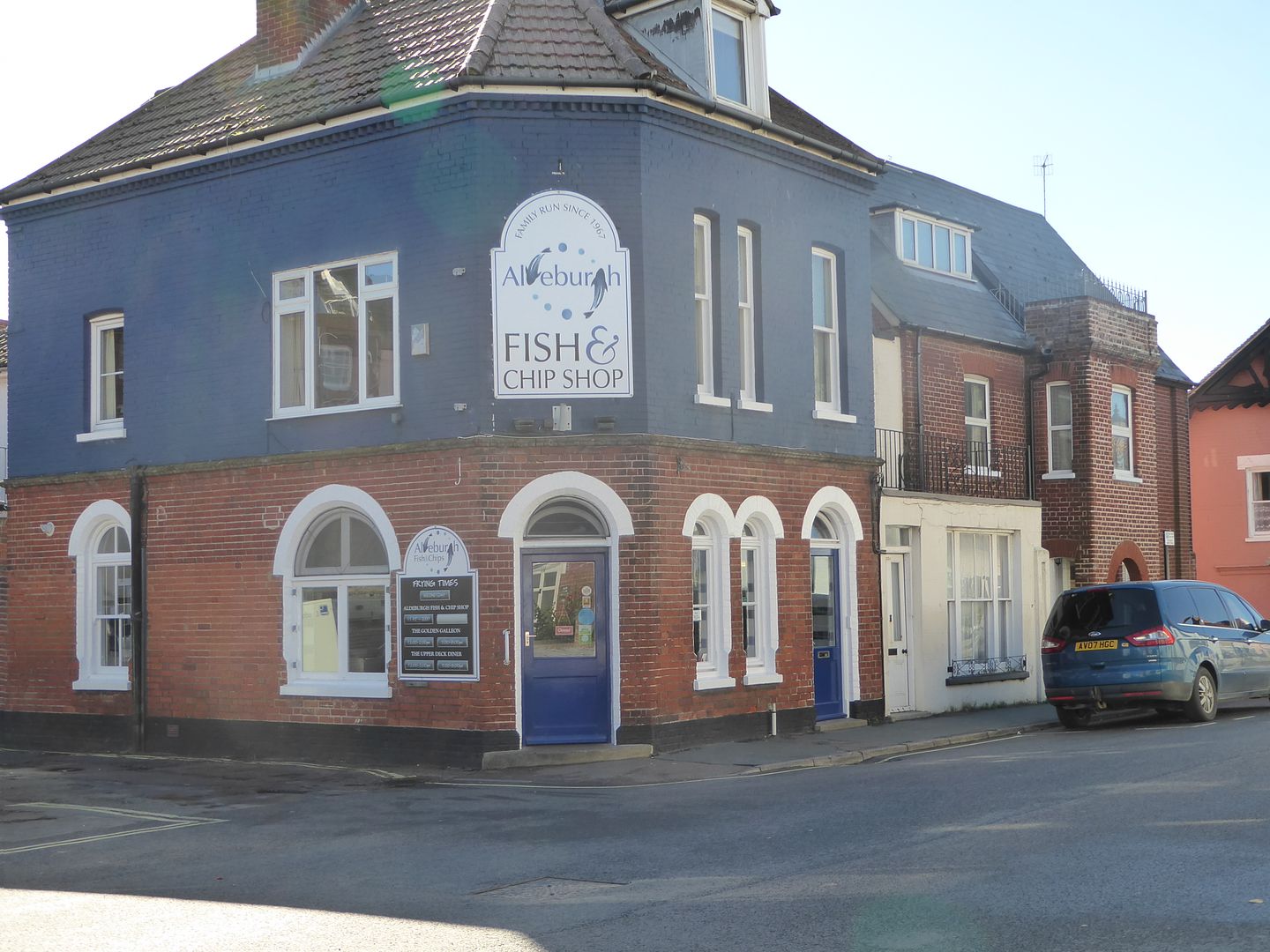 |
|
|
|
Post by mossie on Sept 25, 2015 14:03:46 GMT
You know me, I can't visit one of these old towns without a look at the church. Time was running short so it was a brief visit. It is a fairly standard medaeival English church, built mostly in the 1500's, but seriously Victorianised which spoils the character of a lot of our churches of this period. 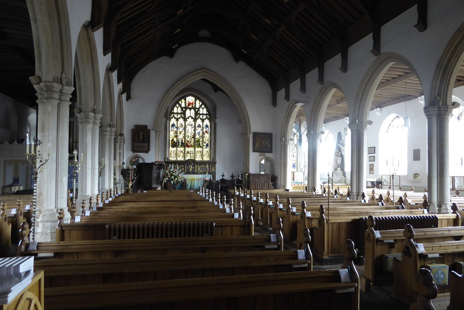 Here, for htmb, is the brass lectern, which is quite a common item in these churches. 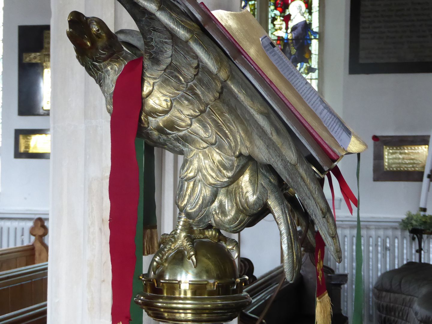 There is a very nicely carved pulpit 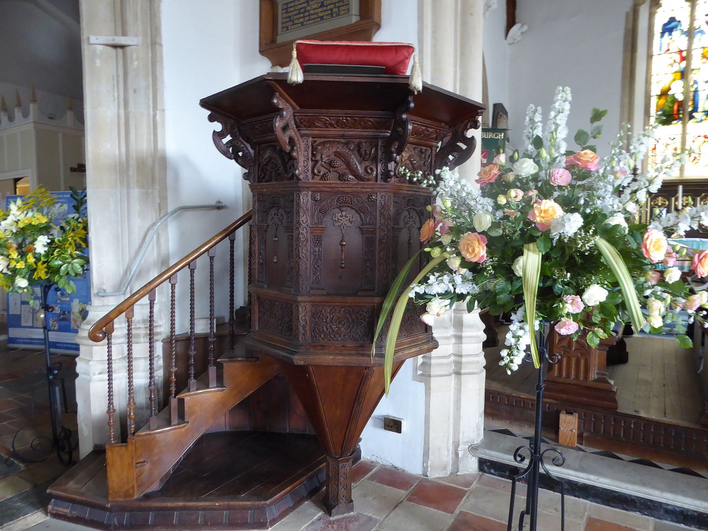 and altar rails 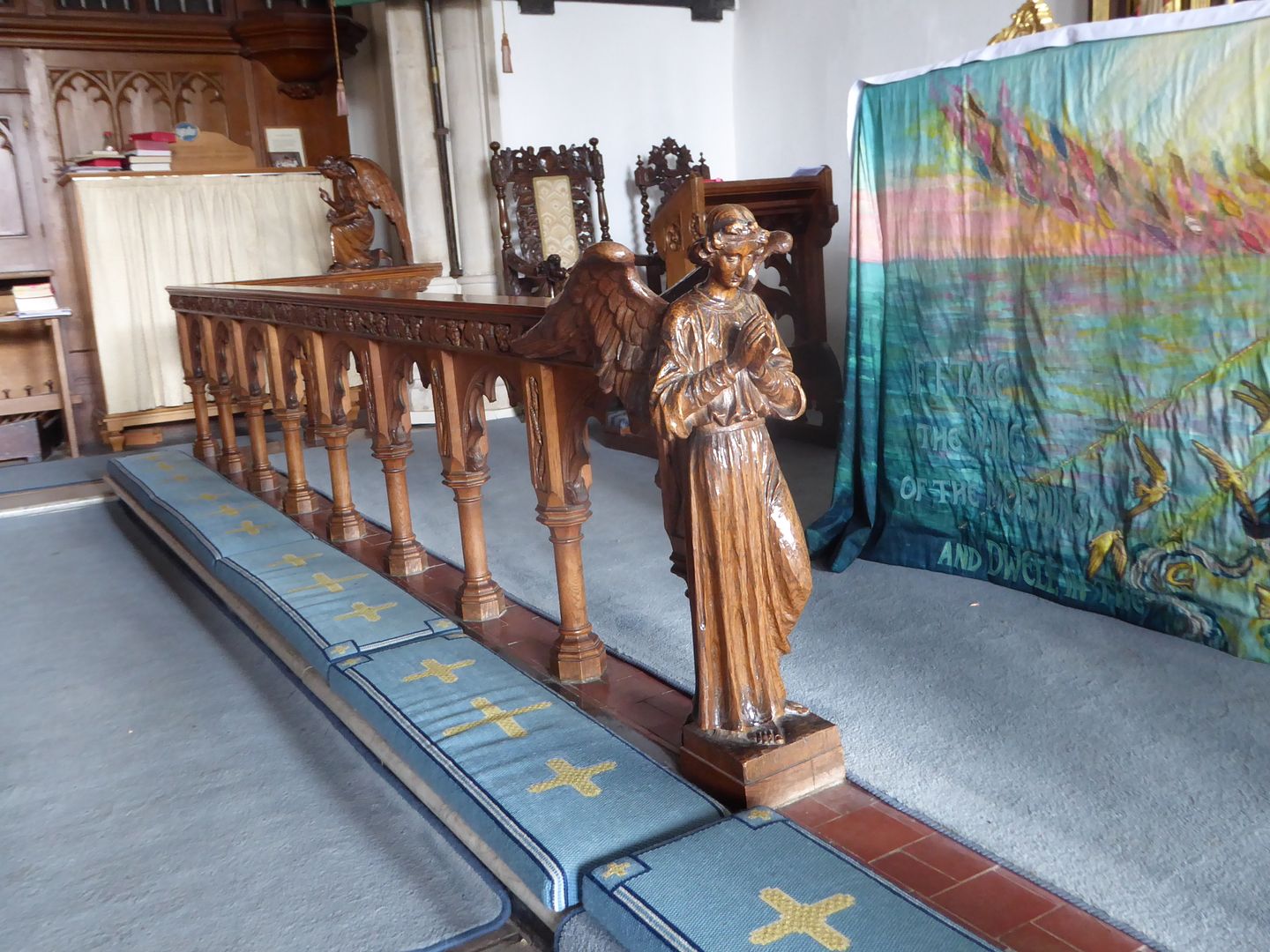 Now some general snaps. A roe of what were once cottages, again posh holiday homes 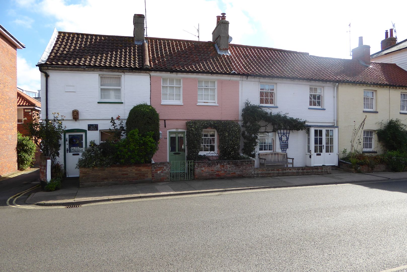 I have commented before about older houses being reformatted to appear grander that they really are. Here is a prime example 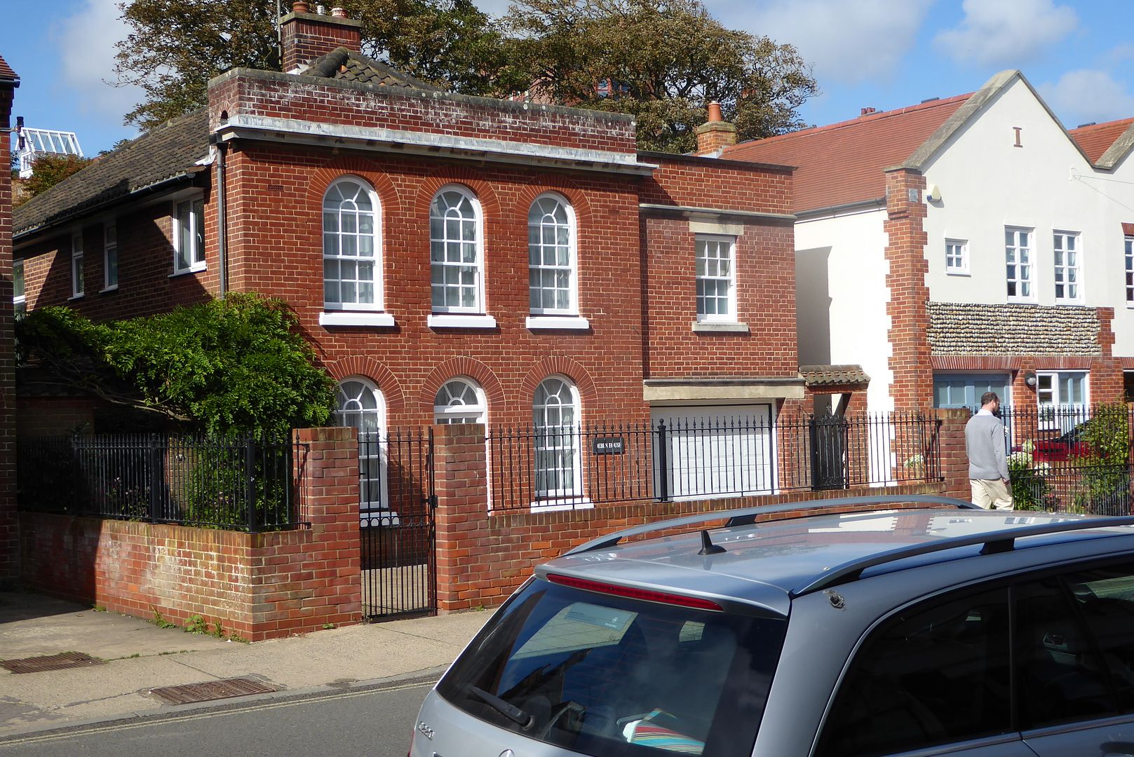 Now the lighthouse, a fancy restaurant  Now a real historic building. The Moot house, originally the town hall which stood in the centre of the town. Now it stands on the sea front, the town having been half swept away in storms and the debris washed down the coast to help form Orfordness 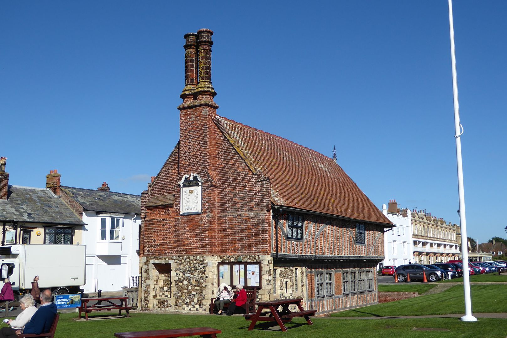 The sundial still gives the right time, although it is strictly GMT, no fancy daylight saving when this was made. 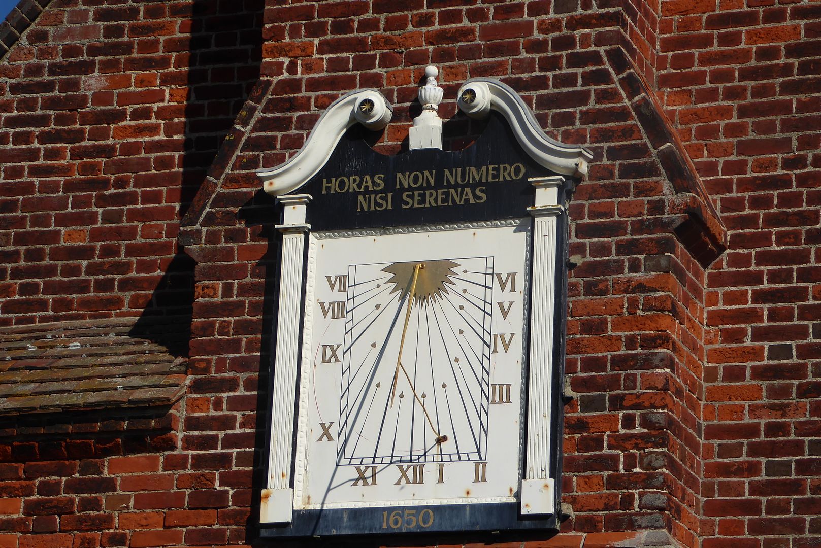 Just along the beach stands this object, an expensive creation by the 'artist' Maggi Hambling 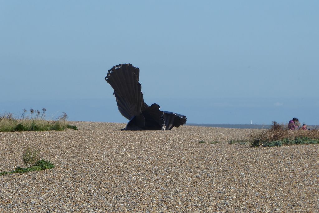 I'll end with a shot taken through an estate agents window of a common or garden house in a road some distance up the hill from the town. A similar house in Ipswich would be seriously less than half this price. the London effect is very strongly felt here, much to the disgust of some locals 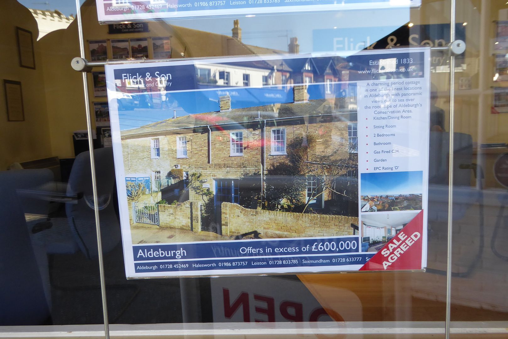 |
|
|
|
Post by bixaorellana on Sept 25, 2015 15:30:18 GMT
The town and the area are full of treasures & interests, but I can see how the direction it's taking will eventually kill its character. You mention the dismay of the locals. I visited Key West in the early 70s and again in the early 90s after it had been well & truly "discovered". There were no more locals, as they could no longer afford to live there. Thank goodness the fishermen of Orford are still there & working.
Wonderful report, Mossie. And I'm glad you keep visiting the churches, always a source of interesting architecture and details.
|
|
|
|
Post by lola on Sept 26, 2015 14:34:45 GMT
Great report, Mossie. Fine photos and narrative; we really get a sense of the place. I bet they do have interesting storms there. And that is some pricey real estate.
I'm happy to believe the merman story.
I'd like to see Noyes Fludde performed by local children, as in the Wes Anderson movie Moonrise Kingdom.
|
|
|
|
Post by lugg on Oct 3, 2015 8:57:36 GMT
Great report and photos Mossie, Aldeburgh and Orford look very nice indeed , but not 600K nice for a 2 bed terrace  I was intrigued by the sculpture , and discovered through power of wiki that it's a scallop dedicated to Benjamin Britten en.wikipedia.org/wiki/Maggi_Hambling |
|
|
|
Post by mossie on Oct 4, 2015 7:51:45 GMT
Thanks Lola and Lugg,.
The "scallop" has a quotation from Noyes Fludde cut into the top edge. If you can enlarge my snap you may make out some of the words.
|
|
|
|
Post by whatagain on Oct 4, 2015 10:02:36 GMT
Great report.
Makes me realize I don't go often enough in the UK.
|
|
|
|
Post by mossie on May 24, 2016 19:51:05 GMT
I have decided to tack this report on here because it continues the coastal erosion theme detailed here. I had long wanted to visit the ancient town of Dunwich, which lays a several miles further north, and took the opportunity today. I say town, in fact it is now only a hamlet, but 1,000 years ago was considered to be the 10th largest town in England. But practically all of it has been washed away by the sea, a continuing process which will possibly see the remaining vestiges of the old town disappear in years to come. The full story is told here, if anyone is interested. www.dunwich.org.uk , from where I have pinched this illustration 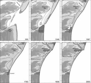 Folklore has it that if you stand on the shore on a day when the sea runs strong, you can hear the old church bells still tolling under the sea, where at least 4 churches are believed lie in ruins. The last to go went less than 100 years ago and is well illustrated in the website. One church remains 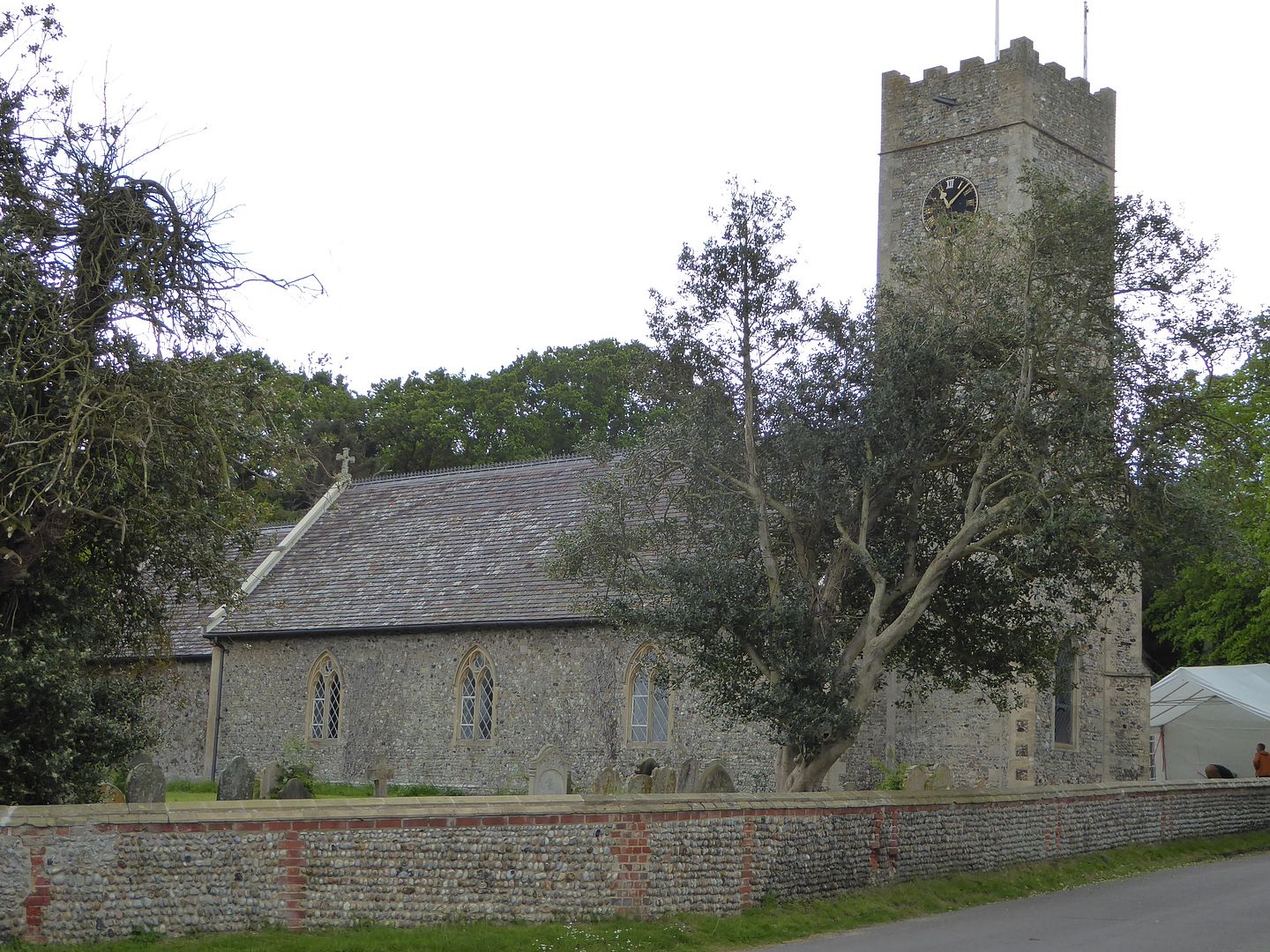 with the remains of the leper chapel beside 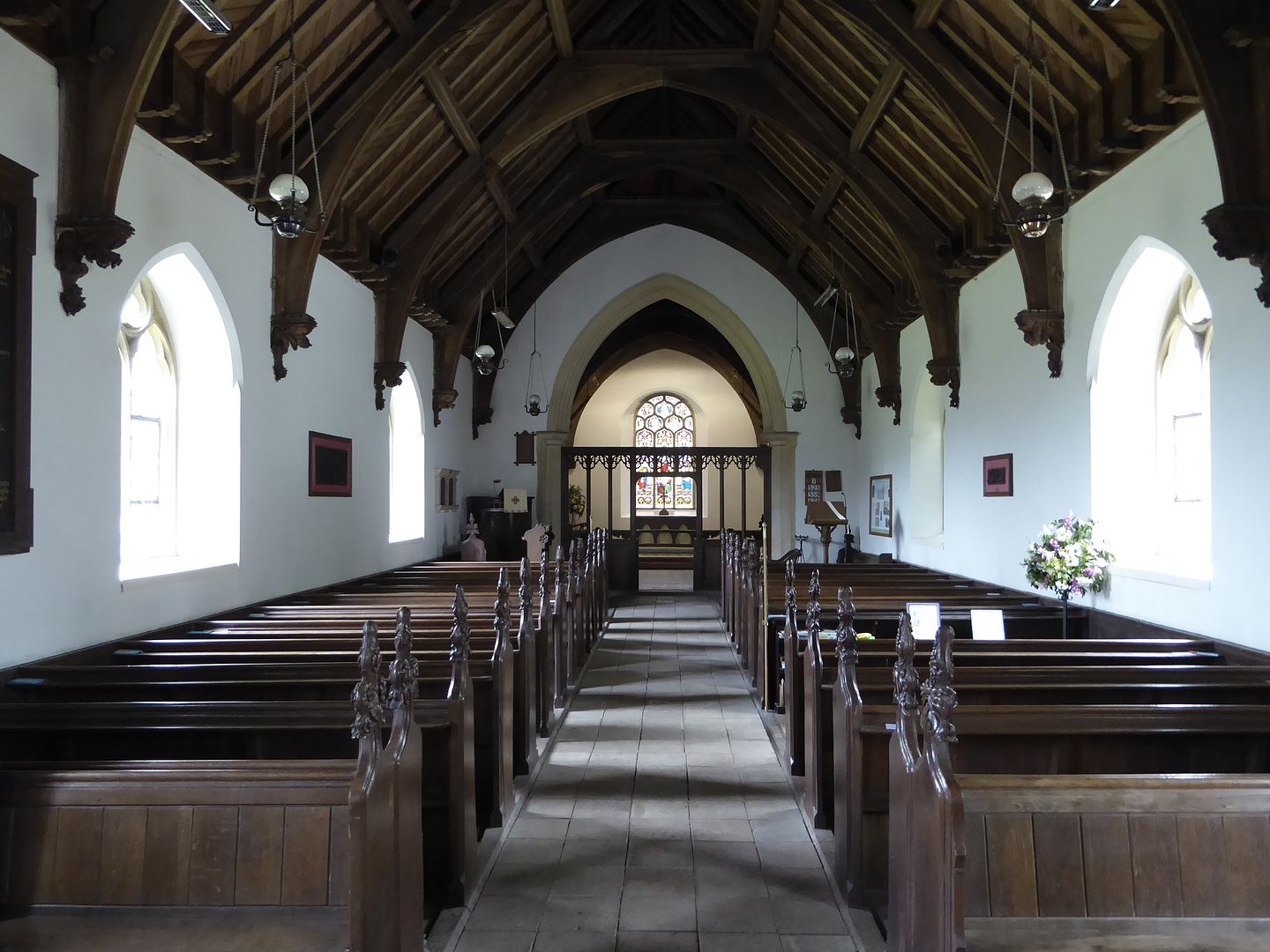 But the most significant remains are the old Priory 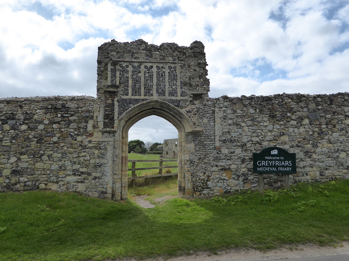 I'll leave you here and return tomorrow to complete my ramblings |
|
|
|
Post by htmb on May 24, 2016 21:33:25 GMT
Yes, more please.
|
|
|
|
Post by mich64 on May 24, 2016 23:19:06 GMT
Looking forward to tomorrow.
|
|
|
|
Post by Deleted on May 25, 2016 3:33:46 GMT
I hope you went diving to make a report on the underwater churches.
|
|
|
|
Post by bjd on May 25, 2016 5:37:56 GMT
I am so glad you revived this thread because I don't remember having seen it before. That southeastern coastal area of England looks nice, especially when the sun is shining. Of course, some colourful fishing boats always help.
It's too bad that so many of those small houses become holiday homes for the wealthy, but at least they are renovated and lived-in. I imagine, like in so many other places, there is not much work available and there are fewer fishermen, people leave and the villages go downhill.
|
|
|
|
Post by mossie on May 25, 2016 13:49:39 GMT
To carry on, I forgot to show you the Leper Chapel which sits beside the church 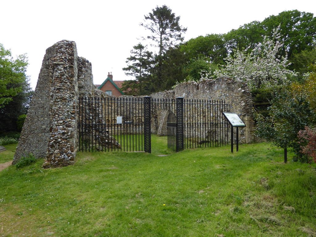 Now we return to the Friary, not priory as I mistakenly put earlier. This stands on top of the cliff which is eroded bit by bit by each winter storm, this cliff is just sand and shingle and cannot resist the waves. 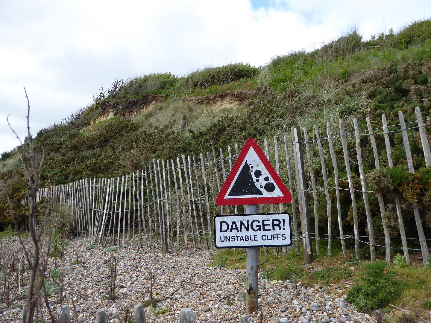 Here is another building? whose days are numbered 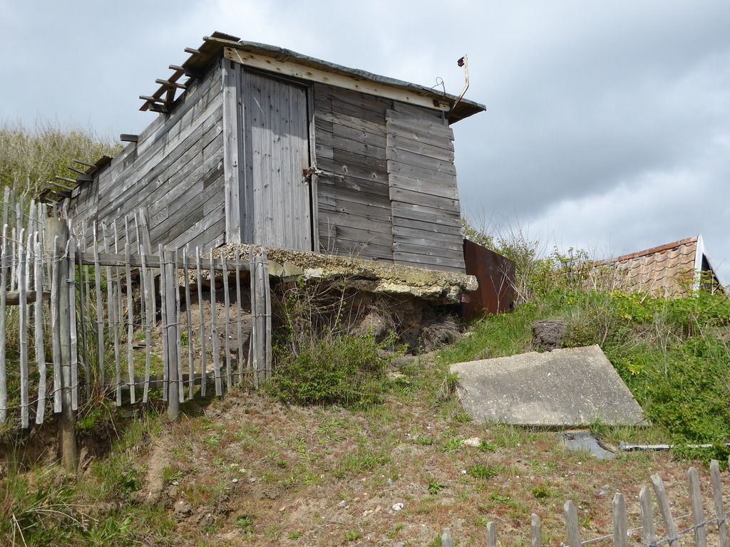 The Friary sits on a decent plot of land which originally had walls all round, but the seaward one is gradually disappearing over the edge This board on site shows how it was 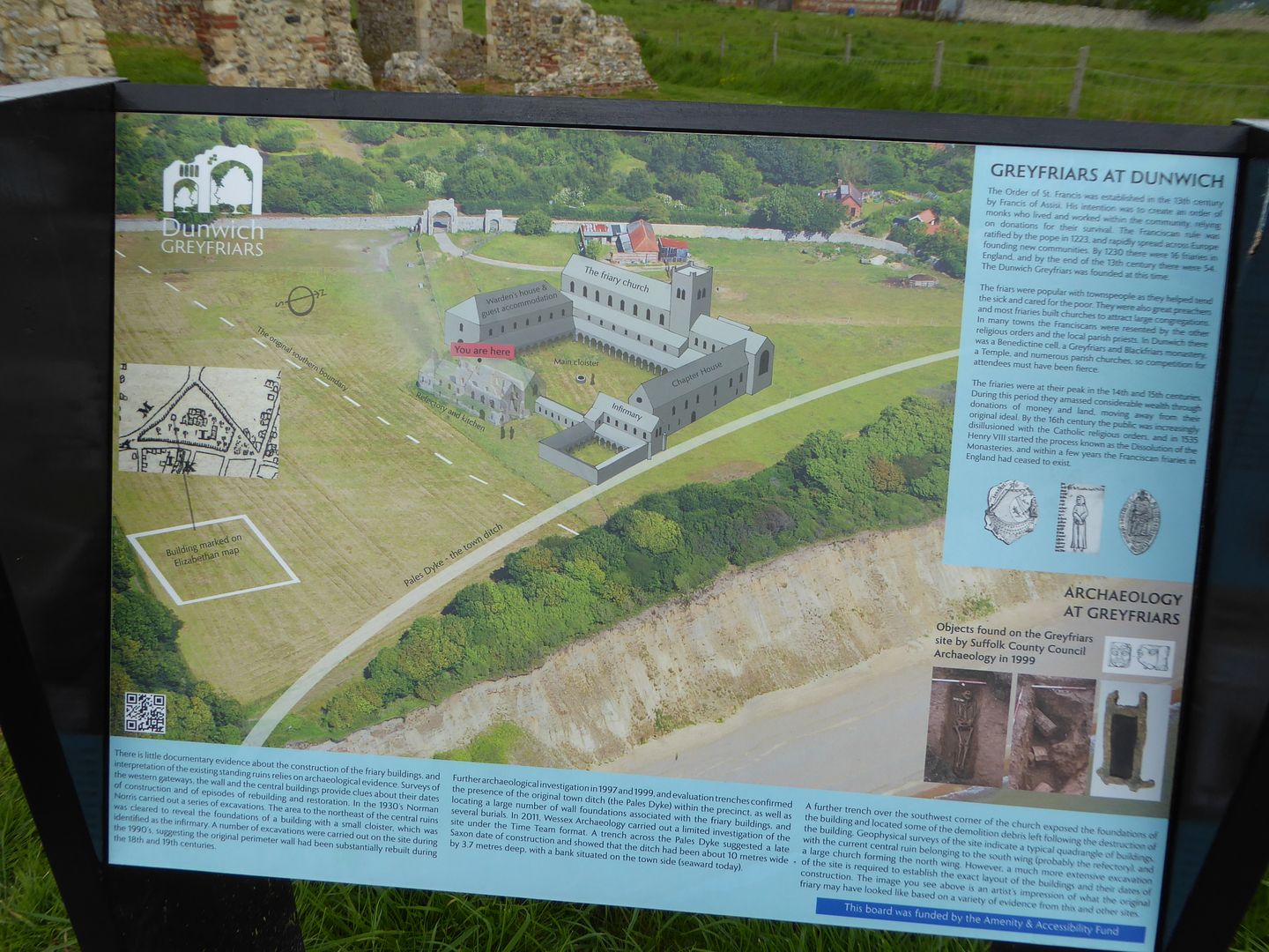 Here is the next section of wall waiting its fate 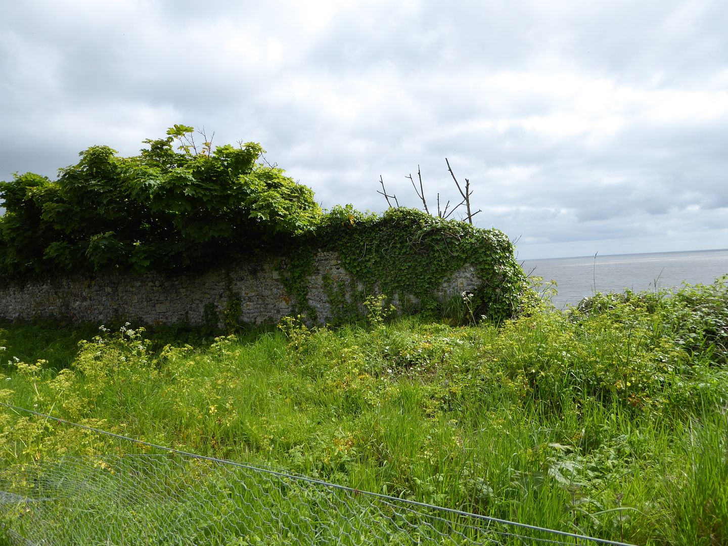 And here is the last grave from the church which once stood beside the wall, I hope you can read the notice which explains it, and heed the warning at the bottom The greedy sea awaits below 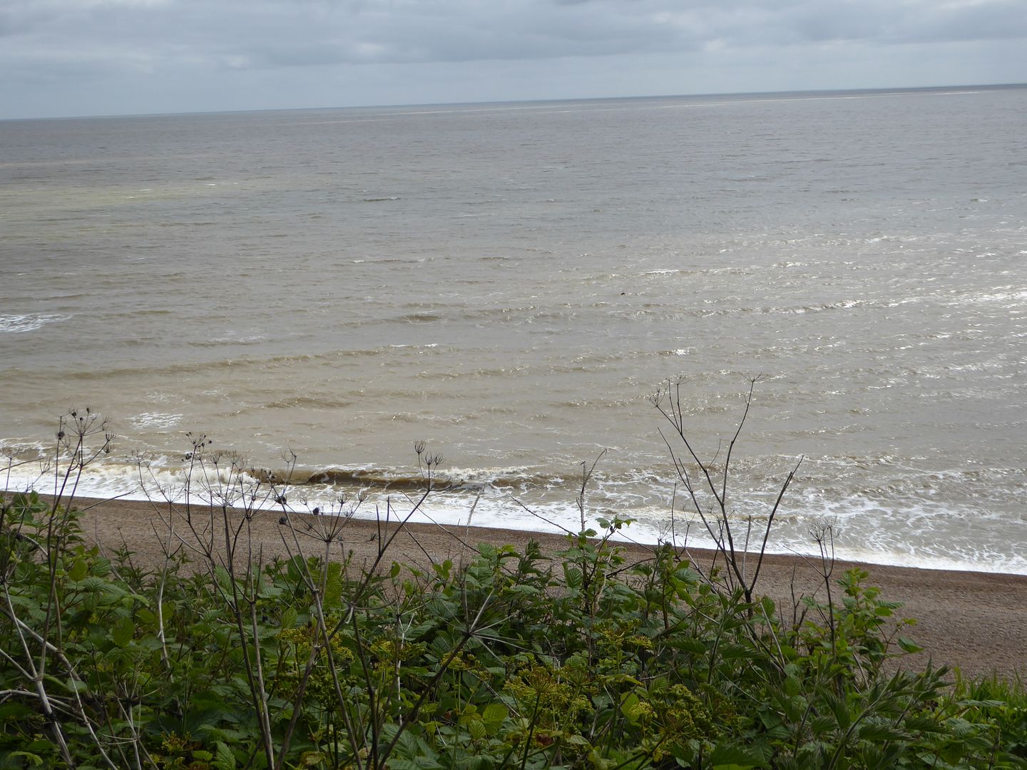 One day it will receive its meal 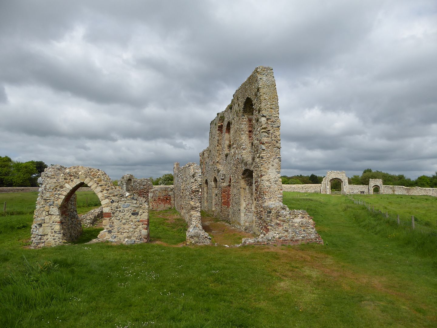 There is a vacant niche for a long departed saint 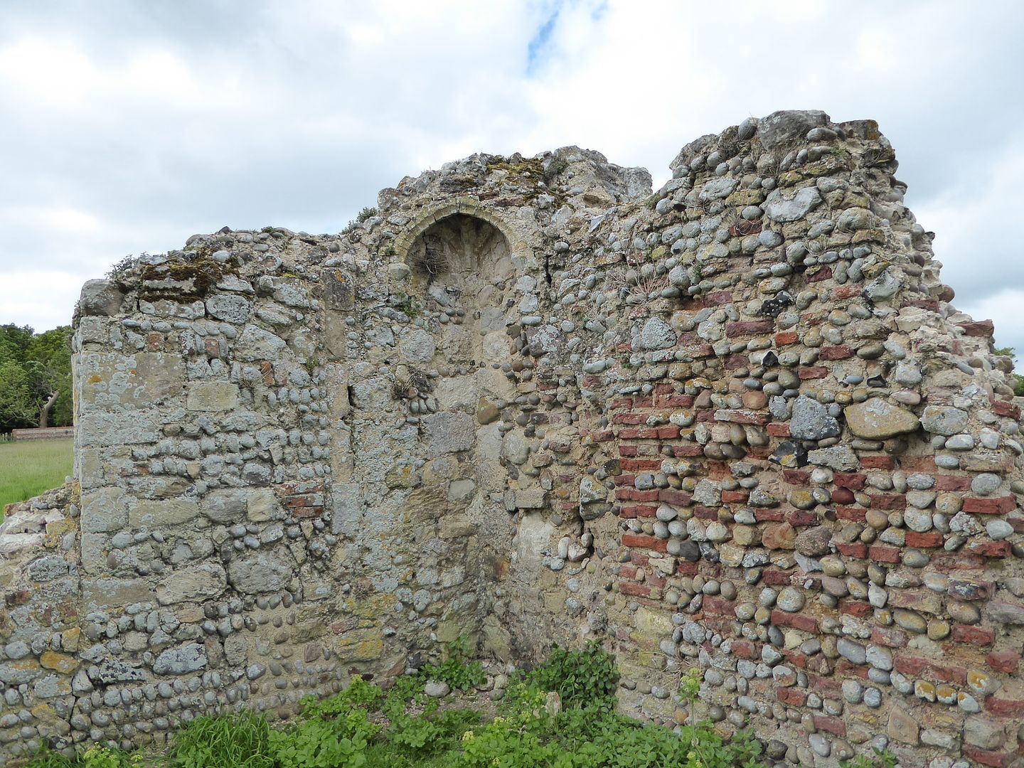 And the walls show a great variety of building materials and cobbled together repairs, note the odd Tudor bricks 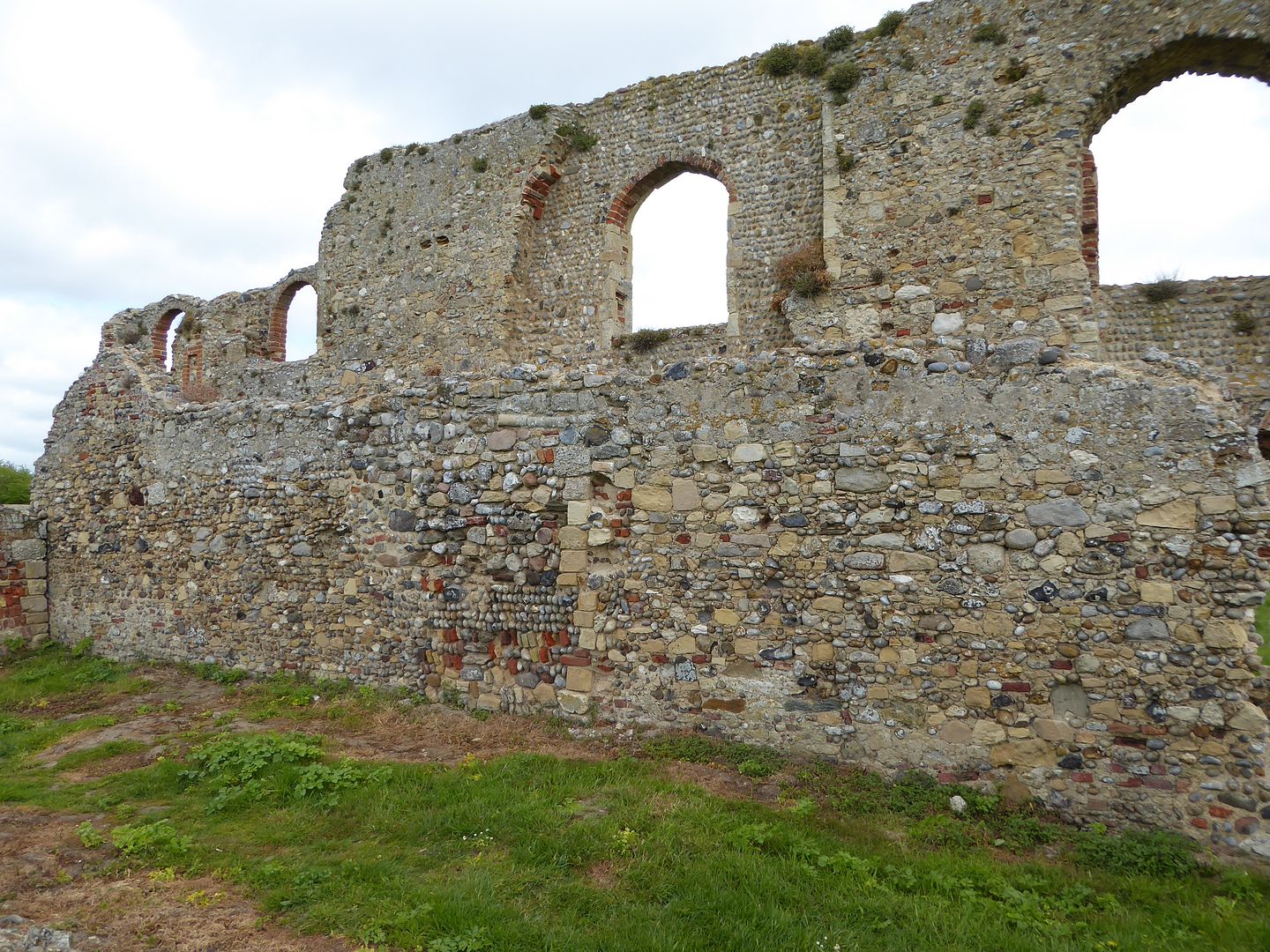 But enough of old ruins, I walked down to the car park and in the excellent cafe continued my own ruin 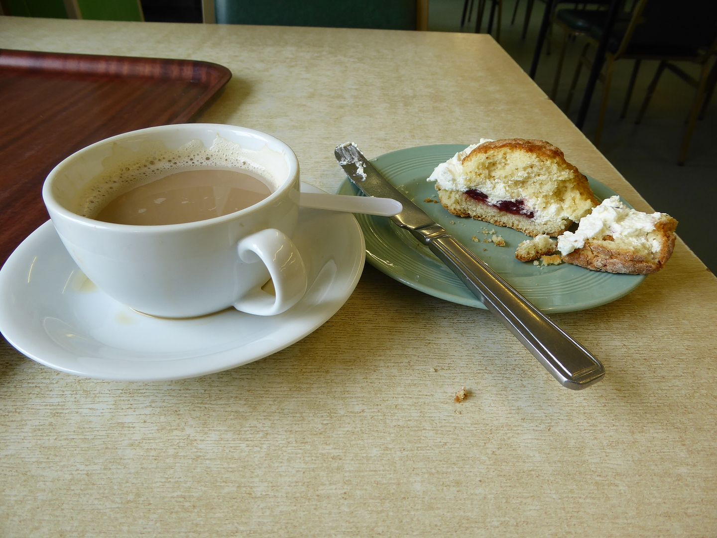 Then went in search of what is left of the village, starting with the essential pub 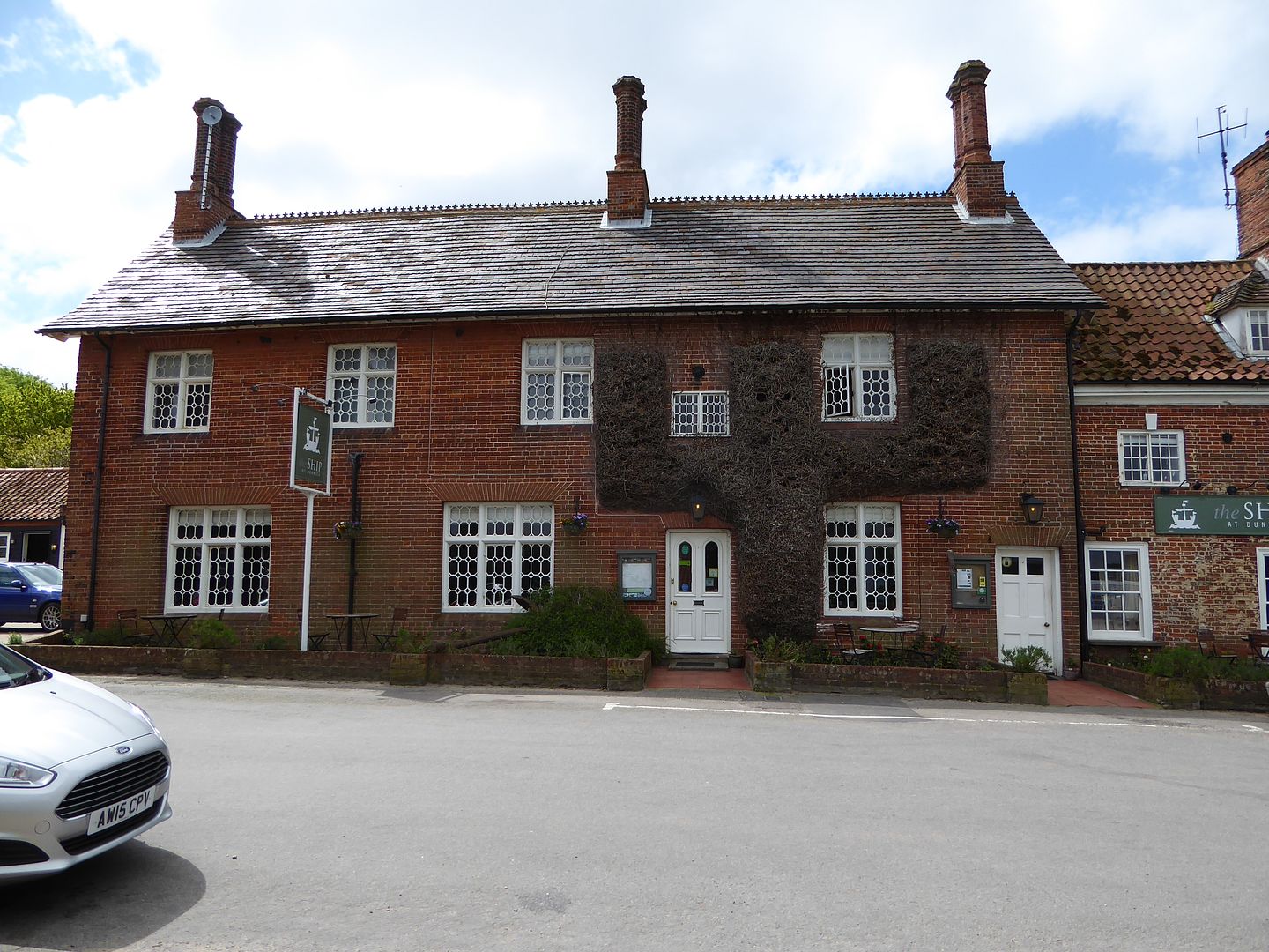 The street leading to the last church 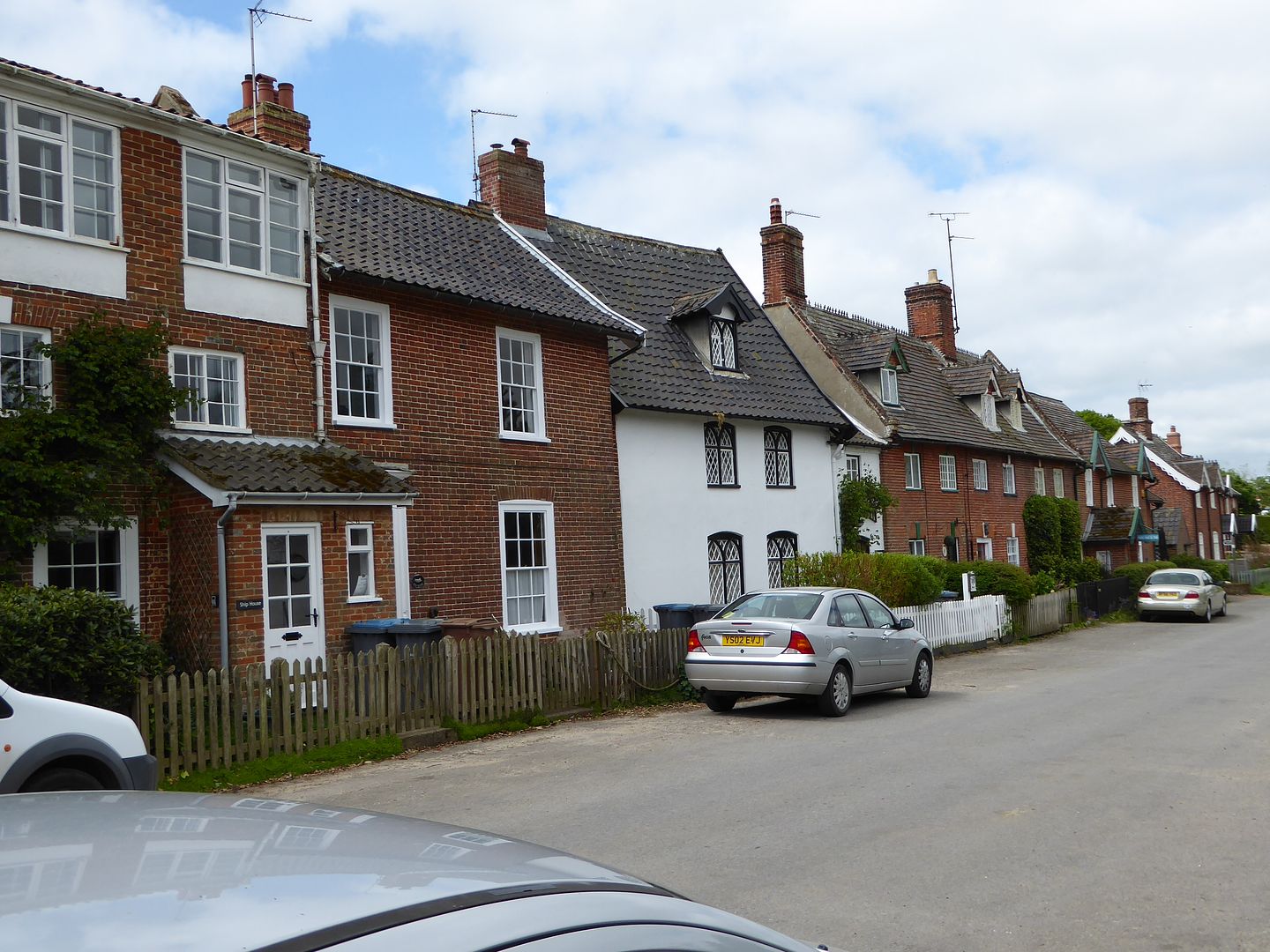 and a couple of naval relics recovered from the sea, they are a real menace to fishing nets 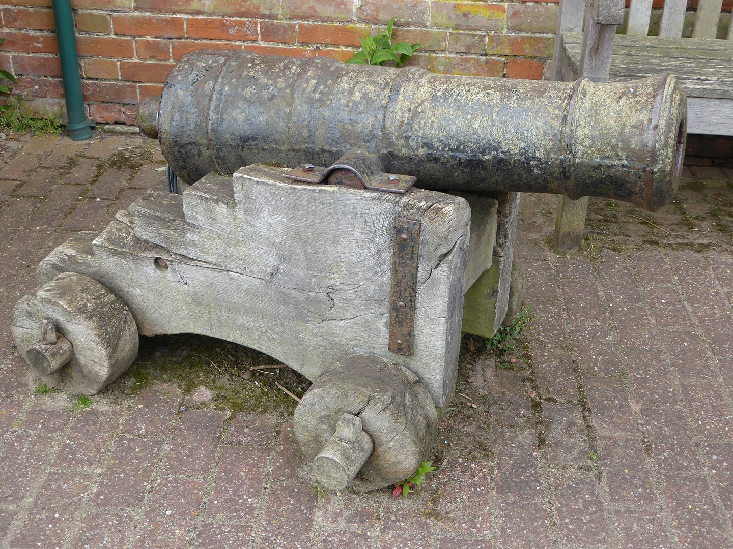  Little left to say except to show you the sad list at the village War Memorial, which is a commentary on the reduction of the place in general, so many more in WW1 compared to WW2 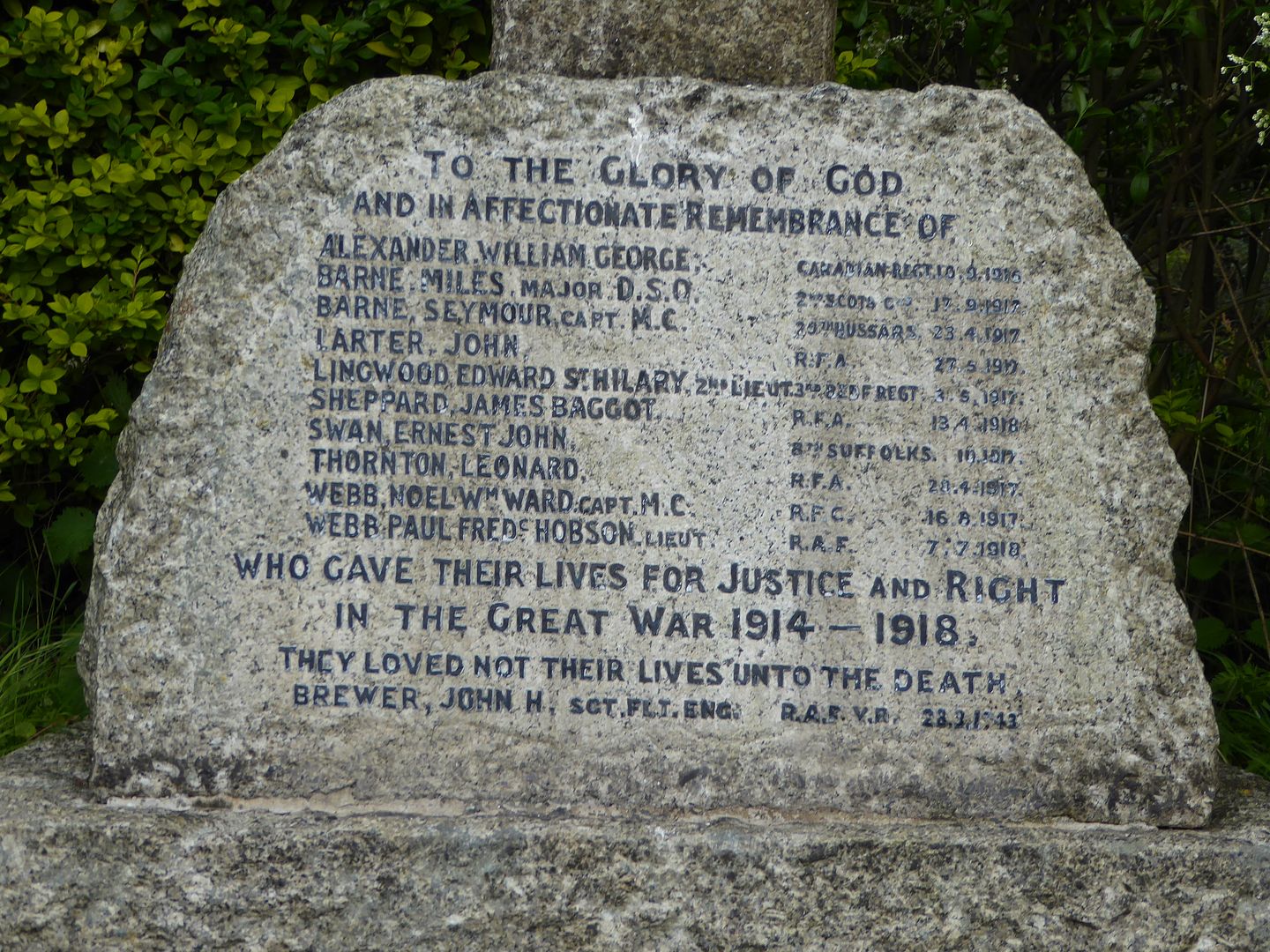 |
|
|
|
Post by mossie on May 25, 2016 13:54:03 GMT
I've done it again, must try harder. Here is the last grave from the old churchyard 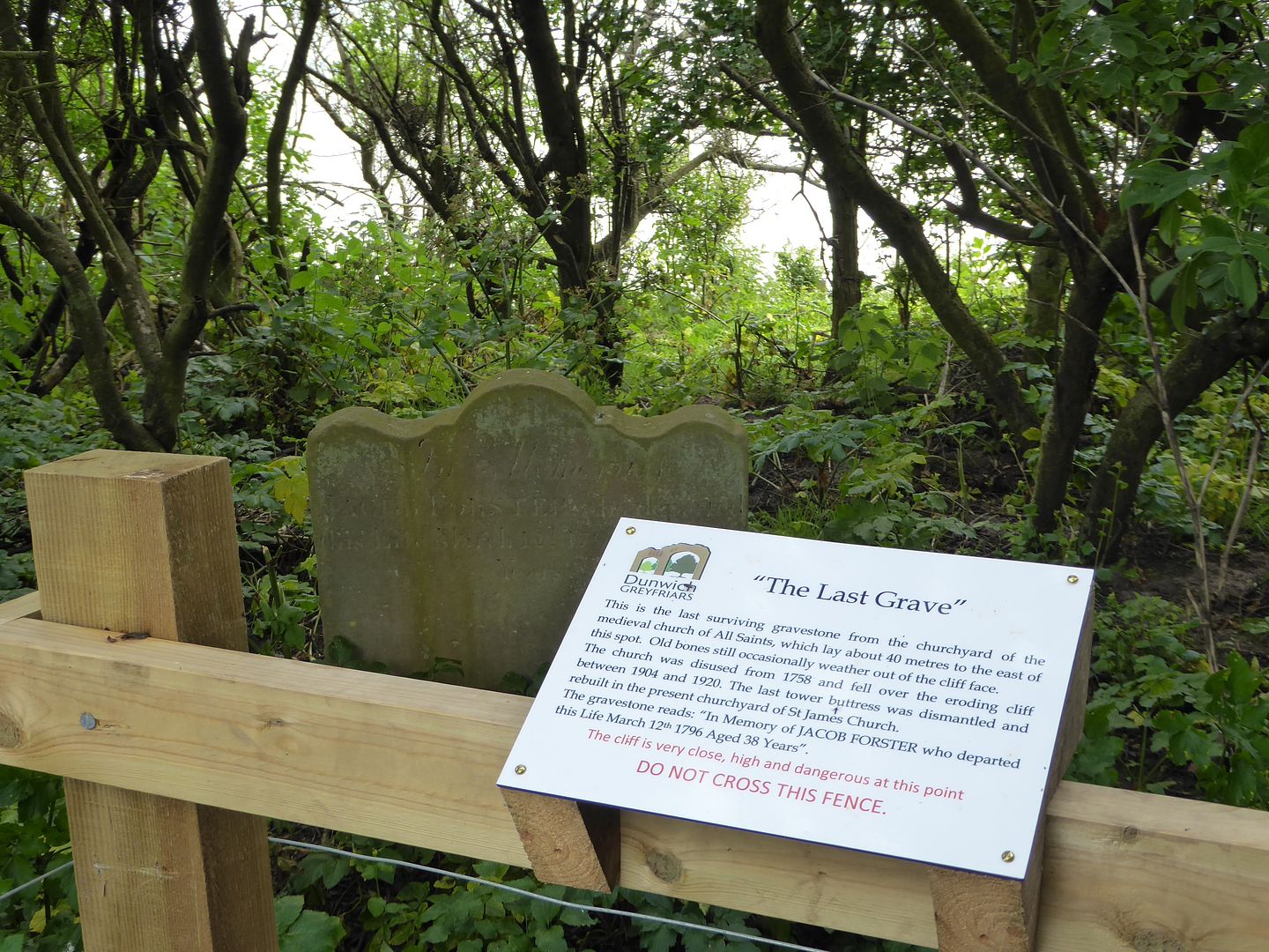 |
|
|
|
Post by bixaorellana on May 25, 2016 17:24:47 GMT
"Very close, high, and dangerous at this point" -- we've probably all had that said about us at some time or another.
I love this report, Mossie, and you've now made it even more interesting and beautiful. I have to say, out of all the great pictures, my favorite is the "ruin" one from inside the cafe -- just lovely and evocative.
Wonder why Greyfriars is called a friary rather than a monastery. For that matter, what does priory actually mean? There must have been many lepers -- enough so that they needed their own chapel. I suppose that means that the monks took in the sick, possibly specializing in lepers. The story of the bells tolling under the waves is charming, but I can't imagine that people wouldn't have gotten their acts together to save the bells before the churches were lost.
|
|
|
|
Post by patricklondon on May 25, 2016 17:46:10 GMT
Wonder why Greyfriars is called a friary rather than a monastery. For that matter, what does priory actually mean? A monastery was a community where the monks stayed put; they might interact with the outside world in various ways (like selling produce, and so on) but their religious commitment was to their work and prayer in the monastery. A friary was a community where the friars went out and did assorted good works in the community (preaching, teaching, offering medical care, and so on) and living on alms (hence "mendicant" friars). The Grey Friars were (I think) Franciscans; there were also Black Friars (Dominicans) and White Friars (Carmelites, whose white hoods also inspired the "cappucino"). A priory was a small community of monks or friars, sometimes linked to/supervised by a monastery or abbey. Hence the name often became associated with what later became a school or a hospital. |
|
|
|
Post by bixaorellana on May 25, 2016 18:35:49 GMT
Thanks, Patrick! I've come across all those terms in reading, but failed to ever look them up. I am now smarter with no effort on my part.  |
|