|
|
Post by onlymark on Apr 25, 2010 18:02:51 GMT
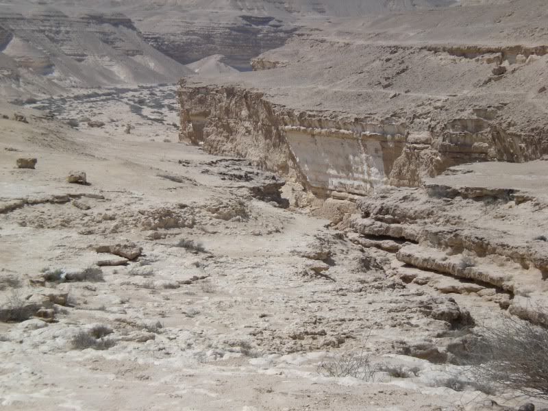
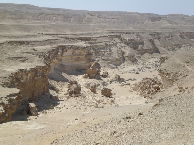
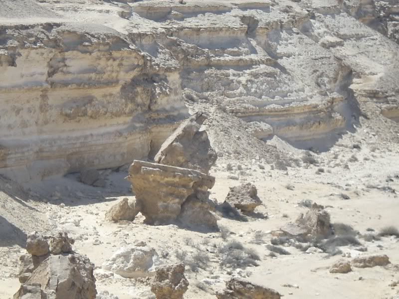
Never sure if this fits here or in the Egypt section, anyway - Roughly 50 – 60 million years ago Egypt was covered by part of the ancient Mediterranean Sea and movement in the tectonic plates was playing havoc with the land. As the sea eventually receded an area to the south east of modern day Cairo became exposed that was of limestone rock. During an era of about 2.5 million years to about 12,000 years ago extended periods of rain eroded this limestone and due to the lay of the land the water ran off to the direction of what is now the Nile, then north and out to sea at the Nile Delta. A deep gash was gouged in the limestone, waterfalls and rock pools were formed. But from about 10,000 years ago the climate began to get dryer and revealed the valley now called Wadi Digla. The wadi stretches for about 30km, starts as a slight depression out in the desert and then gradually gets deeper before flattening out again as it reaches the Nile near a modern day suburb called Maadi (Maadi being where I had the Road 9 walk thread). The wadi is now a protectorate and has many large and small dry waterfalls plus many caves formed in the limestone cliffs. It is home to a number of birds and small animals and due to its proximity to the city is a favourite short trip out for a walk, a jog or generally as a picnic spot. Many tributaries flowed into the wadi and invariably ended up in a waterfall, so as you walk up it, to the left and right are cliff faces seemingly every half a kilometre or so. These may vary in size from a metre tall to fifteen or twenty. In the Spring, when it does rain, some of the rock pools still fill with water and it becomes, for the Egyptian desert, quite green. However this doesn’t last long and it soon returns to its dry, sandy and dusty state. So, it starts out as the land loses height and the surrounding hills channelled the water – 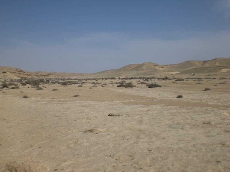 All of a sudden the land drops away and a waterfall occurs – 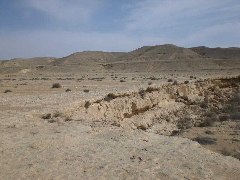 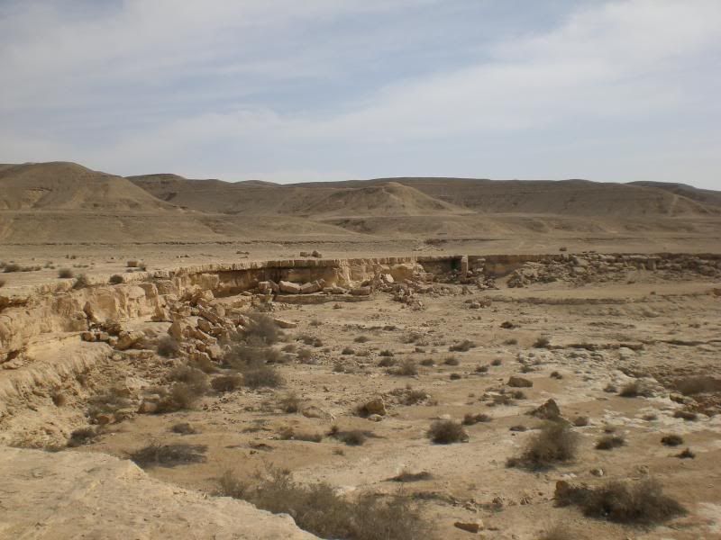 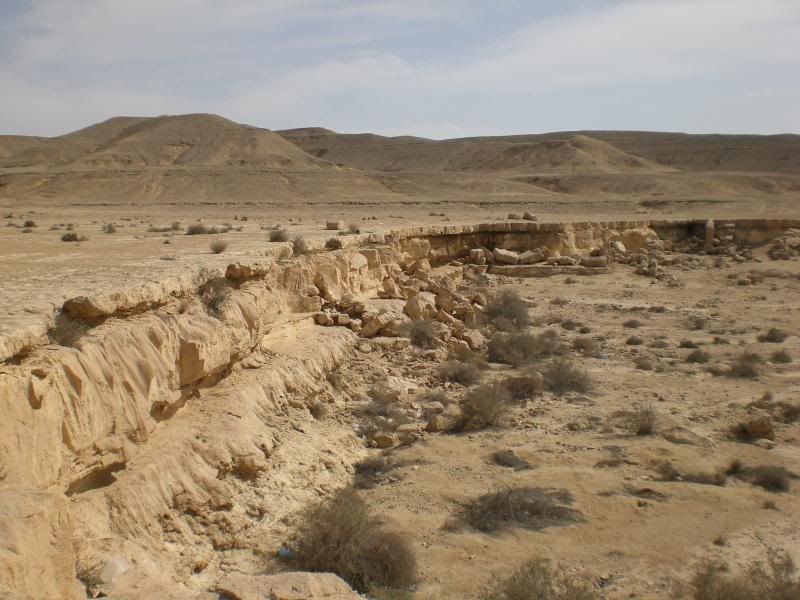 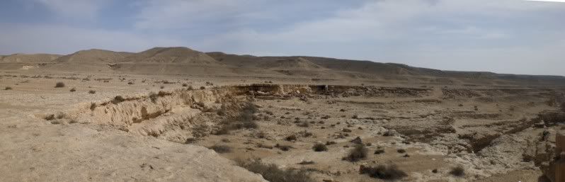 This is the face of the top part of the cliff – 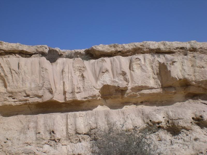 Then in these photos you can just see what happened to the water – 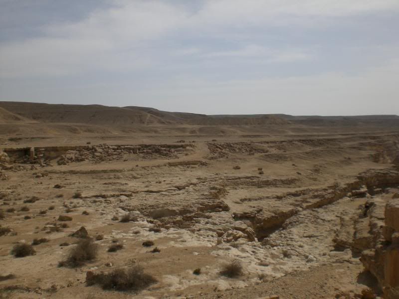 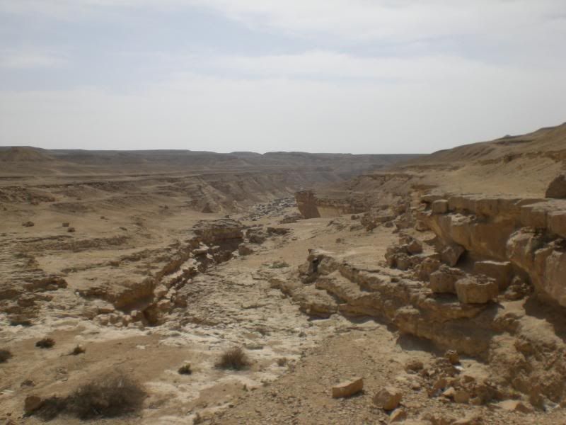 It formed a very deep gash in the limestone and crowded the water into an ever smaller space – 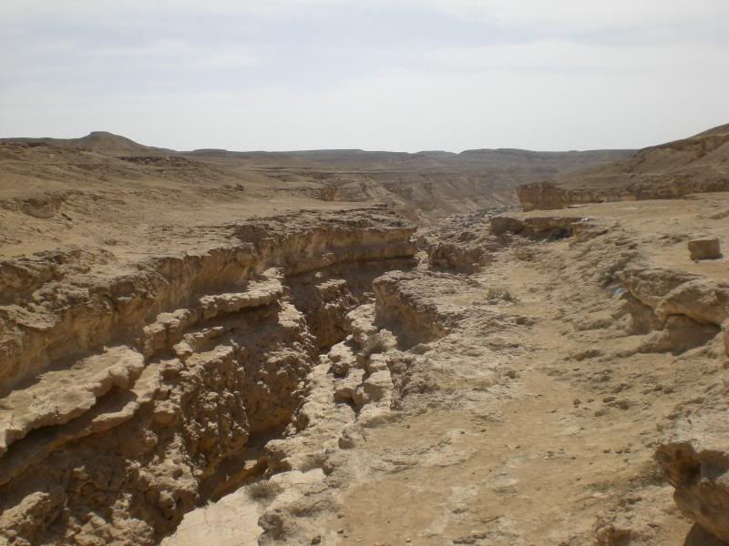 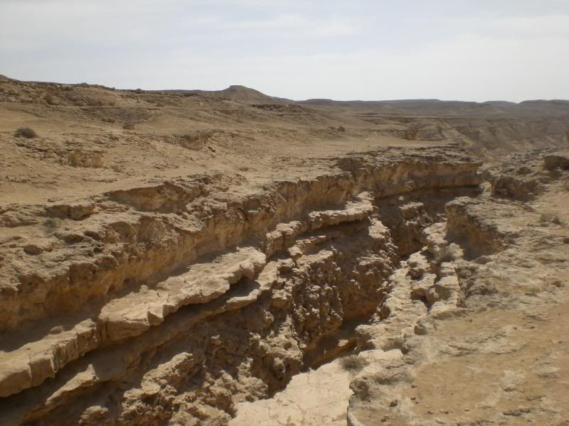 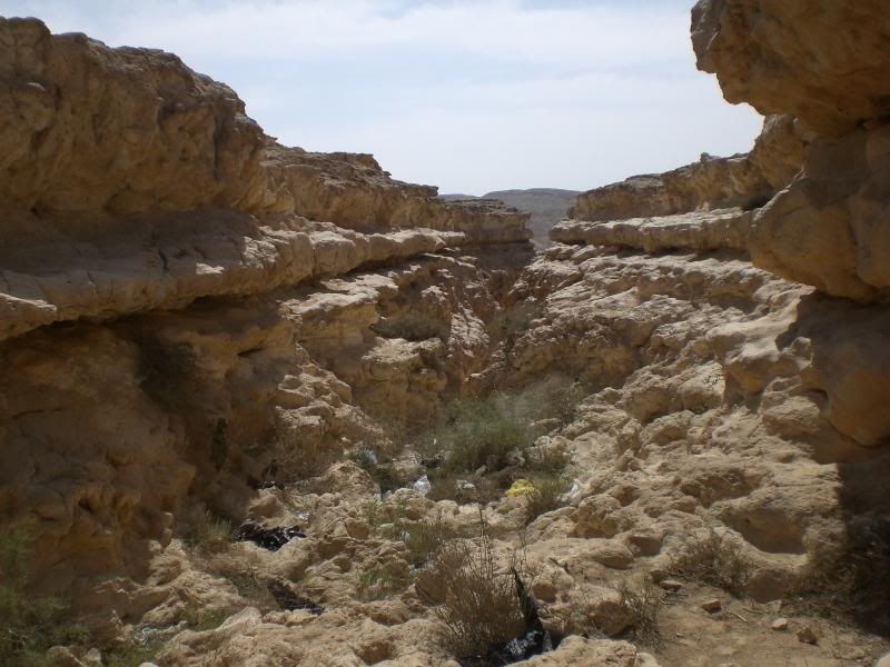 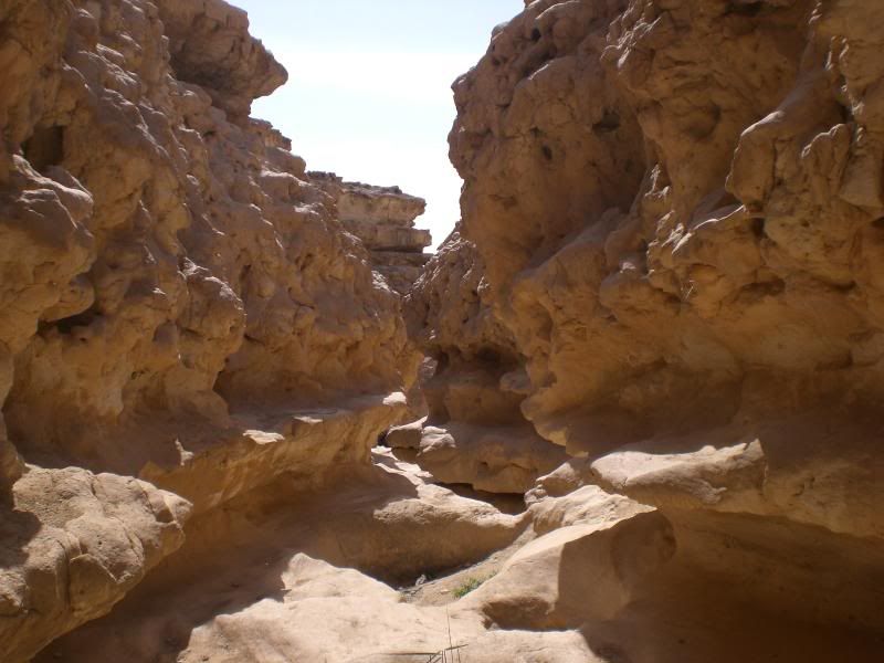 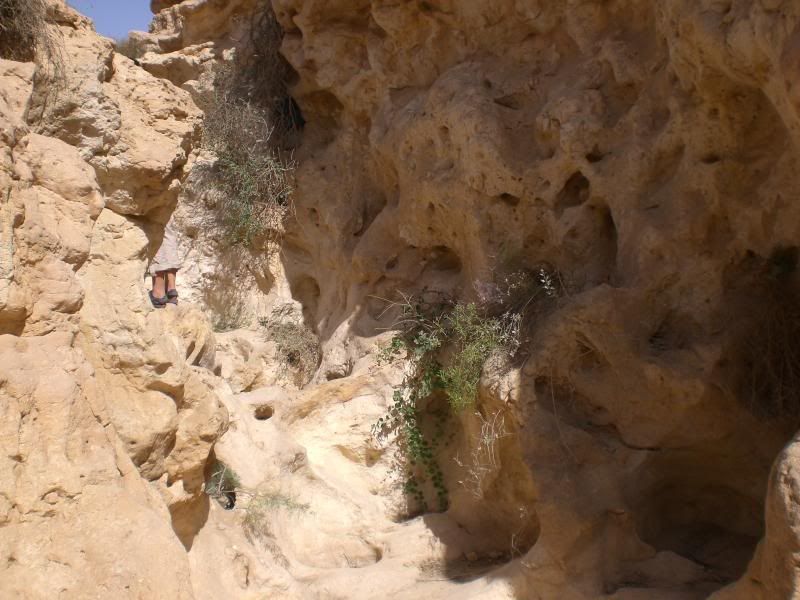 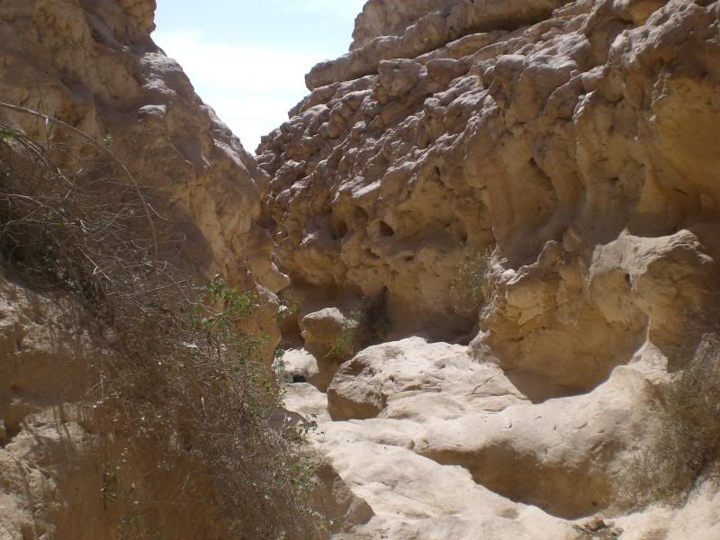 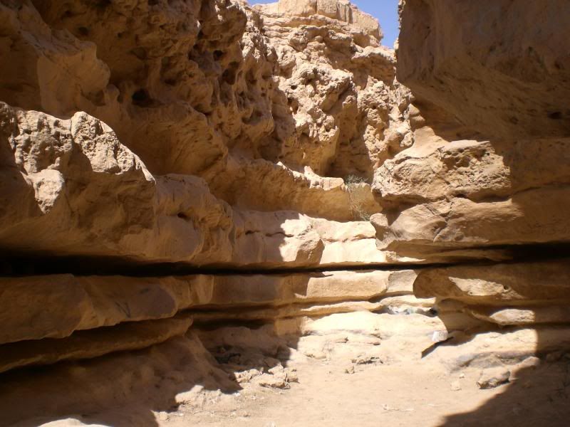 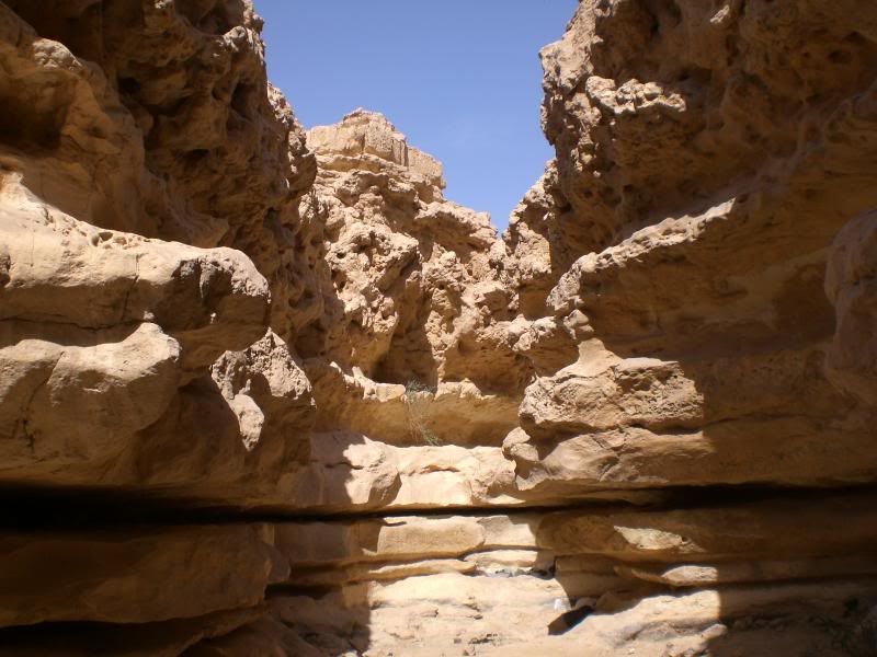 One of the rock pools caused by the swirling water – 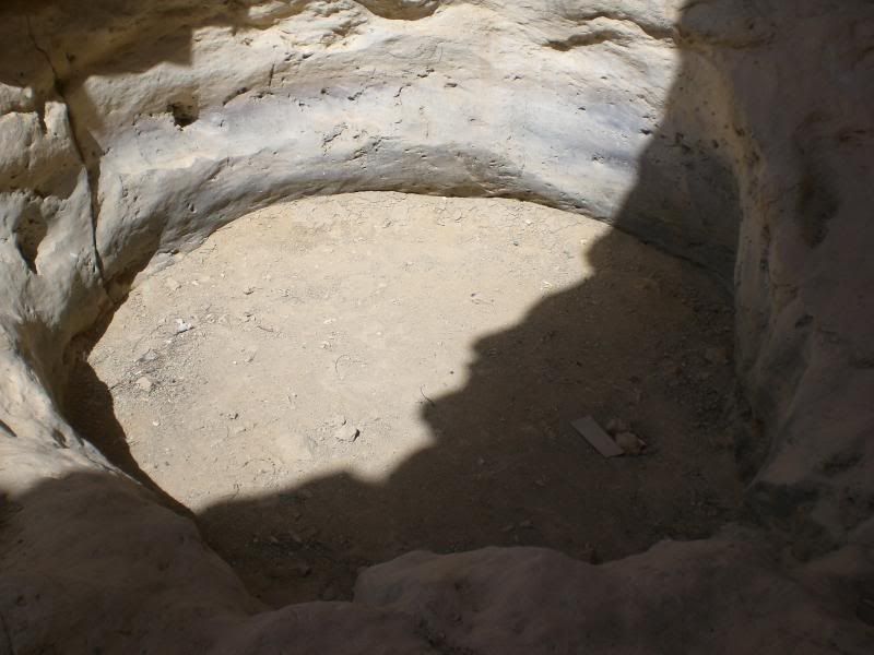 The wadi then opens right out again, the water, when there was some all that time ago, settling back down to a languid meander down to the Nile – 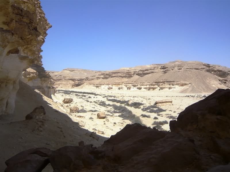 An old photo to give you an idea of the scale – 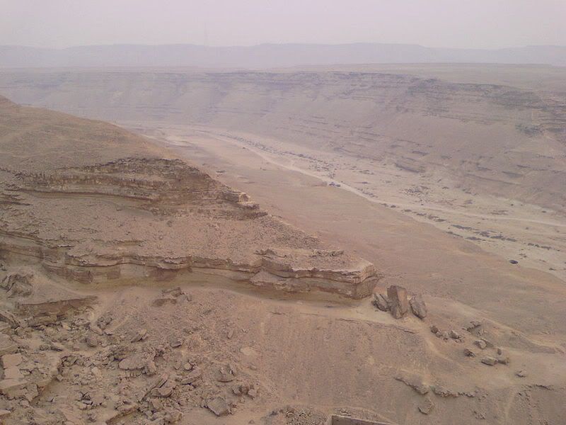 As said, there are a number of tributaries that used to also flow into the wadi, these always seem to end up in a cliff face and a waterfall – 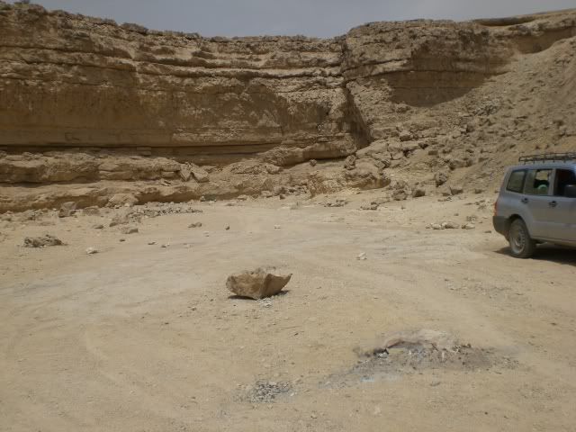 It wasn’t a surprise to me to find a member of this forum has been there before me and left his mark in a unique form of graffiti – 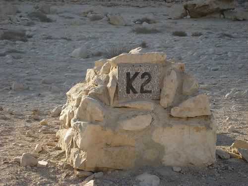 |
|
|
|
Post by Deleted on Apr 25, 2010 18:13:29 GMT
I swear it wasn't me, Mark. My handwriting is not that steady.
I would imagine that the area is subject to (extremely rare) flash floods, no? Of course, what caused all of these impressive scenes definitely lasted longer than a flash flood.
|
|
|
|
Post by bixaorellana on Apr 25, 2010 18:48:21 GMT
Oh, this is great, Mark! I just read through it twice so it would all sink in. The way you explain stuff is so clear and the photos really help, of course. But it was the picture of the rock pool that really hammered home the immensity of the water's force and the ages necessary to create the wadi. Some of the walls around the deeper parts still resemble wet mud. Just fascinating!
|
|
|
|
Post by onlymark on Apr 25, 2010 18:51:59 GMT
Flash floods would probably occur but, as you say, are extremely rare. I've not heard or known of one whilst I've been here though. Plus it would need the rain to occur pretty close to the Wadi otherwise the rest of the desert would just suck it straight up. It's not like these flash floods that occur from rainfall a hundred kilometres away in the hills somewhere like you get in Europe, it has to be raining heavily fairly close by.
|
|
|
|
Post by spindrift on Apr 25, 2010 19:16:07 GMT
How completely fascinating..to actually see an ancient riverbed and waterfalls without any water. It is just mindblowing. That's the sort of stuff we'd never find in a guide book. I wonder whether this rock formation continues, several thousand miles on, into the Rift Valley?
|
|
|
|
Post by onlymark on Apr 25, 2010 20:07:42 GMT
This area is not part of the Rift Valley but as to whether the limestone extends south, well yes it does, but all the way to the Rift valley? Don't know. It'd seem a bit far as it'd have to pass through the Sudan south south east to meet up with it in Ethiopia as it veers off into the Red Sea.
I do know that east of the Nile and south from Cairo, all the way to the Sudan border, there are numerous quarries used by the Romans and ancient Egyptians, so it could be possible.
|
|
|
|
Post by onlymark on Apr 25, 2010 20:19:10 GMT
This graphic shows a lot of the limestone quarries in Ancient Egypt -  Though these would have been popular purely because of the transport options offered by the nearby Nile. Further south than that it tends to be sandstone. Further inland, in the Eastern Desert tended to be quarries for basalt, a volcanic rock, at a place called Wadi Hammamat - en.wikipedia.org/wiki/Wadi_Hammamat |
|
|
|
Post by Deleted on Apr 26, 2010 0:06:27 GMT
Interesting pictures. It's funny how a few green bushes are growing out of what seems to be just rock. What does that K2 sign mean?
|
|
|
|
Post by gertie on Apr 26, 2010 0:47:42 GMT
Looking at some of those rock formations, like the waterfalls and the rock pool, you can almost see the water rushing down and swirling round. Quite spectacular.
|
|
|
|
Post by hwinpp on Apr 26, 2010 3:31:25 GMT
Have you ever seen the riverbed full of water?
|
|
|
|
Post by onlymark on Apr 26, 2010 4:42:06 GMT
The K2 sign is the kilometre marker for the track that goes up the river bed. It just means it is two km from the entrance gate. The track goes for about 14km up to the ex-waterfall when it's walking only.
I've never seen any water in there at all apart from a few damp patches, and I do go in there quite regularly.
|
|
|
|
Post by spindrift on Apr 26, 2010 17:03:41 GMT
Mark - have you scrabbled around in the dirt on the bank of the former river for shards of pottery or other relics?
|
|
|
|
Post by onlymark on Apr 26, 2010 18:28:16 GMT
As far as I'm aware there's never been any habitation in or near the wadi, so relics wouldn't be found. But I'm not sure. I'll have to look into that. There are though small fossils from when it was part of the sea bed. They take some finding though and you're more likely to just come across one than anything. It is a protected area so you couldn't take them away now but before it was then I know some have been. Just north of there is also a petrified forest, but in name only because all there is left is a small amount of 'wood' and it's not worth making a special visit to see. Especially because petrified wood is a dime a dozen around where I live anyway. Every new building site excavates loads of it and it's just abandoned at the side of the site or used as a border for a flower bed or something. Talking about fossils, or at least I am, one place I really must go and see soon is Wadi Al Hitan, known as the Valley of the Whales. It' about 150km south of Cairo, so pretty far from where the sea is now. But in ancient times was covered by water and there are numerous fossils of whale type mammals. en.wikipedia.org/wiki/Wadi_Al-Hitanwww.touregypt.net/featurestories/valleyofwhales.htm |
|
|
|
Post by auntieannie on Apr 26, 2010 18:29:55 GMT
What is the form on the 9th picture from the bottom of your OP? I see a shrub and something dark. It almost looks like a sculpture!
This wadi looks like somewhere they could have filmed for the Indiana Jones film (or some brillian epic from the golden age of the cinema)
|
|
|
|
Post by onlymark on Apr 26, 2010 18:33:38 GMT
I think Egypt is actually the 'poor relation' when it comes to recognition of the amount and variety of fossils. They aren't actually my thing but for anyone who is then it's worth having a quick read of the following. It's a bit dry but informative - www.touregypt.net/featurestories/fossils.htm |
|
|
|
Post by onlymark on Apr 26, 2010 18:40:14 GMT
Annie, well spotted. It's actually the feet of the last person in a group of French expats who I had to wait and wait for to get clear so I could take a photo. They didn't realise how important my mission was and seemed to think they were on a day trip. They didn't understand the urgency of my getting photos to you and persisted in standing around, in shot, talking.
Damned impolite of them if you ask me.
And it was bloody hot.
|
|
|
|
Post by spindrift on Apr 27, 2010 7:47:55 GMT
I read the link on fossils....I found the gigantic snake the most terrifying.
|
|
|
|
Post by onlymark on Apr 27, 2010 11:28:06 GMT
There sure used to be some strange creatures. Probably the Loch Ness monster is one of the last to survive.
|
|
|
|
Post by Deleted on Apr 27, 2010 18:46:45 GMT
You mean Big Iain should be worrying?
|
|
|
|
Post by onlymark on Apr 27, 2010 20:17:32 GMT
I've heard he's only got a small trouser snake. So I think he'll be fine.
|
|
|
|
Post by bixaorellana on Apr 28, 2010 16:36:03 GMT
Mark, the details about the fossils are fascinating. That was my thought in looking at the big overview photo of the wadi, that there might be fossils.
Yes, yes ~~ please make a trip to Wadi Al Hitan one of these days!
|
|
|
|
Post by onlymark on Mar 28, 2011 7:16:35 GMT
|
|
|
|
Post by cheerypeabrain on Mar 28, 2011 16:27:07 GMT
Excellent report....fascinating. ;D
Splendid...looks VERY hot tho...were you wilting medear?
|
|
|
|
Post by tod2 on Mar 28, 2011 16:35:03 GMT
Looking at those wadi's I feel transported back in time to when I visited Israel and stood looking at the cave of the Dead Sea Scrolls, then on the road again until we reached Masada, one of the most fascinating places and palaces I have ever visited.
|
|
|
|
Post by Deleted on Mar 28, 2011 16:54:30 GMT
I really like desert areas, but a nice little oasis would have been perfect for your picnic.
|
|
|
|
Post by bixaorellana on Mar 28, 2011 18:05:14 GMT
Mark, that prominent pile of rocks more or less in the middle of the second and third pictures is quite interesting. You say this whole area is limestone. Would concentrated piles of rocks, such as the one shown, indicate that the wadi used to be a karst area?
|
|
|
|
Post by onlymark on Mar 28, 2011 19:30:23 GMT
Cheery, it wasn't hot, just a pleasant warmth but hot enough to work up a little sweat coming up the hill from the old river bed. There's only a couple of months in the Spring and Autumn when it is pleasant to amble along there. Any other time and it's too hot or the wing whips down there and it becomes pretty cold. The photos make it look hotter than it was, especially with the bleached out colours.
Thinking that we've just come out of winter and it is Spring here, it's then easy to see by the lack of any greenery particularly just how dry the place is. The weather forecast for this coming weekend is that it'll be mid thirties, that makes it far too hot for me in there.
tod, Masada is definitely on my list and the likeliest time I'll visit it is from Autumn on when I'm in Amman.
Kerouac, when you have Bedouin/Berber blood like mine the only reason I need an oasis is to water my camels. But I'm sure you can appreciate the attractiveness in(of?) the sheer desolation of the place.
Bixa, as far as I know an indicator of a karst area is the underground caves. There aren't any that I know of there (and I know it pretty well) though there are caves in the valley walls, but they are relatively quite small. Quite how an area becomes it I think depends a lot on the amount of water in combination with the limestone.
Further north in the middle east my father in law told me of places in Lebanon in a conversation we had about when I visited a cave formation he knew of where my mother in law was born in Slovenia. The only link, apart from my in laws, to the two countries may be the amount of rain they had or do have (in combination to the rock that's there).
I think, no matter what the climate may have been eons ago, that in what are now desert areas there are no karst areas because the rock was of the wrong sort and where it might have been the right sort, there wasn't enough water around. The right combination wasn't happening.
You need in Africa to probably go all the way down to the south to get or have had enough of both.
|
|