The Dead Sea....errr... again in brief
Oct 6, 2011 14:01:24 GMT
Post by onlymark on Oct 6, 2011 14:01:24 GMT
Unfortunately the only time I can have a wander round at leisure are when the kids are at school. That means I’m a little restricted as to how far I can travel away from Amman so as to be sure to get back for when they need to be at home.
The other thing is even if a place isn’t too far away, I can’t do it justice by exploring every part of it.
This is the problem with the Dead Sea. It’s close enough to home, but too big and too many places on it to see that I can only give it a flying visit, a sort of 'drive through', or, as my wife refers to it, SAS style (in and out so quick you’re not detected).
The SAS technique works for me on most things like shopping, Parent/Teacher meetings, duty visits to little liked relatives, etc, apart from sex. I get detected at the initial approach every time.
Anyway, Amman is at and above 700m above sea level, the Dead Sea, at its lowest point, is 423m below sea level. Hence there is a bit of a downhill to get to it.
I left home around 9am and then stopped off at a place a few kilometres south and west to grab a couple of falafel sandwiches for sustenance (falafel, salad, humus and pickle in a pita bread sandwich for equivalent of 0.25 Euro each).
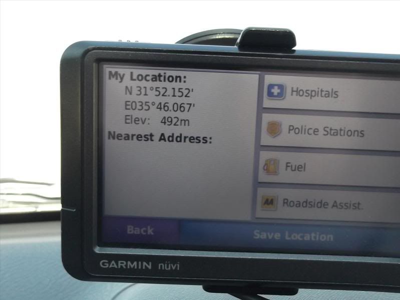
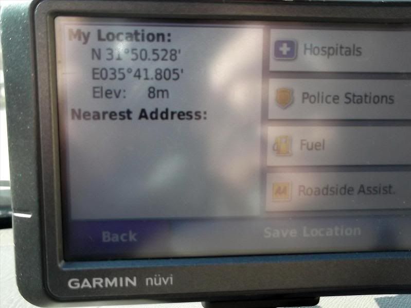
I checked my elevation as I’d already dropped down a fair way and I saw –
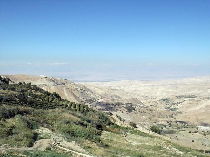
A little further on I spotted the depression formed by the Jordan Rift Valley, the separation between the African tectonic plate and the Arabian one.
The Dead Sea is only fed by the Jordan River (apart from a few minor springs), the same river referred to a number of times in the Bible and the subject of a few religious songs as well. However, it flows from the north, filling and exiting from the Sea of Galilee then meanders into the Dead Sea – where it doesn’t exit at all.
Originally the whole valley was open to the Meditteranean Sea and periodically flooded and then drained. Over time a 3km deep layer of salt developed.
As the tectonic plates moved around the land rose and cut off the access to the Med forming a large lake, this becoming the Dead Sea. It was then extremely salty, a figure of 31% concentration is generally accepted, though it does vary. This is approx six times that of normal salt water seas.
It also is not helped by the mass use in recent times of the Jordan River waters for agriculture. This cuts the flow into the sea causing it to shrink and becoming even more salty.
Enough of the lesson.
This is where I first saw the depression (first as in today. I have been there a few times before) –
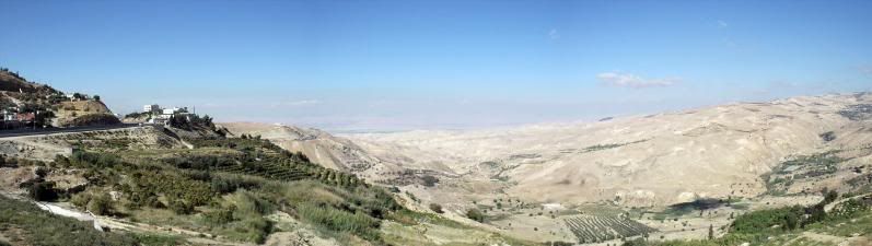
My different and newer camera stitches together panoramas, so you’ll have to suffer a few of those as well. Israel can be seen over the other side –
I drop down even further with an eye on the GPS and see the elevation –
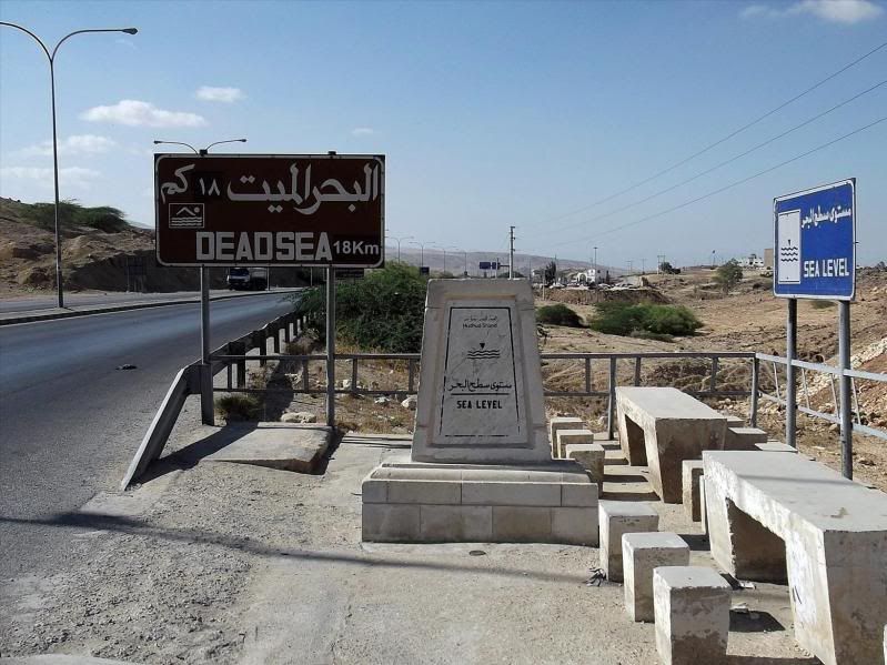
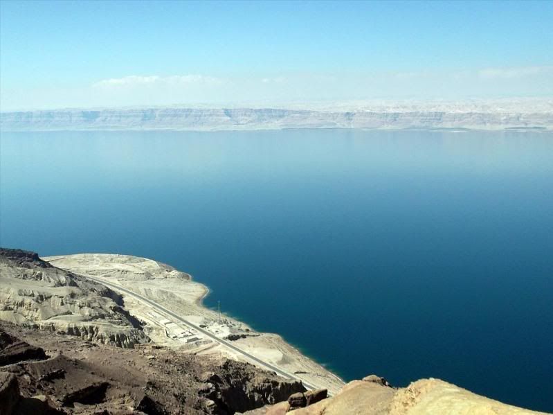
I stop and low and behold –
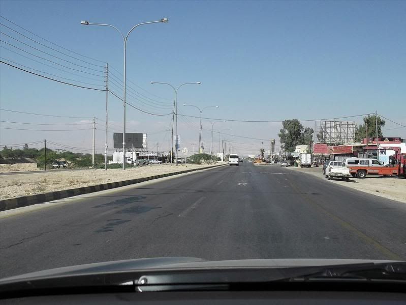
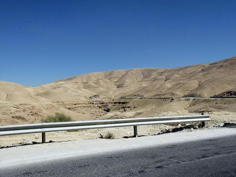
The road begins to flatten out as I drop down into the valley and becomes quite boring. Nowhere near as nice as the initial drop out of Amman –
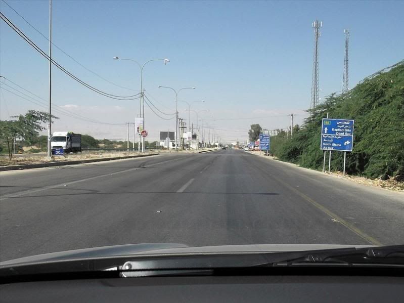
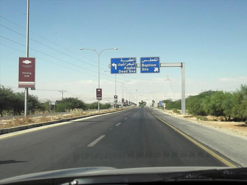
There is no ‘straight on’ as you reach near the bottom. It’s either left to the sea itself or right to the ‘Baptism Site’ –
What is this Baptism Site?
None other than just round the corner is where, so they say, John the Baptist was baptised and subsequently did the same to Jesus in the same place.
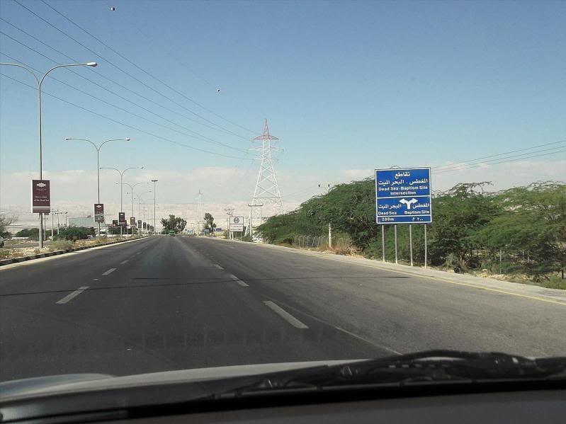
I turn left.
At the first convenient point I stopped, saw the elevation was –
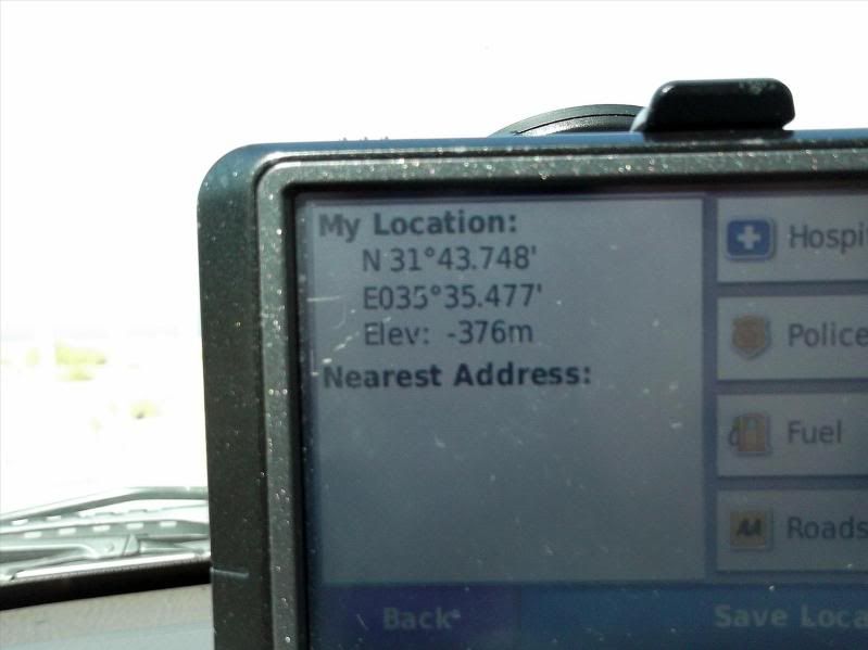
..........and then thought I’m still a bit short of the true bottom. Never mind, a couple of photos will cheer me up –
The next part, down the side of the Dead Sea, is actually, if you ignore the geography and history of the place, is quite boring. A long line of hotels and apart from a public beach, Amman Beach where I bathed a couple of times (ouch, ouch, shouldn’t have shaved) there’s not much else.
There are three main routes north/south in Jordan. The Kings Highway, the Desert Highway and the Dead Sea Highway.
The Kings Highway is the fast way to the south from Amman and ends in Aqaba. This is the route most with little time travel.
The Desert Highway is the slowest and tends to cut through a lot of towns and villages.
The Dead Sea Highway is one of the most interesting as it cuts down the valley bordering Israel. However, unless you have a fetish about being stopped at Police and Military checkpoints all the time, most tend to avoid it unless all your papers in order, you have plenty of time, are not carrying anything you shouldn’t and lastly have a happy disposition.
The last one gets me every time after the umpteenth stop.
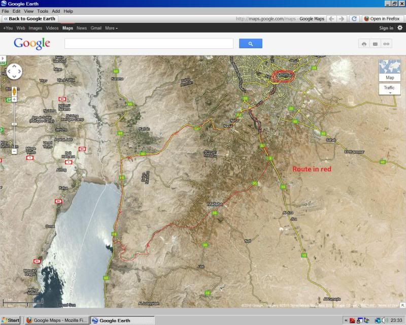
My intention was to skirt down the Dead Sea Highway for a little distance and then turn left up into the hills where there is a new(ish) visitors centre. This I’d not been to as I’ve not been in the area for a number of years, plus the road it’s on is a convenient route through Madaba (the town with the mosaics previously reported) and back to Amman without re-tracing my steps.
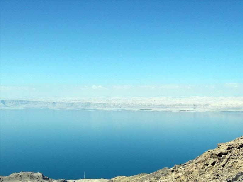
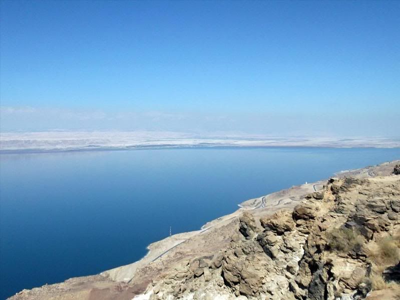
In short order I turned off the highway and started climbing. I stopped first in the car park of the centre and had a walk to the viewpoint –
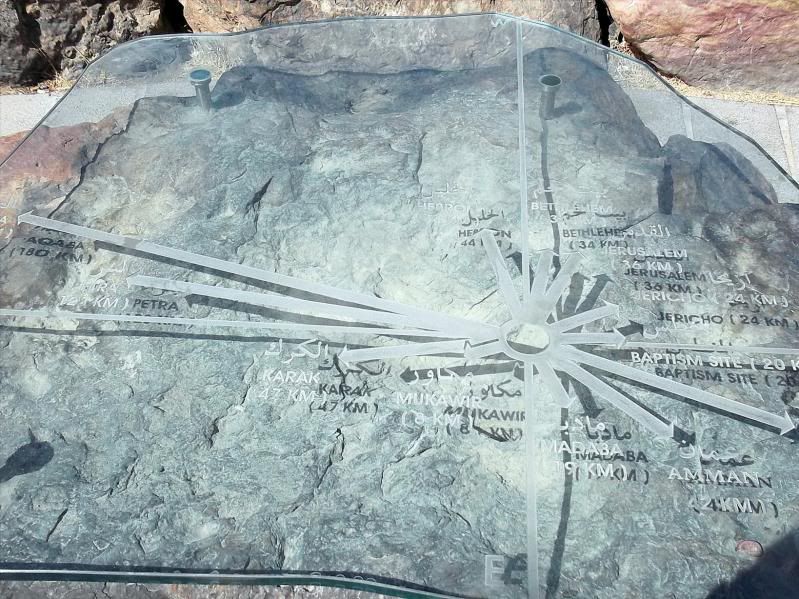
I wonder what I’m looking at, thought I. Conveniently there was, though not too clear, a bit of a reference –
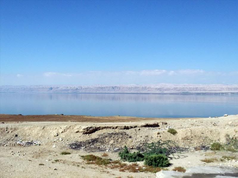
Must be worth a few more photos though. After all, it is the Dead Sea –
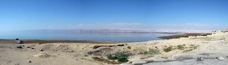
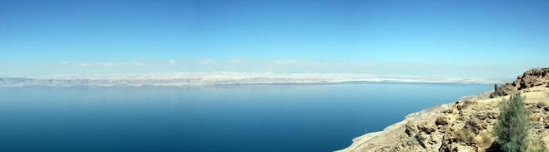
Managed to slip a panorama in as well –
One thing I forgot to mention. I left Amman and it was 16 degrees C. Here, not too much later it was 30 degrees. I didn’t feel liking walking round on to the cliff path walk so I turned and went towards the Visitors Centre –
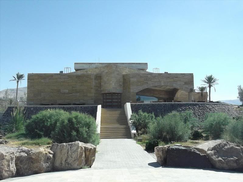
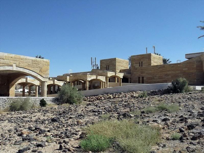
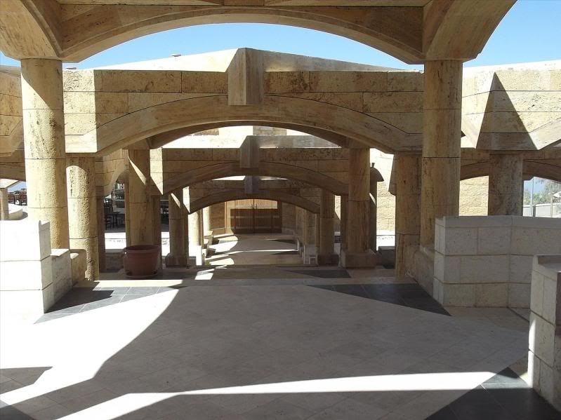
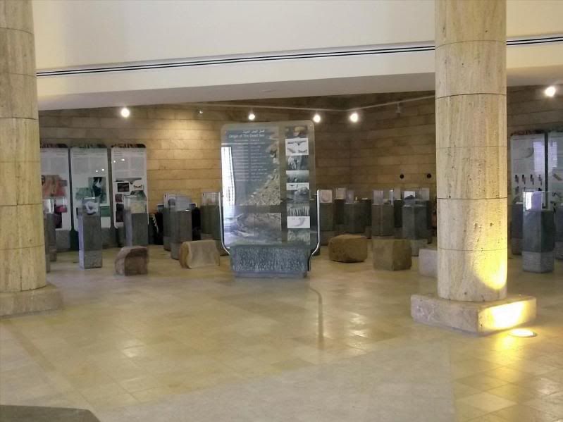
Inside is a gift shop, as you would expect, also a restaurant that was closed as it was still too early, but also a conference centre, an office of the Royal Society for the Conservation of Nature, and a small museum –
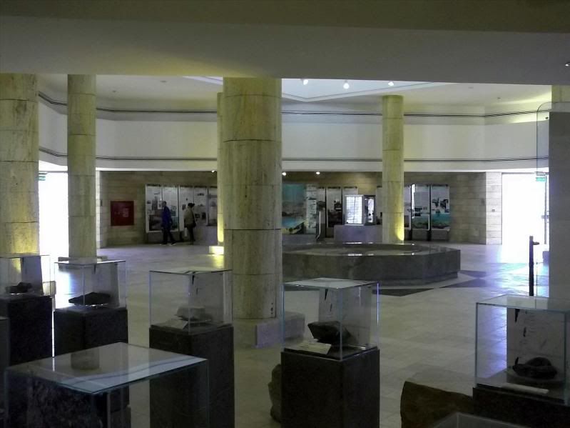
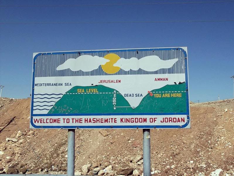
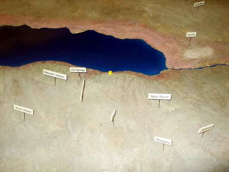
A bit of geography for the tourists –
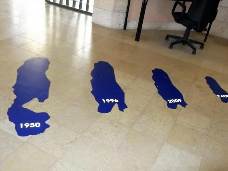
A depiction of how the Dead Sea has shrunk since 1950 and projected to 2400 –
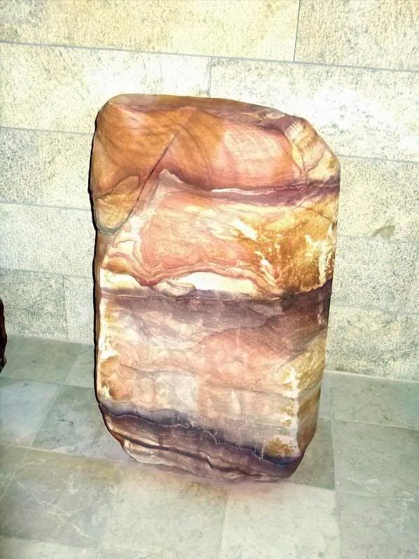
There were also a number of large rocks on display from the immediate area showing all the different types. The one that took my interest was the following. It is travertine. The whole building is clad in it and it is an up and coming thing to use in houses, especially in the USA. There used to be a choice to put on your floor of wood, tile or marble. This stuff, travertine, is priced less than marble but can look just as good –
Anyway, time was passing and I needed to start back.
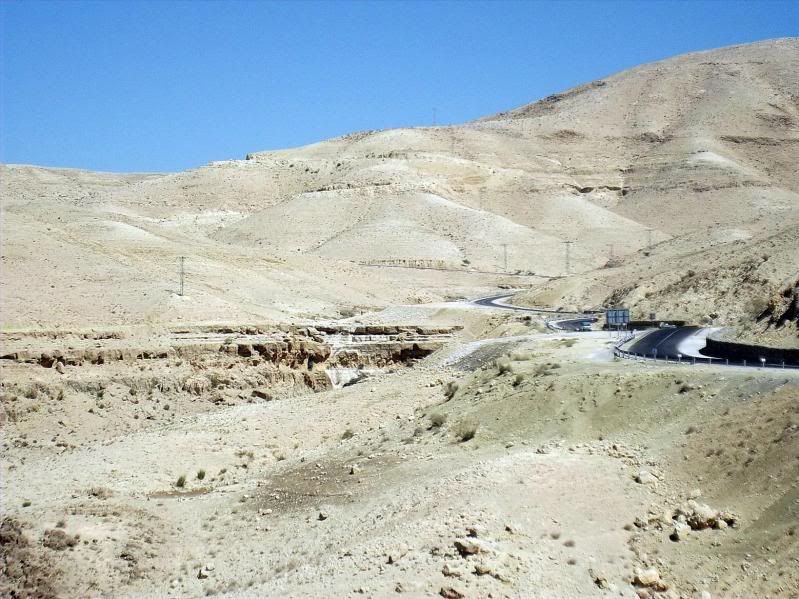
The road rose quite a bit further and was more interesting that the ride down anyway –
I’ve not really put any links in here, mainly because nothing is obscure. The Dead Sea and the Jordan River have enough information written about them to find out anything biblical or otherwise.
One thing you might not know though is that for many years there was a thriving trade in bitumen from the there. It would rise up in great lumps into the water, it would be cut up and dragged to the shore where it was then transported to, for example, Egypt, where it was used for waterproofing boats –
“The 'Judaicum Bitumen' is a famous deposit of native asphalt seeping through diapirs at the bottom of the Dead Sea, which comes occasionally to the surface through seismic activity in blocks of up to 100 tons in weight which are more than 99.99% pure. It was the object of the first known battle for a hydrocarbon deposit, between the Seleucids and the Nabateans in 312 B.C”
So there you are. Time to make dinner.
The other thing is even if a place isn’t too far away, I can’t do it justice by exploring every part of it.
This is the problem with the Dead Sea. It’s close enough to home, but too big and too many places on it to see that I can only give it a flying visit, a sort of 'drive through', or, as my wife refers to it, SAS style (in and out so quick you’re not detected).
The SAS technique works for me on most things like shopping, Parent/Teacher meetings, duty visits to little liked relatives, etc, apart from sex. I get detected at the initial approach every time.
Anyway, Amman is at and above 700m above sea level, the Dead Sea, at its lowest point, is 423m below sea level. Hence there is a bit of a downhill to get to it.
I left home around 9am and then stopped off at a place a few kilometres south and west to grab a couple of falafel sandwiches for sustenance (falafel, salad, humus and pickle in a pita bread sandwich for equivalent of 0.25 Euro each).
I checked my elevation as I’d already dropped down a fair way and I saw –
A little further on I spotted the depression formed by the Jordan Rift Valley, the separation between the African tectonic plate and the Arabian one.
The Dead Sea is only fed by the Jordan River (apart from a few minor springs), the same river referred to a number of times in the Bible and the subject of a few religious songs as well. However, it flows from the north, filling and exiting from the Sea of Galilee then meanders into the Dead Sea – where it doesn’t exit at all.
Originally the whole valley was open to the Meditteranean Sea and periodically flooded and then drained. Over time a 3km deep layer of salt developed.
As the tectonic plates moved around the land rose and cut off the access to the Med forming a large lake, this becoming the Dead Sea. It was then extremely salty, a figure of 31% concentration is generally accepted, though it does vary. This is approx six times that of normal salt water seas.
It also is not helped by the mass use in recent times of the Jordan River waters for agriculture. This cuts the flow into the sea causing it to shrink and becoming even more salty.
Enough of the lesson.
This is where I first saw the depression (first as in today. I have been there a few times before) –
My different and newer camera stitches together panoramas, so you’ll have to suffer a few of those as well. Israel can be seen over the other side –
I drop down even further with an eye on the GPS and see the elevation –
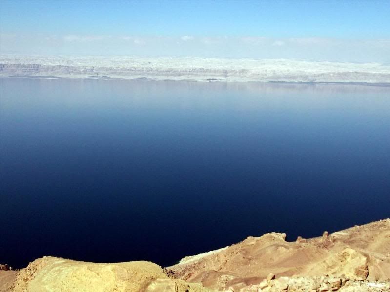
I stop and low and behold –
The road begins to flatten out as I drop down into the valley and becomes quite boring. Nowhere near as nice as the initial drop out of Amman –
There is no ‘straight on’ as you reach near the bottom. It’s either left to the sea itself or right to the ‘Baptism Site’ –
What is this Baptism Site?
None other than just round the corner is where, so they say, John the Baptist was baptised and subsequently did the same to Jesus in the same place.
I turn left.
At the first convenient point I stopped, saw the elevation was –
..........and then thought I’m still a bit short of the true bottom. Never mind, a couple of photos will cheer me up –
The next part, down the side of the Dead Sea, is actually, if you ignore the geography and history of the place, is quite boring. A long line of hotels and apart from a public beach, Amman Beach where I bathed a couple of times (ouch, ouch, shouldn’t have shaved) there’s not much else.
There are three main routes north/south in Jordan. The Kings Highway, the Desert Highway and the Dead Sea Highway.
The Kings Highway is the fast way to the south from Amman and ends in Aqaba. This is the route most with little time travel.
The Desert Highway is the slowest and tends to cut through a lot of towns and villages.
The Dead Sea Highway is one of the most interesting as it cuts down the valley bordering Israel. However, unless you have a fetish about being stopped at Police and Military checkpoints all the time, most tend to avoid it unless all your papers in order, you have plenty of time, are not carrying anything you shouldn’t and lastly have a happy disposition.
The last one gets me every time after the umpteenth stop.
My intention was to skirt down the Dead Sea Highway for a little distance and then turn left up into the hills where there is a new(ish) visitors centre. This I’d not been to as I’ve not been in the area for a number of years, plus the road it’s on is a convenient route through Madaba (the town with the mosaics previously reported) and back to Amman without re-tracing my steps.
In short order I turned off the highway and started climbing. I stopped first in the car park of the centre and had a walk to the viewpoint –
I wonder what I’m looking at, thought I. Conveniently there was, though not too clear, a bit of a reference –
Must be worth a few more photos though. After all, it is the Dead Sea –
Managed to slip a panorama in as well –
One thing I forgot to mention. I left Amman and it was 16 degrees C. Here, not too much later it was 30 degrees. I didn’t feel liking walking round on to the cliff path walk so I turned and went towards the Visitors Centre –
Inside is a gift shop, as you would expect, also a restaurant that was closed as it was still too early, but also a conference centre, an office of the Royal Society for the Conservation of Nature, and a small museum –
A bit of geography for the tourists –
A depiction of how the Dead Sea has shrunk since 1950 and projected to 2400 –
There were also a number of large rocks on display from the immediate area showing all the different types. The one that took my interest was the following. It is travertine. The whole building is clad in it and it is an up and coming thing to use in houses, especially in the USA. There used to be a choice to put on your floor of wood, tile or marble. This stuff, travertine, is priced less than marble but can look just as good –
Anyway, time was passing and I needed to start back.
The road rose quite a bit further and was more interesting that the ride down anyway –
I’ve not really put any links in here, mainly because nothing is obscure. The Dead Sea and the Jordan River have enough information written about them to find out anything biblical or otherwise.
One thing you might not know though is that for many years there was a thriving trade in bitumen from the there. It would rise up in great lumps into the water, it would be cut up and dragged to the shore where it was then transported to, for example, Egypt, where it was used for waterproofing boats –
“The 'Judaicum Bitumen' is a famous deposit of native asphalt seeping through diapirs at the bottom of the Dead Sea, which comes occasionally to the surface through seismic activity in blocks of up to 100 tons in weight which are more than 99.99% pure. It was the object of the first known battle for a hydrocarbon deposit, between the Seleucids and the Nabateans in 312 B.C”
So there you are. Time to make dinner.


 I like the look of the visitor's center and I, too, think travertine is very pretty. Such interesting colors and variations in it.