|
|
Post by htmb on Nov 4, 2012 19:33:09 GMT
|
|
|
|
Post by bixaorellana on Nov 4, 2012 19:53:42 GMT
*gushing alert*
I ADORE this thread! Htmb, you have a real gift for nature photography and a great way of enhancing it with pertinent background.
There are too many great pics to cite all of them, but the one of the boat ramp turning golden under the tannic water is surpassingly beautiful and the last one above, with the dazzling colors and limpid sense of water and air just knocks me out.
Can't wait for the part about the first explorers & how they affected the land and its inhabitants. I read every book I find on that subject, as it was something skimmed over at best in school.
|
|
|
|
Post by htmb on Nov 4, 2012 19:59:45 GMT
Thank you, thank you, thank you, bixa!
|
|
|
|
Post by htmb on Nov 4, 2012 20:26:39 GMT
|
|
|
|
Post by htmb on Nov 4, 2012 22:01:46 GMT
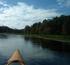
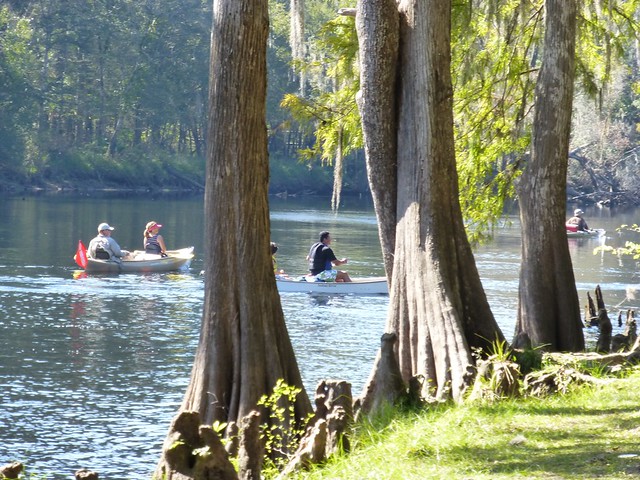
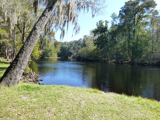
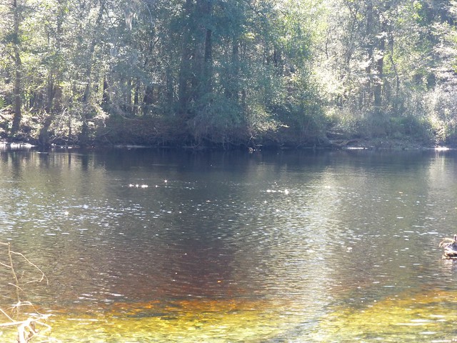
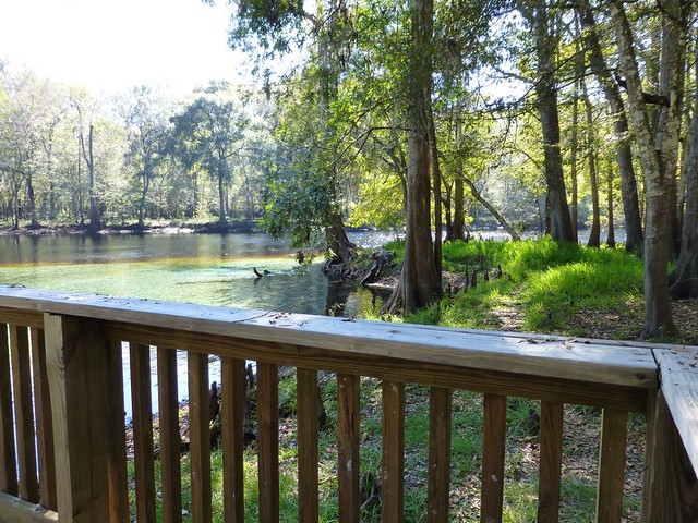
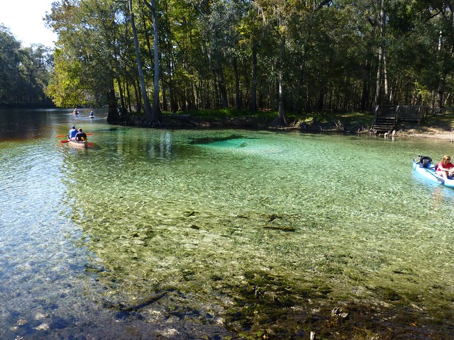
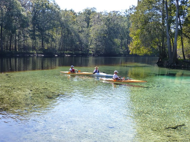
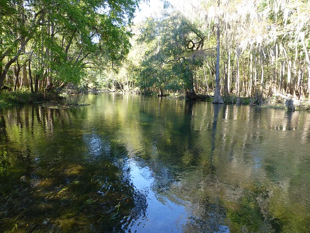
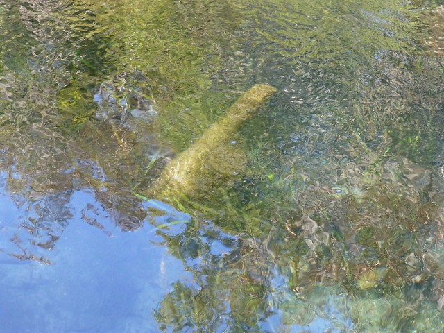
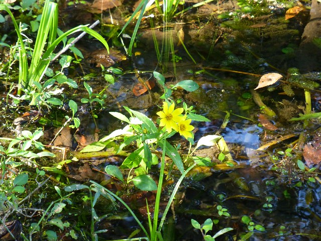
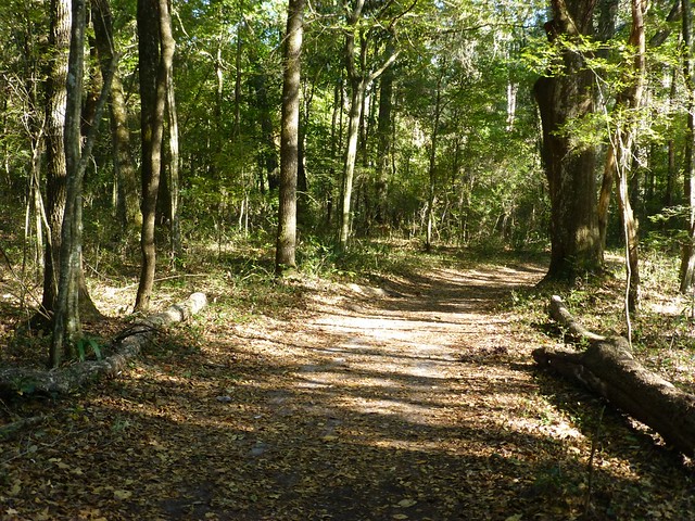
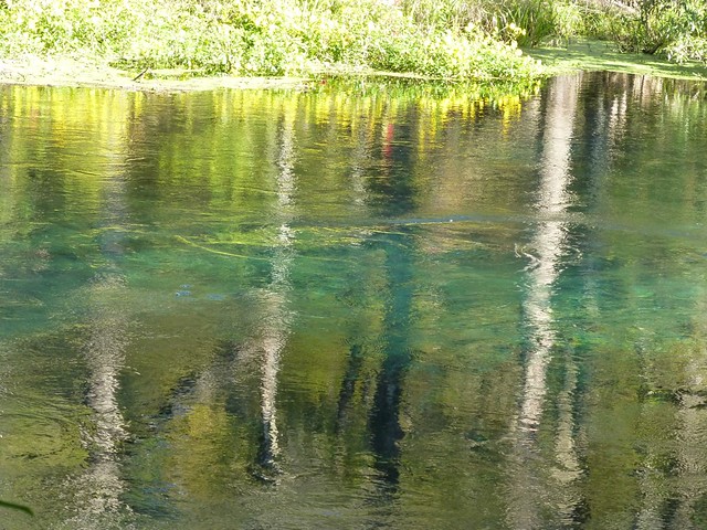
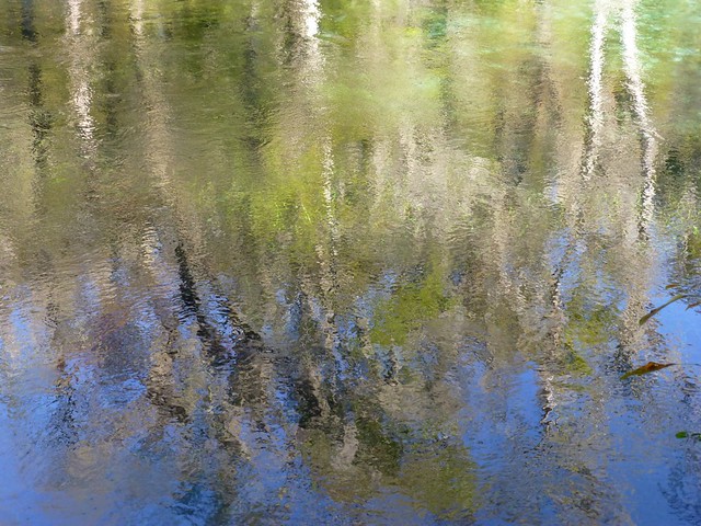
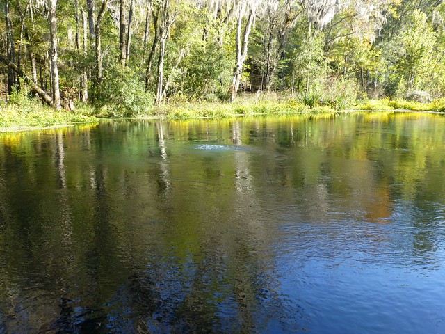
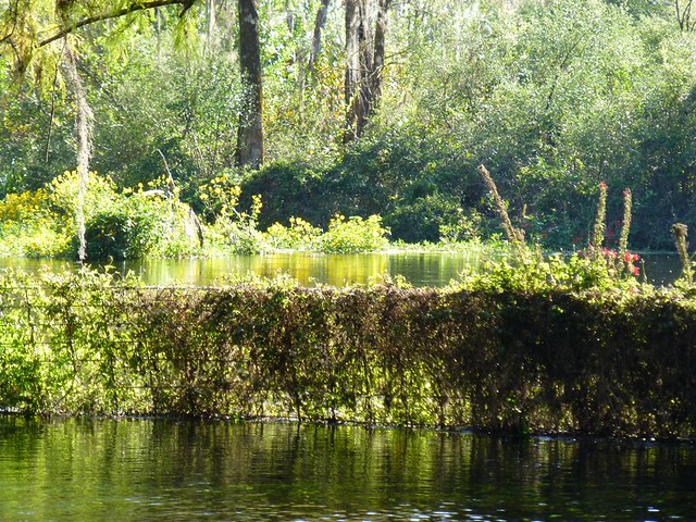
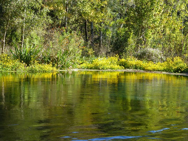
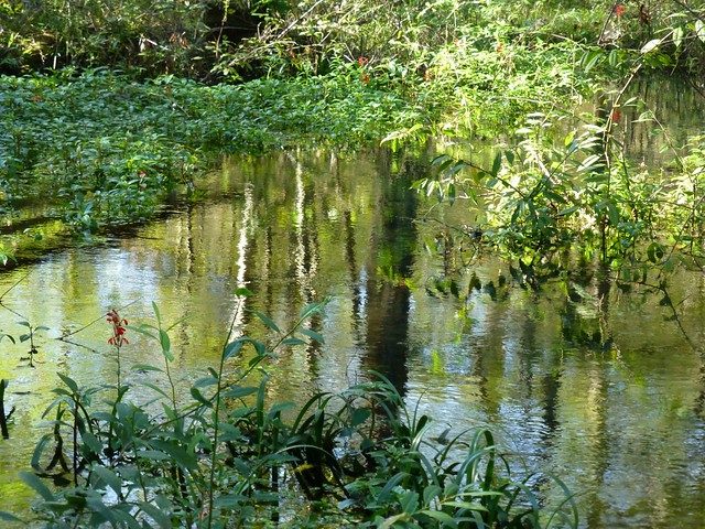
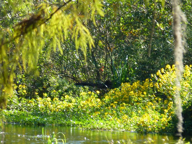
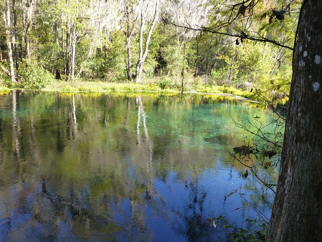
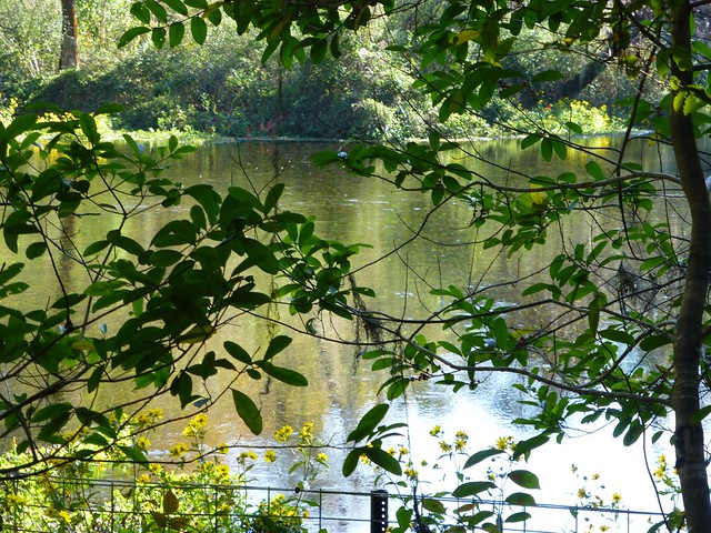
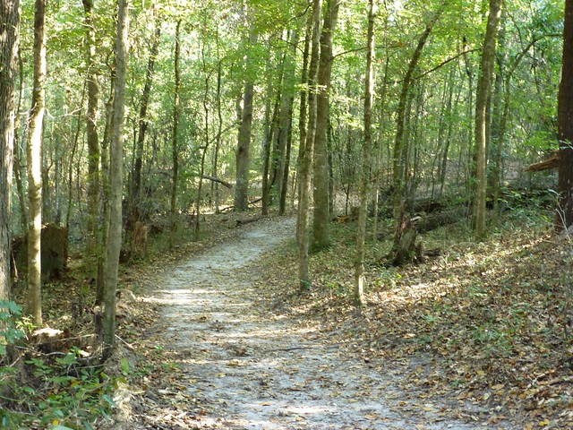
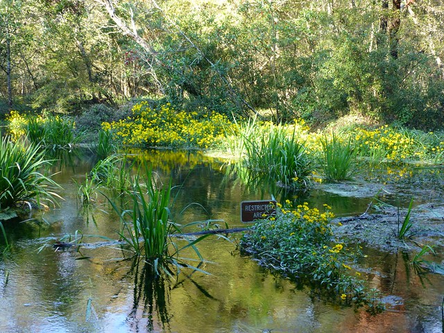
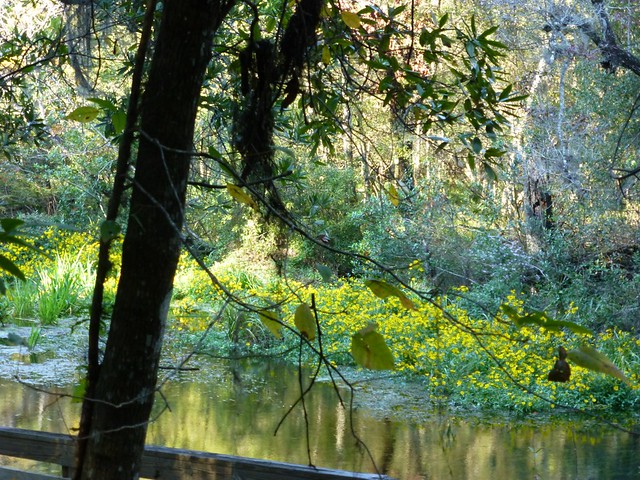
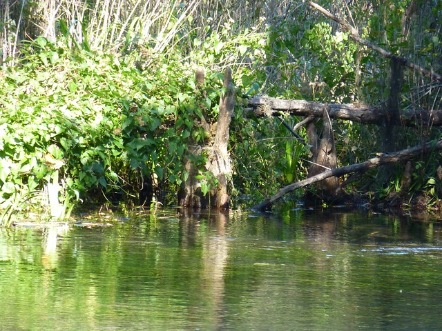
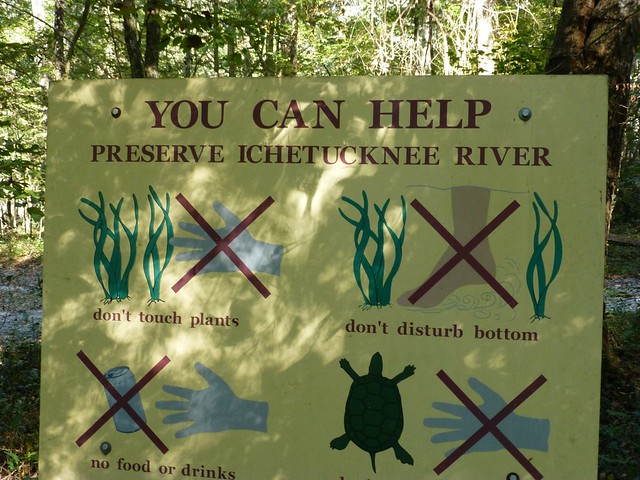
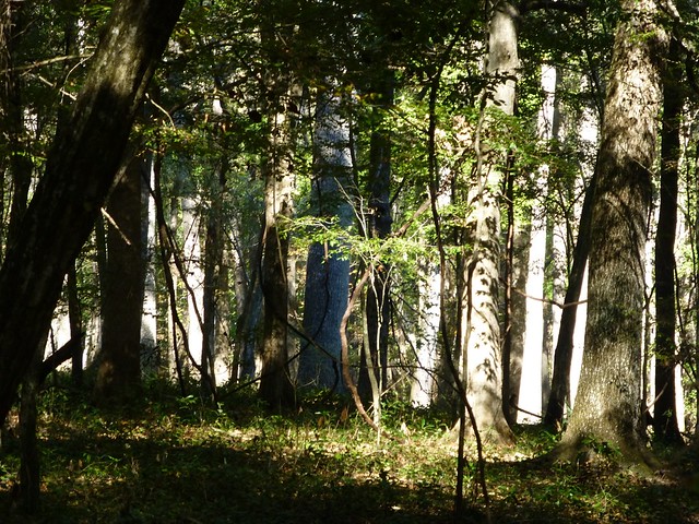
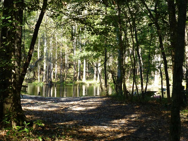
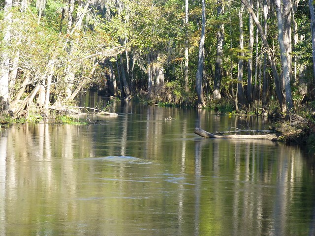
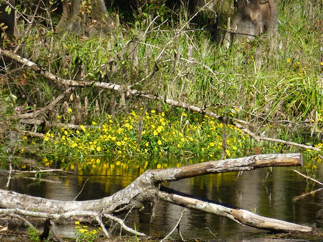
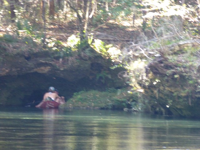
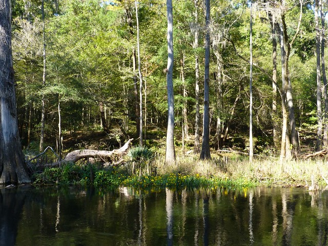
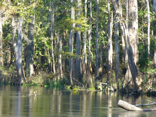
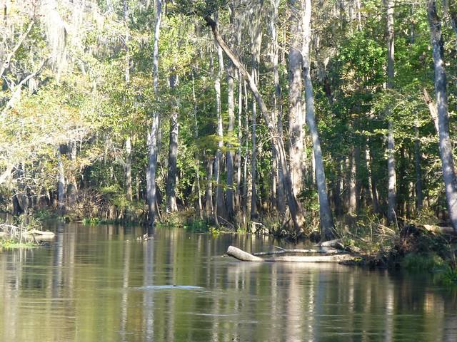
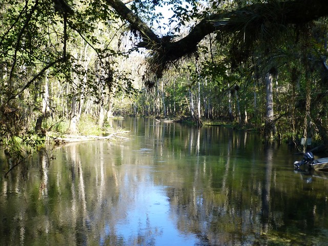
It's now time to refer back to the map of the Santa Fe River. The Ichetucknee flows into the Santa Fe ten miles before they both merge with the Suwanee. On the map below you can see the Ichetucknee as it flows from north to south (starting at the top-middle part of the map). 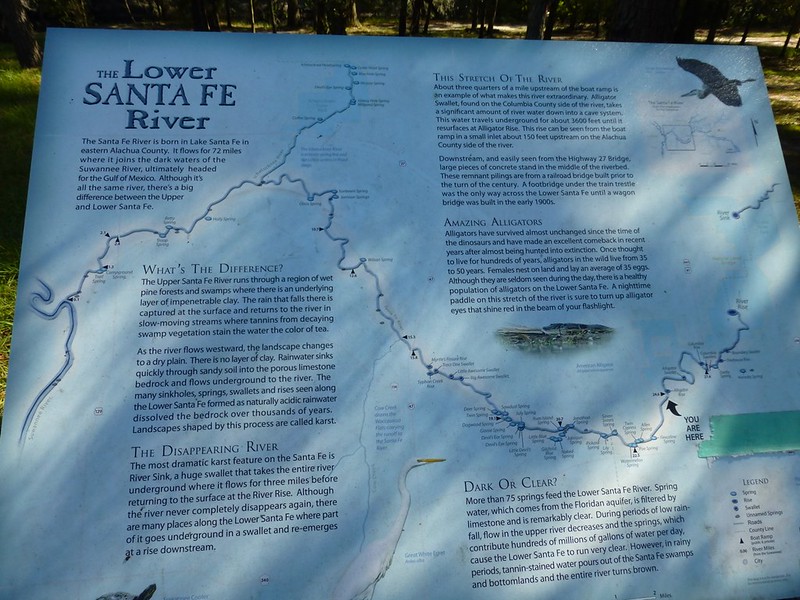 The Ichetucknee actually begins to form in the Lake City area several miles to the north. The terrain acts as a huge funnel of sorts as water from runoff and rain flows into creeks which eventually disappear underground carrying with it all types of vegetation matter and debris. The river surfaces at the Ichetucknee head spring as well as other springs along the six mile stretch of river. The area we are going to visit is blocked out in light green on the map below.  I first visited the Ichetucknee when I was a college student. It's one of the favorite cooling off spots during the summer as the water temperature maintains an even temperature of 72F/22C all year round, a great experience on a swelteringly hot afternoon. Back in the day, tubers use to strap beer kegs onto rafts and float down the river drinking and partying, littering and wreaking havoc on the environment. As it became even more popular, the crowds grew and so did the destruction of the delicate ecosystem. Flash forward to today and things have changed dramatically. The river area is now government owned and managed by the park service. Tubers are allowed during the summer months, but many restrictions have been put into place. Disposables are not allowed on the river, admission is open only to a limited number of tubers daily, and the health of the river is constantly monitored. I no longer venture onto the river during the summer months, but late fall through early spring are the perfect months to launch a kayak at the end of the park, paddle up the river, and then enjoy floating back down. The headwaters spring is just inside the main entrance of the park.   Somewhere in the bottom of that spring lie the keys to a 1976 Oldsmobile Cutlas. |
|
Nora Gallagher
Guest
Offline
|
Post by Nora Gallagher on Nov 4, 2012 23:40:44 GMT
[missing message]
Hello, Nora & thanks for responding to this excellent thread.
The Reply + Captcha + quote feature seem to have messed up your message, but we hope you'll try again. Thanks!
|
|
|
|
Post by htmb on Nov 5, 2012 2:08:51 GMT
Hi, Nora. I hope you are enjoying reading AnyPort. Perhaps you will try re-posting your message again. We'd love to hear from you.
|
|
|
|
Post by bixaorellana on Nov 5, 2012 2:13:40 GMT
And you ARE going to tell us about the drowned keys, are you not?!
|
|
|
|
Post by htmb on Nov 5, 2012 2:40:43 GMT
Oh, yeah, the keys. It wasn't me who lost them, but the now former Mr HTMB who, in his enthusiasm, plunged into the springs without emptying his pockets. A really not so bright move. It's been so long I don't remember all of the details. I believe he drove someone else's car home and retrieved his spare, which probably took him at least two and a half hours. I just always picture those keys sitting somewhere down in a deep limestone crevice.
|
|
|
|
Post by htmb on Nov 5, 2012 4:48:58 GMT
|
|
|
|
Post by mossie on Nov 5, 2012 19:30:03 GMT
I found the description and diagram of the Blue Hole very interesting. In the little village where I grew up we had a stream, called the Nailbourne, which only flowed now and then. This was because the ground is chalk and the water has carved out large holes as you show. The water only comes to the surface when there has been a long period of rain and then it can cause floods. Local legend has it that either the stream only flows every 7 years, or it only flows as a warning of bad times. In fact it ran in 1939 and I remember the station yard was flooded and froze over, so that people could skate on it.
|
|
|
|
Post by htmb on Nov 5, 2012 19:52:25 GMT
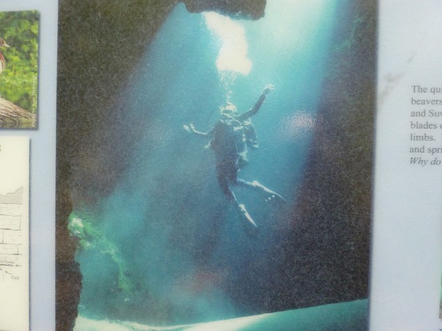
I found the description and diagram of the Blue Hole very interesting. In the little village where I grew up we had a stream, called the Nailbourne, which only flowed now and then. This was because the ground is chalk and the water has carved out large holes as you show. The water only comes to the surface when there has been a long period of rain and then it can cause floods. Local legend has it that either the stream only flows every 7 years, or it only flows as a warning of bad times. In fact it ran in 1939 and I remember the station yard was flooded and froze over, so that people could skate on it. Oh, wow, mossie! It's fascinating to think about water running under the ground not to be seen until a flood. Where is this stream? This is kind of like putting the cart before the horse, but since I've already posted the trail sign with the photo of a diver down in Blue Hole, here is a link to a video file of an underwater dive. Warning, it's not for the faint of heart.  Please note, "Jug Hole" is another name for Blue Hole, so called because of the jug shape to the section of the spring closest to the surface. Warning: Cave diving can be extremely dangerous and should not be attempted by someone who is not cave certified. |
|
|
|
Post by htmb on Nov 6, 2012 1:39:27 GMT
|
|
|
|
Post by htmb on Nov 6, 2012 1:52:46 GMT
|
|
|
|
Post by htmb on Nov 6, 2012 2:39:19 GMT
|
|
|
|
Post by htmb on Nov 6, 2012 15:14:22 GMT
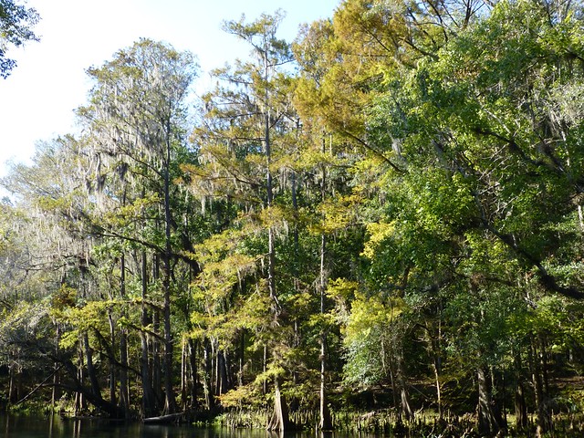
The Ichetucknee River area has a fascinating and rich history that includes a 17th century Spanish mission. Here is a brief historical reference from the park's website: Perhaps the Ichetucknee's greatest historical treasure is the Mission de San Martin de Timucua. This Spanish/ Native American village was one of the major interior missions serving the important Spanish settlement of St. Augustine. The mission, built in 1608 flourished through most of that century. The river and springs were used consistently by even earlier cultures of Native Americans, dating back thousands of years. During the 1800s, early travelers on the historic Bellamy Road often stopped at Ichetucknee Springs to quench their thirst. Later that century, a gristmill and general store were located at Mill Pond Spring. With high quantities of limestone at or just below the ground surface, the area became early headquarters for North Florida's phosphate industry in the late 1890s and early 1900s. Small surface mines are still visible throughout the park. Continuing through the 1940s, cypress and longleaf pine forests were harvested by the local timber and naval stores industries. Ichetucknee Springs State Park was purchased by the State of Florida in 1970 from the Loncala Corporation to preserve one of the state's outstanding natural wonders. In 1972, the U.S. Department of the Interior declared the Ichetucknee Spring a National Natural Landmark.
Source |
|
|
|
Post by bixaorellana on Nov 6, 2012 19:48:58 GMT
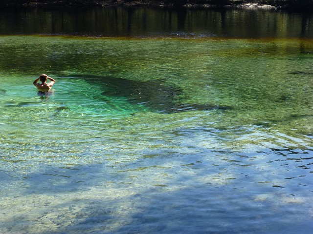
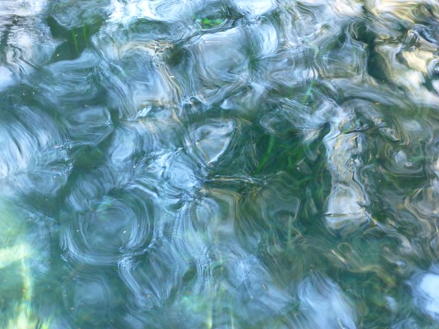
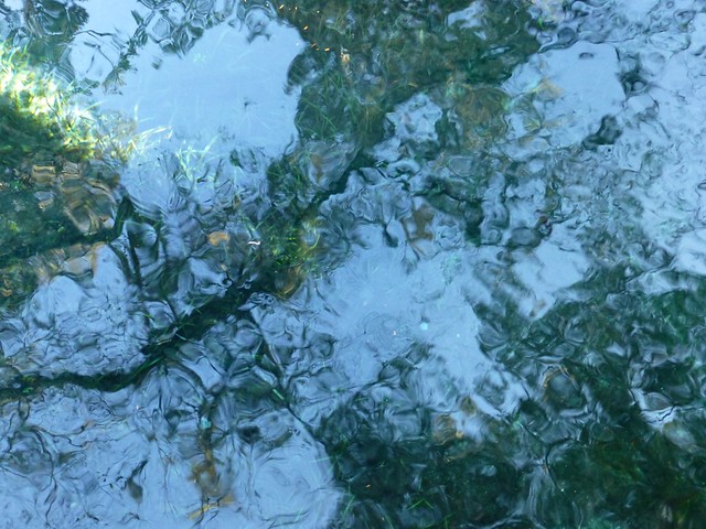
Dammit! I just went & stamped on my camera. That's because I know we have the same camera, but that I will never, ever achieve a photo as wonderful as the first one in Reply #72, nor indeed, as any of your nature shots.  I am going to look at the video, really I am, but I take seriously the warning about not for the faint of heart. The line drawing of the blue hole gives me the heebie-jeebies! Htmb, you've probably said & I missed it, but are the pictures you're showing right now from this season? In other words, what could be seen in the area right now? Absolutely fascinating account of the underground stream in your home village, Mossie! Does anyone know if chalk and limestone are similar in the sense of being newer (in geological time) kinds of rock? For that matter, can chalk even be considered a rock? Regardless, your story about the appearance of the water from below gives a whole other dimension to "the ground beneath our feet". Interesting that it did it in 1939, too -- definitely a precursor to bad times. |
|
|
|
Post by mossie on Nov 6, 2012 20:35:28 GMT
Some super scenery there htmb, sorry to hijack your excellent thread.
My little village is Elham about 10 miles south of Canterbury in Kent, but I left home in 1948, although of course I returned many times while my parents were still alive. If you find it on Google Earth there are some good Panoramio photos.
|
|
|
|
Post by htmb on Nov 6, 2012 21:07:40 GMT
Well, bixa, that's just not true. Your photos with the new camera have been wonderful!! I'm glad you liked these shots of mine.
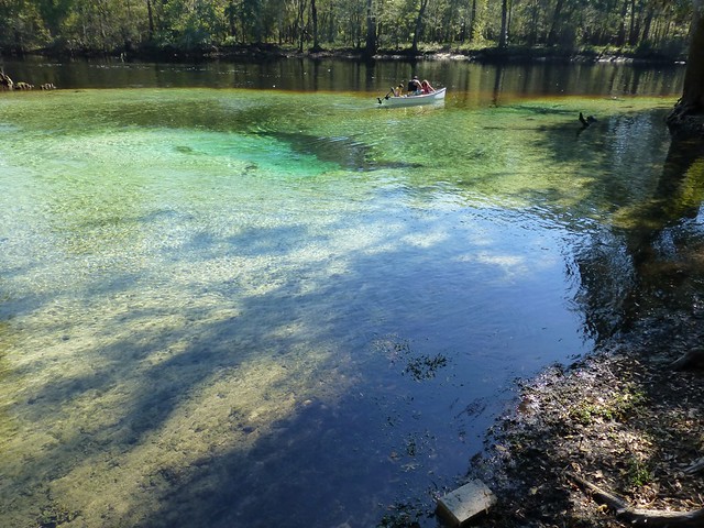
I actually took all the photos of the Santa Fe and Ichetucknee this past Saturday. In fact, all the photos in the thread were posted within days of taking them except for a couple of early Ichetucknee shots (on page 2).
Thanks, Mossie. I will have to look up your home stream on google.
|
|
|
|
Post by Deleted on Nov 6, 2012 21:22:23 GMT
The photos just keep getting better and better. I absolutely must find my photos of Crystal River, though! I'll probably have to scan them all again -- not a big problem.
|
|
|
|
Post by htmb on Nov 6, 2012 21:25:50 GMT
Yes, you really must, kerouac, and your photos of Washington, DC, too.
|
|
|
|
Post by htmb on Nov 6, 2012 22:42:06 GMT
|
|
|
|
Post by htmb on Nov 6, 2012 23:00:47 GMT
|
|
|
|
Post by htmb on Nov 7, 2012 0:26:14 GMT
Some super scenery there htmb, sorry to hijack your excellent thread. My little village is Elham about 10 miles south of Canterbury in Kent, but I left home in 1948, although of course I returned many times while my parents were still alive. If you find it on Google Earth there are some good Panoramio photos. Elham looks like a lovely little village, Mossie. One I'd like to visit. I've been to Bogner (to see family), which I suppose is about a three hour drive west from Elham. I've also been to London, Oxford, and a few other places in the area, but I really would like to see more of England than what I took in during a ten day trip thirty years ago. |
|
|
|
Post by nycboy on Nov 7, 2012 3:25:43 GMT
I had a very memorable trip to Okefenokee when I was a kid, I have to get back there one of these days, hopefully with kids of my own.
|
|
|
|
Post by nycgirl on Nov 7, 2012 5:23:51 GMT
Such beautiful scenery, and I love the Monet-like reflections you captured. You have a great eye. I would love to while away a few hours kayaking there. I'd pass on diving in the jug hole, though. I'm not even very claustrophobic, but I'd be hyperventilating. I had a very memorable trip to Okefenokee when I was a kid, I have to get back there one of these days, hopefully with kids of my own. I've never been. My husband never takes me anywhere. |
|
|
|
Post by htmb on Nov 7, 2012 13:48:59 GMT
Though with the right mask and flippers I might venture down into Blue Hole a little bit, I would not attempt to go all the way down to the 50 ft bottom of the main entrance (and I doubt I physically could even if I wanted to). Cave diving is for certified experts only, and terrible accidents can even happen to some of the more experienced divers. At Ichetucknee Springs State Park divers are required to leave their certification card at the ranger office before diving in Blue Hole.
What amazes me is the volume of water flowing out of the spring, 26, 668 gallons per minute. In one of the reports I read from a cave diver, he stated there is a strong current of water flowing out of the spring making it even more challenging to swim down into the lower regions of the cave system.
|
|
|
|
Post by tod2 on Nov 7, 2012 15:02:51 GMT
Thoroughly enjoying this wonderful photo-essay! I have never seen a sinkhole with water. The nearest was the Lava Caves in Australia where you could fall down a hole if you strayed off the designated pathway.
Thanks htmb for the great photos!
|
|
|
|
Post by htmb on Nov 7, 2012 16:38:33 GMT
Thank you very much, Tod  |
|
|
|
Post by nycboy on Nov 8, 2012 2:11:32 GMT
I had a very memorable trip to Okefenokee when I was a kid, I have to get back there one of these days, hopefully with kids of my own. I've never been. My husband never takes me anywhere. Never said they'd be your kids! |
|