|
|
Post by mossie on Nov 14, 2012 20:14:39 GMT
I didn't want to hijack Marks thread on the Jordan, I've trampled all over it already I'm afraid. But Mount Sinai bugged me, so I did another search and found the picture of an icon. 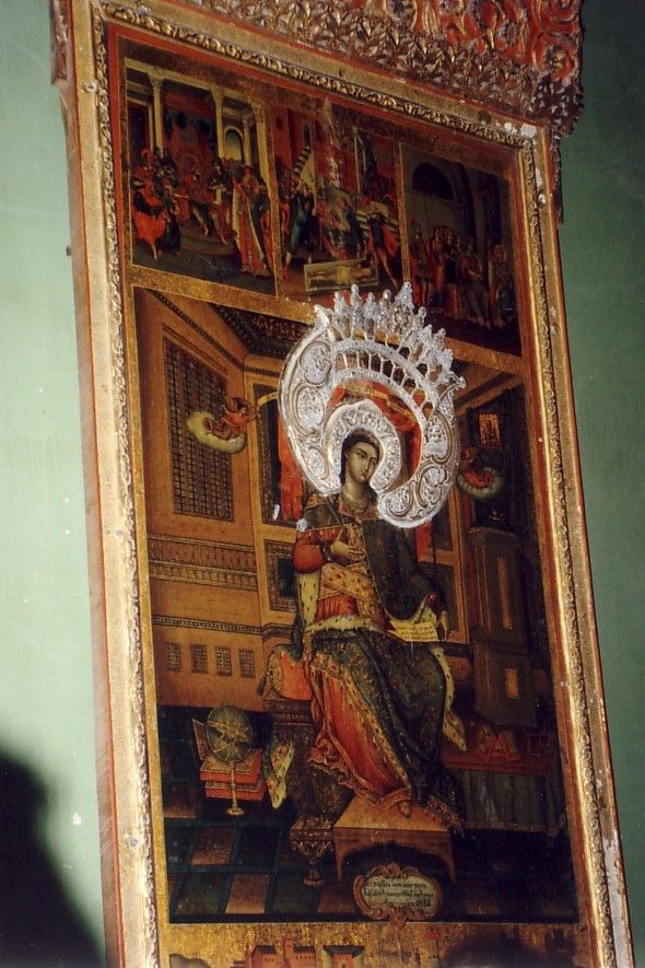 The strangely named Monastery of St Catherine sits in a deep valley at the foot of Mount Sinai in one of the most inhospitable spots in Egypt. My pilot was mad keen to see it, so one afternoon, when we could slide off in one of Her Majesty's precious aeroplanes, we went looking for it. Our fuel was such that I allowed 10 minutes for locating it, once we had reached the area. It was a poor day, the cloud cover was only just above the mountain tops. Mount Sinai is about 8500 feet high, and we spent some time zooming through the valleys before finding it. What the locals in that desolate region thought, I dread to think  Anyway here is how it looked when I visited more recently 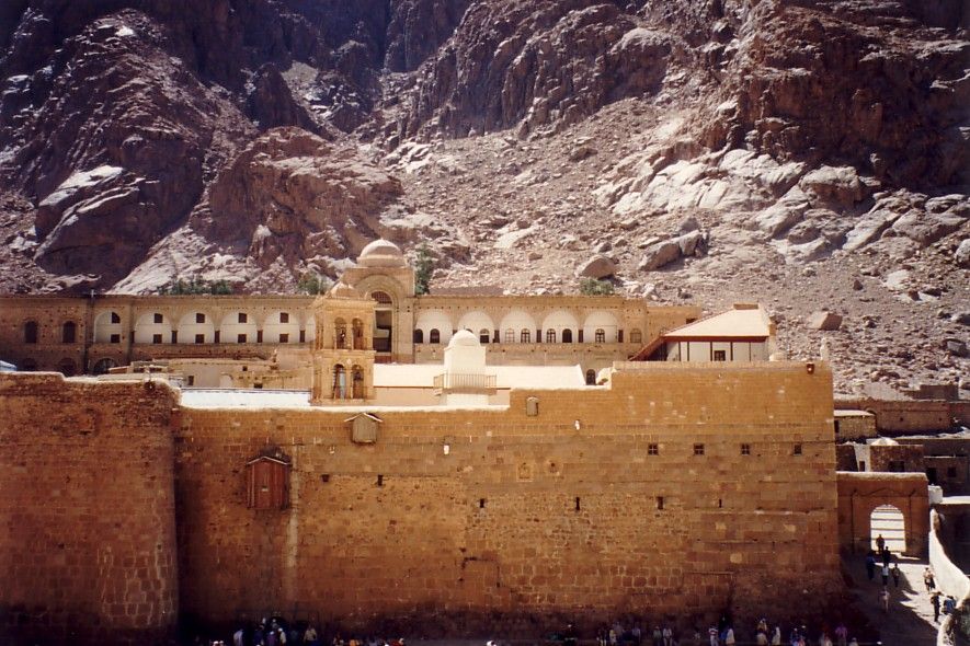 The box near the top of the wall was where the original inhabitants and visitors were hoisted in and out. There was no other entrance so as to keep out the marauding Bedouin. This was built about 550AD by the Emperor Justinian to house the relics of St Catherine. Wikipedia as always, goes into considerable detail. How poor Moses got on carrying the stone tablets down that hill is a mystery. It is on this map, near the bottom of the Sinai peninsula, marked as G(ebel) Katherina, with a spot height of 2841 metres or 8642 feet. Gebel being Arabic for hill or mountain 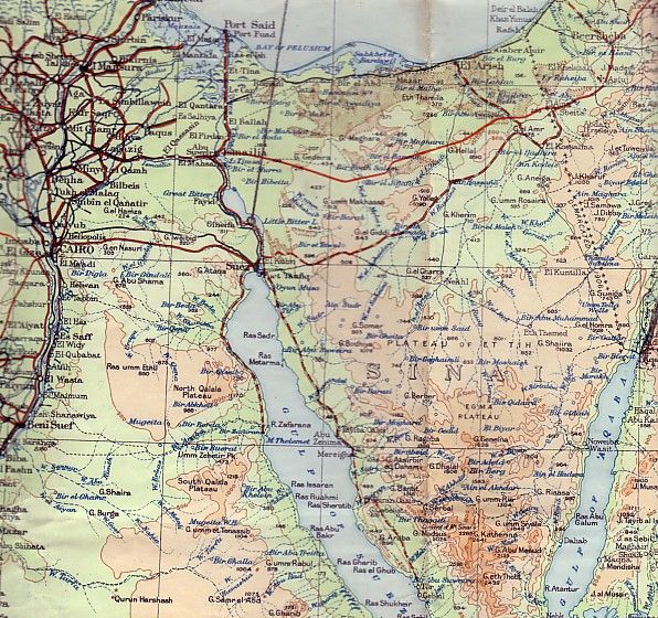 |
|
|
|
Post by mossie on Nov 15, 2012 8:10:22 GMT
I must apologise to Egypt for ceding Mt Sinai to Jordan, and I did Geography in my General Schools exams  I snitched the picture of the icon when we went on a guided tour of the church. The monk leading the party was most insistent that there were no photos. The place was not lit so I had to use flash . The picture was scanned from a print, I shall have to find the album as there are a few more. |
|
|
|
Post by bixaorellana on Dec 1, 2012 15:25:50 GMT
November has not only gotten past me way too quickly, it's taken some excellent threads along with it. I'm just now seeing this, Mossie. These bible threads have been a revelation, as my imagination is incorrectly stocked with either saccharine images meant to illustrate the major stories, or Renaissance paintings that actually show the Tuscan countryside.
Mount Sinai is 8500 feet high?! No wonder it's deemed a place where someone would go to meet God. Do you have any idea if the region was quite so desolate in Old Testament times or, for that matter, in 550 AD? (& no, I'm not suggesting that you'd actually remember it from back when)
So, have you laid your hands on that album yet? More pics & more details, please!
|
|
|
|
Post by Deleted on Dec 1, 2012 20:21:50 GMT
Fascinating, mossie. The Monastery of St Catherine looks awesome. I wonder how they maintain it, to keep it such a good condition?
|
|
|
|
Post by mossie on Dec 2, 2012 15:18:46 GMT
The monastery is staffed by a group of volunteer Greek Orthodox monks, who are extremely devout. The pure desert air also helps to keep it looking reasonable. here is the other half of it 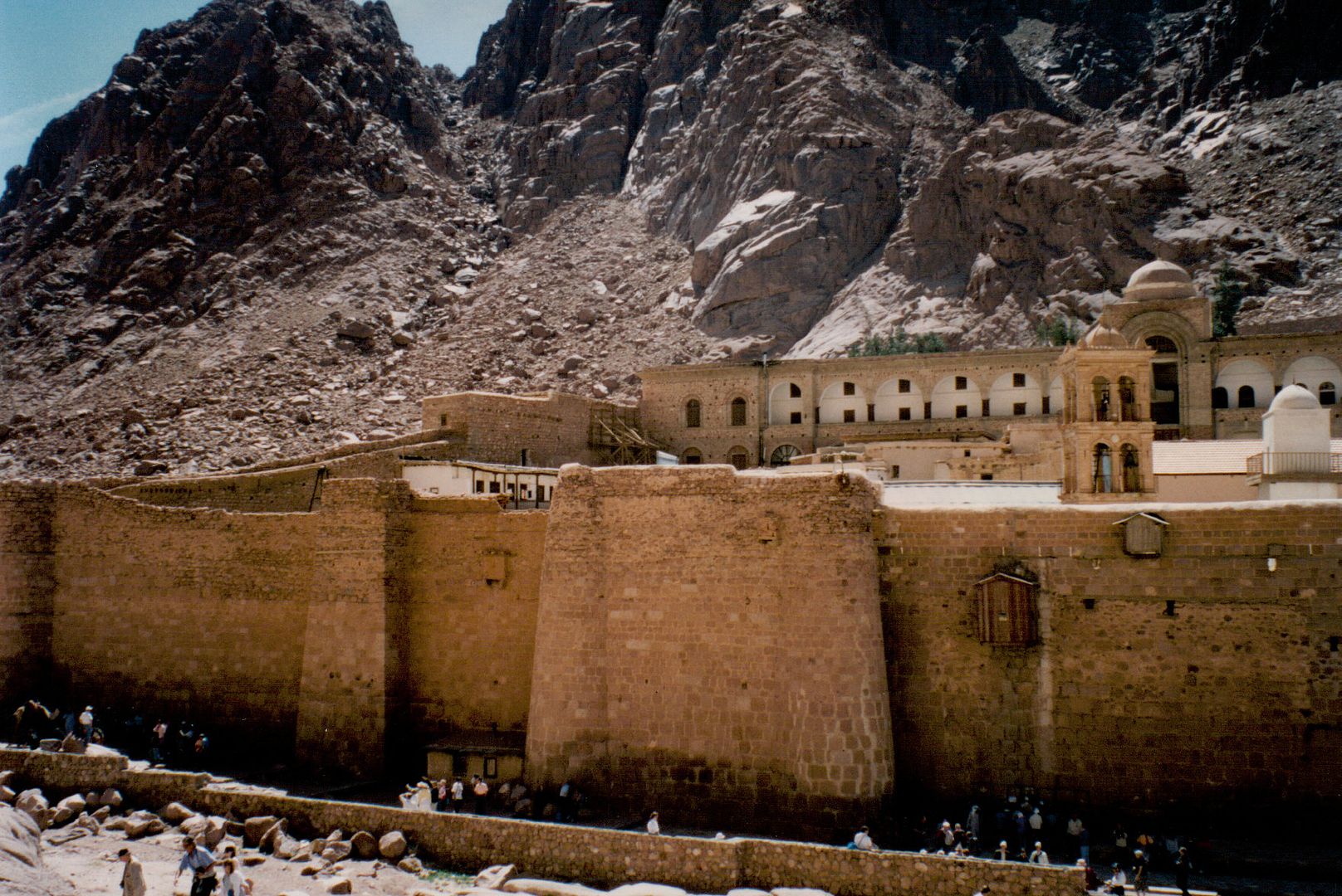 And for Marks benefit here is the original Burning Bush, still carefully tended in the little corner built round it to protect it. (Oh ye of little faith) 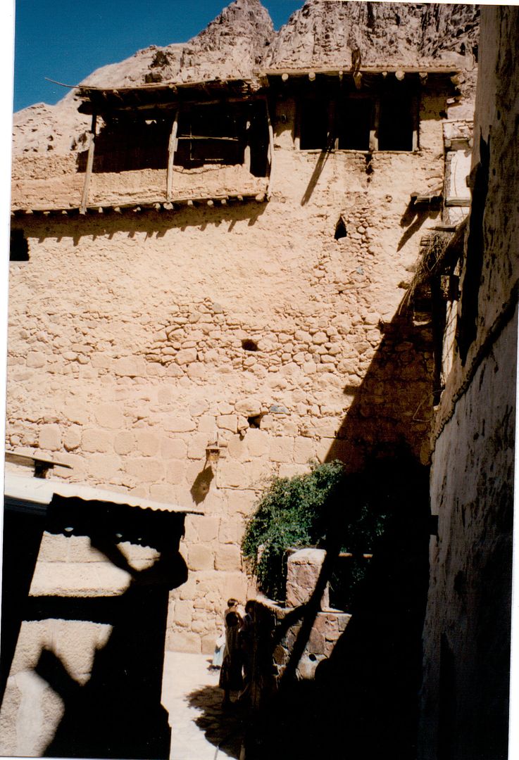 here is St George killing the dragon. I am wondering if anyone knows who is the little fellow riding pillion? 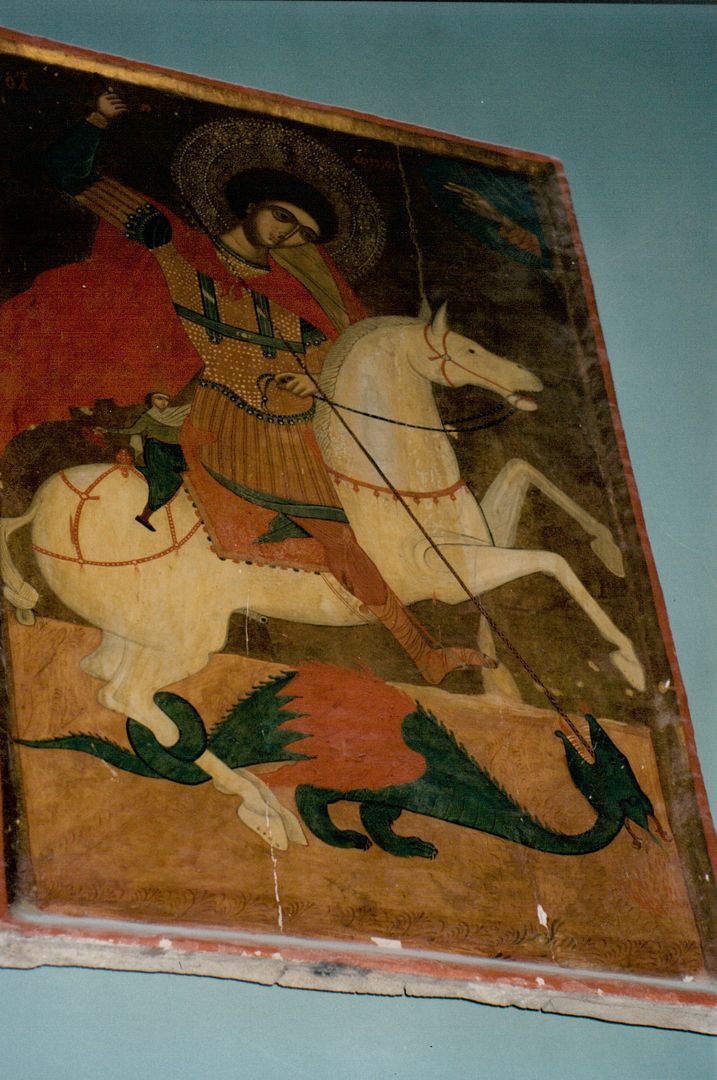 Keeping in season, here is St Nicholas 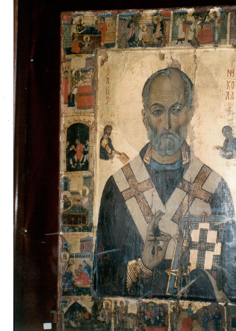 On this excursion we also visited Wadi Fieran, home to the quaintly named Monastery of the Nine Nuns 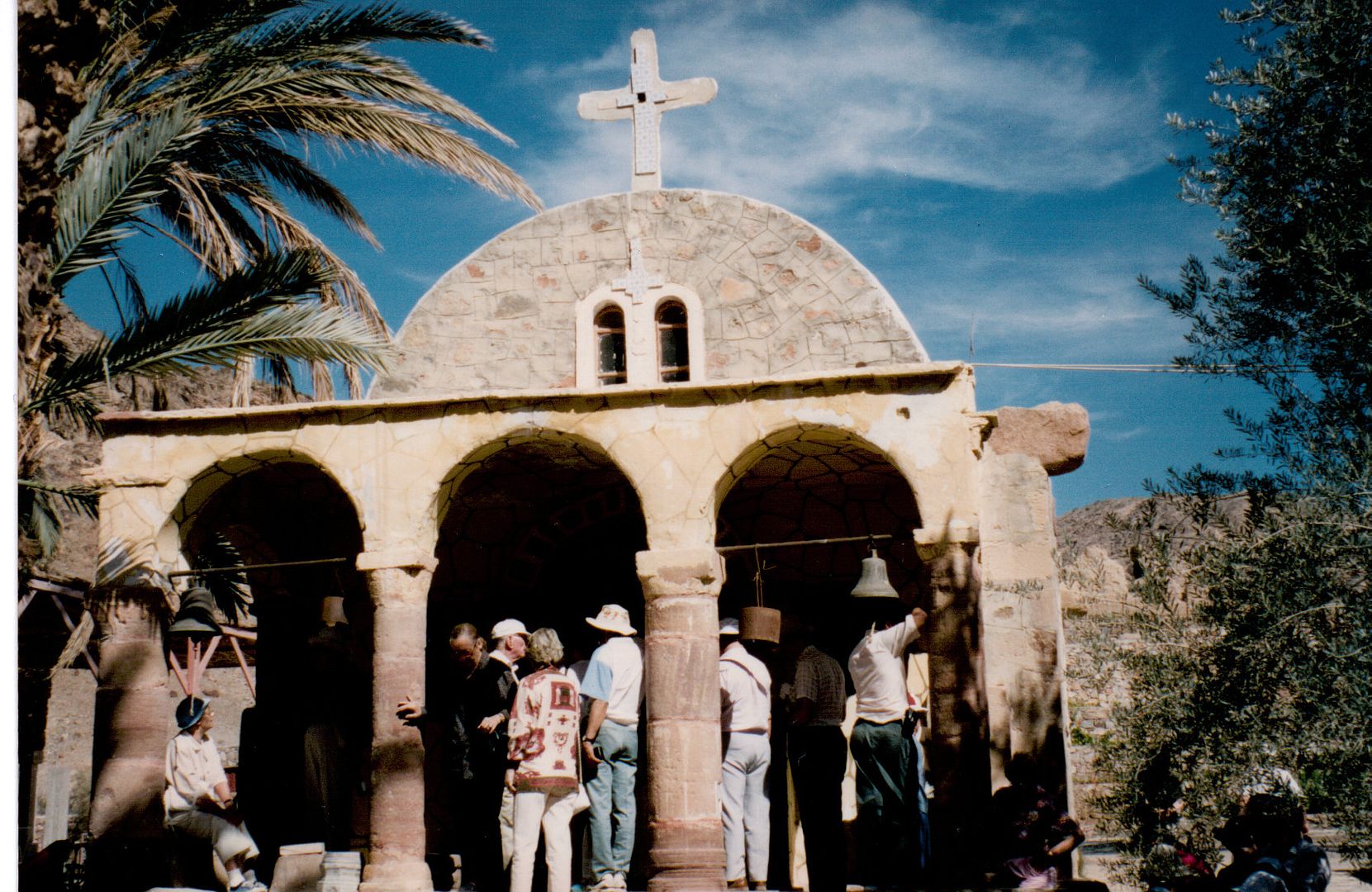 Located in an equally desolate spot 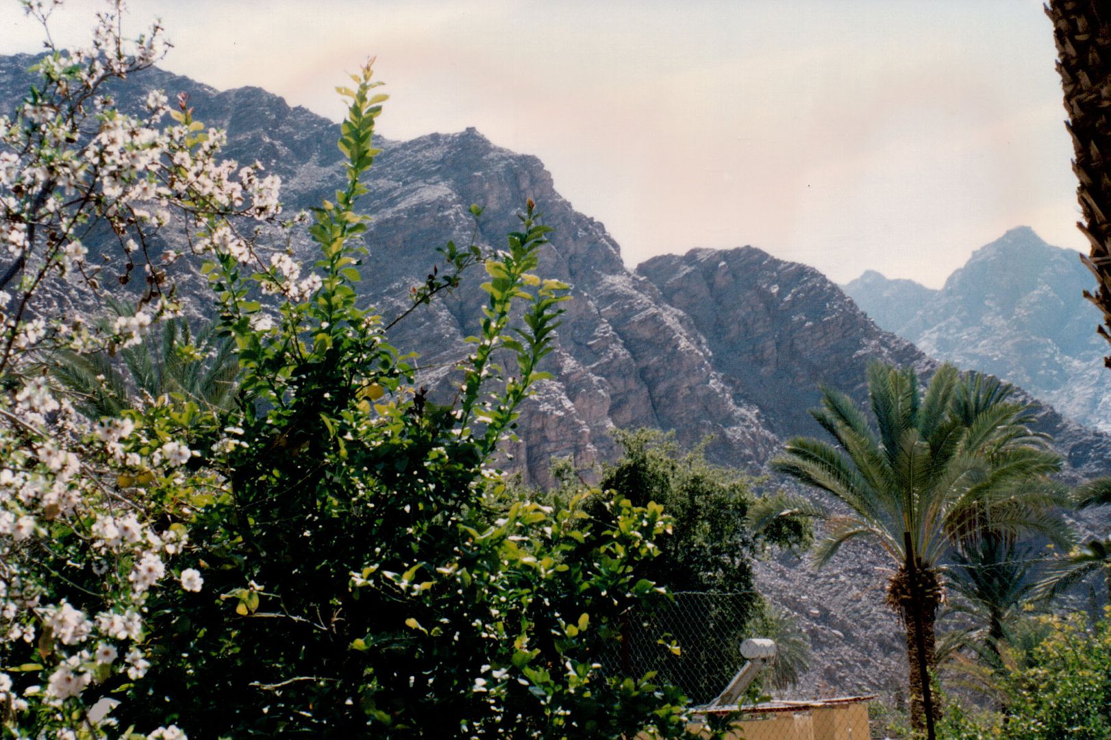 Some of the local children came to inspect us. I had captioned the original print in my album "the local children soon appeared and looked so much cleaner and well dressed than I remembered". This trip was in March 1994, I had served in Egypt Feb '52 to Aug '54. 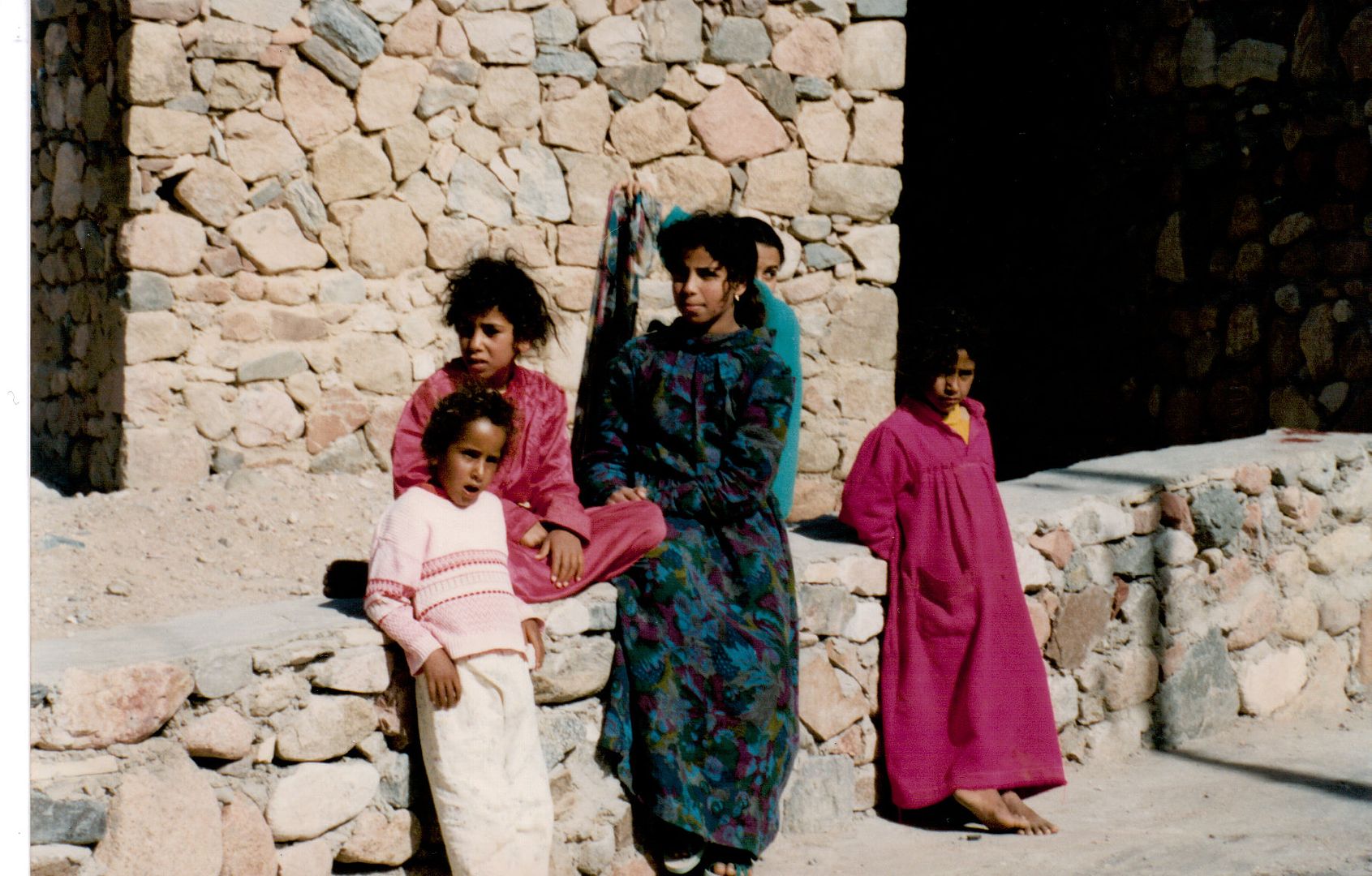 |
|
|
|
Post by onlymark on Dec 2, 2012 18:17:09 GMT
Thanks for this mossie. I have been there a few times but never seemed to take any photos. The burning bush still looks rather green considering. As regards the person on the horse behind St George it could well be the Prince/King/Nobleman who obtained assistance from Mr. George (he wasn't a saint then) to kill the dragon so that it didn't devour the daughter who had been offered to appease the dragon to allow local villagers to collect water from the lake/well. Funnily enough, not far from me is a town called Madaba with a St. George's church. Therein lies a piece of art showing George, the daughter and the king/prince amount the flanks of the said equine mammal - www.bible.ca/archeology/maps-bible-archeology-exodus-ancient-geographers-madaba-map-st-george-slaying-dragon-dinosaur.jpg |
|
|
|
Post by mossie on Dec 2, 2012 20:03:56 GMT
Thanks for clarifying that Mark. It is interesting how similar the two pictures are, even down to the knot in the horses tail. Yours of course adds the sacrificial virgin into the bargain. Strange also that it parallels the story of Andromeda, I suppose there are many of these legends sculling about.
|
|
|
|
Post by mossie on Dec 2, 2012 20:29:38 GMT
Bixa, I think the Sinai has always been a bad place. That was the wilderness in which the Israelis spent 40 years trying to find the promised land. The southern half where these monasteries are is extremely rocky, most of it looks as if it is just piles of stone as have just been tipped out of a dump truck. The southern and eastern coastal areas have some modern holiday resorts, but in the past the whole peninsula was home to a few tribes of nomadic Bedouin. Along the eastern, Gulf of Suez, coast there are some scruffy mines where precious stone has been got, going back to the time of the Queen of Sheba. There is also some small scale oil extraction. Moses burning bush was most likely an oil flare, the airfield that I was stationed on was called Kabrit after the local village. While kabrit in Creole means goat, in Arabic it means light or flame. There was signs of oil or some other mineral staining the sand on the far side of the airfield near the Bitter Lake. Correct my Arabic please Mark  . The northern half is more like your average desert but still contains barren rocky hills, with areas of sand dunes caused by the dreaded khamsin which can blow for a few days at a time, obliterating everything in its path in a solid cloud of sand, travelling at 30 or 40 miles per hour. The climate is awful, 100+ by day in summer, dropping sharply at night, which splits the rocks. The winters range from 50 to 80 with the occasional frost and the rare heavy shower which causes flash floods in the wadis. Incidentally, in the north is a very strange feature, Lake Bardawil. This is formed on the Mediterranean coast by two sand bars which enclose this inland sea. It supports a tribe called Bardawil, who live on fish. They catch them by allowing the sea in with the fish through narrow channels, then when the tide goes out, they put nets across the channels. End of lecture. |
|
|
|
Post by onlymark on Dec 3, 2012 4:18:37 GMT
Can't correct your Arabic mossie as I only know a few words - of which you've mentioned one of them, khamsin, which means the number fifty.
|
|
|
|
Post by Deleted on Dec 4, 2012 17:31:22 GMT
Well the monks must be very devoted, they do a great job on the upkeep of the monastery.
|
|
|
|
Post by nycgirl on Dec 6, 2012 3:53:23 GMT
That sure is a lovely and remarkably well-preserved monastery. Interesting information about the Sinai, too.
|
|
|
|
Post by bixaorellana on Dec 6, 2012 4:51:31 GMT
Mossie, that's fascinating information about the region. The theory about the burning bush is particularly interesting, as I've often wondered how a story like that would get started & then stuck into the popular consciousness until it finally got written down. (I reject the chariots of the gods theory. ) Amazing to think about that hostile terrain being inhabited, no matter how sparsely, through the ages. Imagine those fisherman using a technique their ancestors must have developed back in pre-history! Your "lecture" of really vivid descriptions and most interesting information is most appreciated. |
|


 .
.