|
|
Post by anshjain97 on May 16, 2013 16:09:40 GMT
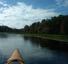
If some pictures appear missing, hopefully this will help:  Just testing...this one is the view of the skyline from the car when coming from the airport. |
|
|
|
Post by anshjain97 on May 16, 2013 16:31:09 GMT
OK- that's a bit small. My next ones will be bigger.  This one is Columbus Av from the base of the Transamerica Pyramid. This direction is North Beach, SF's Little Italy. Will come to it later.  This is the busy area outside Chipotle near my hotel. Here's a view of Huntington Park, the small square opposite Grace Cathedral.  Here's the view from just opposite Grace Cathedral.  And here's the perch up the steep incline I was talking about...4-5 blocks north.   Here's the metro- also known as MUNI Streetcar (MUNI is the name of the company running SF public transport- buses, streetcar and cable car).  |
|
|
|
Post by anshjain97 on May 16, 2013 16:46:49 GMT
The next day we saw 2 major SF landmarks: the Alcatraz and the Golden Gate bridge. Tickets to visit Alcatraz can only be bought from one company and can book out days in advance- so we bought our tickets more than a week in advance. We had breakfast in this place barely a block from the hotel:  Later, I would have their amazing macaroons. It's very difficult to find good macaroons in India- the best ones (rather, the only ones I've had outside India) were here and from a small bakery in Nice, France. We went to Market St to grab a streetcar for the Embarcadero- the seaside road- to head to the pier from which our ferry was leaving. Here is a shot of Market St:  Here is a street going south of Market street in the area of...you guessed it, South of Market (SoMa). I will come back to this part of town later.  We had to wait a bit for our ferry's departure. From the lines, there was a good view of the area around. Transamerica Pyramid on the left and Coit Tower on the right.  And...then the ferry left. Perfect views were awaiting us...here is one of the Fisherman's Wharf area. Notice all the boats.  |
|
|
|
Post by htmb on May 16, 2013 22:18:13 GMT
Looks like you had good, clear weather for going out in the bay.
|
|
|
|
Post by anshjain97 on May 17, 2013 0:22:18 GMT
Yes- the weather was very clear allowing for perfect views (and photos) from the ferry as well as from Alcatraz itself.
|
|
|
|
Post by Deleted on May 17, 2013 5:08:59 GMT
I didn't realise that Alcatraz has become so popular. When I visited it, I just walked up, bought my ticket and took the next boat.
|
|
|
|
Post by bixaorellana on May 17, 2013 6:10:33 GMT
Great report, Ansh. You really got some super angles in your pictures, and nice rich color, too. It's very difficult to find good macaroons in India Do you mean what I mean by macaroons -- those chewy, sweet, coconut cookies? If you mean that & not the French macarons, you reeeeeeeeally ought to start making & selling them when you get back home. You could be a zillionaire before you're 21! |
|
|
|
Post by bjd on May 17, 2013 6:29:25 GMT
This is all interesting because I had no idea what San Francisco actually looked like. All we ever see in tourism advertising photographs are those old Victorian-style houses on a hill or else Golden Gate bridge.
|
|
|
|
Post by anshjain97 on May 17, 2013 8:27:58 GMT
Bixa, actually, yes, I'm talking about macarons, not macaroons, wonder why I called them that!
|
|
|
|
Post by anshjain97 on May 17, 2013 8:53:28 GMT
Here's the first view of Alcatraz with the stunning bay behind.  And here's a view of the city's skyline.  Here's the first view of Alcatraz's buildings.  Built as a military facility, it was converted to a prison in the 1930s, amongst the most high-security prison in the US- home to only convicts (no undertrials) who were thought to be an escape risk. The main attraction there is the main cellhouse. However, before getting there, there is a small building with some old photos of Alcatraz. Here's one with the prisoners at work.  Look at this sign:  At the entrance of the cellhouse:  Alcatraz is known for its amazing audio tour, which contains interviews with convicts as well as officials. It is both informative and touching. Here is a typical cell:  |
|
|
|
Post by anshjain97 on May 17, 2013 11:36:13 GMT
A closeup of the skyline- the slopes are so mind-boggling!  That was towards the end of our time at Alcatraz- I was feeling claustrophobic! We took the ferry back, and headed for uber-touristy Pier 39- a place with a theme-park like atmosphere- with loads of great restaurants. Here is its entrance on the Embarcadero:  And here are a few more shots of the area:   We went to a first floor restaurant. There were nice views from up there.  After having lunch, we walked the short way to Ghirardelli Sq, the centerpiece of the chocolate maker Gihrardelli. Besides being a shop, it is home to its world-famous ice cream parlour.  We then went back to the hotel because my dad was meeting up with a friend who lives in the Bay Area. This friend then volunteered to take us to the Golden Gate bridge that evening. Random streetview: This one is most likely in the Polk Gulch area: another rather upscale residential area near Nob Hill.  We decided to stop for a few minutes on a famous, crooked part of Lombard St. The road spirals as it goes downhill here, and this spot in Russian Hill affords great views.  Here is that crooked section of that street.  The plants were added later to beautify the road. |
|
|
|
Post by lugg on May 19, 2013 5:34:51 GMT
Just caught up with your last postings Ansh. All your photos are showing for me in these sections but some still missing on pg1. The close up photo of the skyline and then the very last looking down the crooked road illustrate the city's steep inclines so well. Of course I have to ask did you try any of the chocolate or ice-cream  |
|
|
|
Post by bjd on May 19, 2013 6:32:00 GMT
Nice view from Russian Hill.
Ansh, you're too young to know this movie, but you might enjoy seeing the hilly streets of SF
|
|
|
|
Post by anshjain97 on May 19, 2013 11:10:28 GMT
Hi Lugg, yes, the pictures I have posted in #30-31 are replacements of the missing ones. Sorry for the missing ones- I tried to create more space on my flickr account by deleting some old ones; didn't know these would stop showing here. Funnily, I can still see them though. Didn't have their ice cream but got back some chocolates. Unsurprisingly I saw several flavours here which I haven't seen in other parts of US or in Europe.
Thanks bjd, I will take a look at that.
|
|
|
|
Post by anshjain97 on May 19, 2013 11:21:12 GMT
My first uploads every time seem to have to reduced by 84% every time...I will post these later, when I can use my Flickr account again. Here is a view of the Bay and Alcatraz from near the Golden gate bridge.  Here is the bridge from close to its base.  And here's a view of the bridge, from it.  Besides being a tourist attraction, this bridge is actually an important link, the only direct route from the city to Marin county. A view of the city from the bridge.  I would've tried to take more and better pictures but it was cold and very windy. Below is a shot of the Presidio area. Once a military area, now property can be bought be anyone.  Here is the Palace of Fine Arts. I don't know much about it, but here's a small Wiki description: " a monumental structure originally constructed for the 1915 Panama-Pacific Exposition in order to exhibit works of art presented there. One of only a few surviving structures from the Exposition, it is the only one still situated on its original site. It was rebuilt in 1965, and renovation of the lagoon, walkways, and a seismic retrofit were completed in early 2009."  Right opposite it is one of the Marina's residential streets.  As you can see, this area was pretty dead; yes there was some traffic, but very few pedestrians. It was a Monday evening. |
|
|
|
Post by anshjain97 on May 19, 2013 11:51:20 GMT
But here's a slightly more lively street in the same area: as you can see, there seems to be some commerce going about.  Back to passing through Polk Gulch, here one must park perpendicular to the street.  A random streetview  |
|
|
|
Post by htmb on May 19, 2013 16:02:19 GMT
No need to take more bridge pictures, Ansh. Yours are perfect!
|
|
|
|
Post by anshjain97 on May 20, 2013 0:59:36 GMT
Thanks htmb! Although I would like to show one more: which I had taken from Coit Tower. That was my favourite viewpoint in all of SF.
|
|
|
|
Post by anshjain97 on May 21, 2013 13:29:53 GMT
The next day my dad had to go to work so he left early. Bored, we left around 8 am too- far too early to see the hubbub of Chinatown. Anyways, here is the first view of the area as you come east on California St.  The red structure is the Old St Mary's cathedral.  A quick look inside.  Then we simply took a stroll though Chinatown.   Hereabouts, Chinatown merges with the Financial District.  But we stay in Chinatown itself- the streets here would be far more lively a few hours later, but right now it's just empty.  Here's another street looking down towards the Financial District.   And here's the famous Chinatown's Dragon Gate.  |
|
|
|
Post by bixaorellana on May 21, 2013 17:43:17 GMT
You all really got around! Super coverage, Ansh. The way you show what's adjacent to major tourist attactions is particularly interesting. Love your skyline pic, with the major streets sloping down to the ocean and the wonderful one from the bridge, where the city appears to float.
|
|
|
|
Post by fgrsk8r1970 on May 21, 2013 17:44:53 GMT
Those are great photos !! I just spent a few days with my dad in SF (his first time) mid April and I love it. We did drive there so traffic was horrible for me crossing the Bay Bridge LOL.
I thought about taking dad to Alcatraz but as it has to be booked at least a week in advance I didn't want to chance it because of weather. Kerouac - first time I went there in 1994 I did the same, walk up and buy a ticket.... times certainly have changed.
Anyway - again.. thanks for sharing this great report and photos Ansh, I am really enjoying it!
|
|
|
|
Post by nycgirl on May 21, 2013 23:43:32 GMT
Nice report. I took a quick look at your blog, too. Wow, you sure have covered a lot of ground! Good for you. It's great that you're documenting it all.
Lombard Street is wacky, isn't it? The hairpin turns were created because the steep grade was too hazardous, both for cars and pedestrians.
|
|
|
|
Post by htmb on May 21, 2013 23:50:15 GMT
Back when I went to San Francisco for the first time with my mother, sister and brother, the boat only cruised around Alcatraz. There were no tours of the prison (which had been closed at that point).
It was on one of those China town streets that I talked my mother into letting me get my ears pierced. I recognized the area as soon as I saw your photo, Ansh.
|
|
|
|
Post by anshjain97 on May 24, 2013 6:20:13 GMT
Thanks all! Here's some more of Chinatown:   A temple here:  And exiting Chinatown, towards Financial District.  Right there, here's Kearney St, a major street.  My internet is sketchy so I'll post before going further. |
|
|
|
Post by anshjain97 on May 24, 2013 6:35:05 GMT
Then we thought of going to Golden Gate Park- it's SF's major park and it's huge. It has nothing to do with the Golden Gate bridge- it is in a completely different area. This park is located in southwest SF. We approached the park from the south from the Sunset area. It looks like a nice area but seems to have crime issues. Here's a picture of the area:  Unfortunately, we didn't see anything because everyone seems to drive here (there are major roads right in the middle of the park), there were no signboards and no pedestrians. So we headed back. Here's a bit of the park. I didn't want to flash my camera around in a desolate area devoid of pedestrians.  Back around Union Sq, we decided to walk around the streets around, which are the main shopping area of SF with lively streets.  Towards the Financial District now, this building looked interesting.  I decided then to walk around the district south of Market St, called South of Market (SoMa).   A food truck was parked here. It was the first one of its kind I remember seeing.  Which reminded me- it was time for lunch. |
|
|
|
Post by bixaorellana on May 25, 2013 4:06:10 GMT
........ and we're left dangling, wondering what he had. Dim sum? Tacos? Seafood?
Yet again, super job of capturing urban scenes, Ansh. Love your angles. It does kind of make me cringe, looking at all those acres of glass & thinking about earthquakes.
|
|
|
|
Post by anshjain97 on May 25, 2013 4:38:01 GMT
We decided to take a take away of falafel sandwiches from a small Lebanese deli and eat them while sitting on Union Sq.
I too am wondering of the consequences of the earthquake that is supposed to strike the city in the coming decades...
|
|
|
|
Post by htmb on May 25, 2013 6:59:17 GMT
The first time I saw Golden Gate Park it was filled with "nasty, dirty hippies." The year was 1967.  |
|
|
|
Post by anshjain97 on May 25, 2013 9:37:24 GMT
Htmb, must have been a rather unsafe place back then? We continued in the SoMa district. It was pretty different- seemed more densely packed than other parts of SF but hey- I like the urban atmosphere.  And then we ran into the Yerba Buena Gardens. It is part of the famous Yerba Buena Centre for the Ars. Wiki says: "Yerba Buena Center for the Arts (YBCA) is a multi-disciplinary contemporary arts center in San Francisco, California, United States. Located in Yerba Buena Gardens, YBCA features visual art, performance, and film/video that celebrates local, national, and international artists and the Bay Area's diverse communities. YBCA programs year-round in two landmark buildings—the Galleries and Forum by Japanese architect Fumihiko Maki and Theater by American architect James Stewart Polshek."  Opposite it was this peculiar looking building.  Not interested in the arts, we just sat for a while in the gardens; the setting was pretty good. Here was the view from it.  The concrete jungle just around:  I am encountering a problem here, so sorry, will post later. |
|
|
|
Post by anshjain97 on May 25, 2013 9:46:04 GMT
Here is the fountain in the garden.  Leading from the other side, to Market St is a small lane called the Yerba Buena Lane. A few pictures of that. One of these buildings may be the Cartoon museum.   And now, back to Union Sq.  |
|