|
|
Post by anshjain97 on Jan 6, 2014 14:11:48 GMT
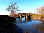
After visiting Varanasi we went to Darjeeling, which is a hill station in the state of west Bengal in north east India. The nearest airport was at Bagdogra, around 3-4 hrs away. A few pictures en route:    The railway track is used by the "toytrain"- these tiny trains run some routes in this hilly area. Finally we reached darjeeling.  It is a popular tourist destination, at an elevation of around 2000m.   This pedestrianised road was called the Mall- basically a string of shops, hotels and restaurants.  As you can see, it was relatively cold. Maybe 7-8 C at that time.     The snow-capped mountain is Kanchenjunga (8586 m- third highest in the world). If you don't like the lack of clarity, don't worry- the next day offered much better views. These were taken from my hotel terrace, which was blessed by a beautiful location. |
|
|
|
Post by Deleted on Jan 6, 2014 14:29:13 GMT
You're off to a great start again. I love the views from towns like that, but those steep streets wear me down very quickly once I start walking around -- I am reminded of Sapa, Vietnam.
|
|
|
|
Post by bjd on Jan 6, 2014 16:38:26 GMT
Looking forward to more, Ansh.
|
|
|
|
Post by anshjain97 on Jan 6, 2014 18:10:27 GMT
Next morning, the first stop was the terrace.  Notice the frost on the rooftops.  We were going to the railway station, a 15 min walk away.  Here's our old friend Kanchenjunga again.   Now for some sightseeing around the city. All these attractions were outside the main town. This is the entrance to the Japanese Peace Pagoda.  It was built in 1992. There is a temple alongside the pagoda.   The interior was interesting but photography was not allowed (a very Indian quirk). And now to the pagoda.     The next stop was Tiger Hill. It is a very popular spot to view the sunrise- the sun shines directly on Kanchenjunga on clear days. However that involves reaching the base of the hill at 3 AM and dealing with large crowds, and finally making way to the summit...no thank you! But the view in the afternoon was good enough. Since you have gotten an idea how the Kanchenjunga looks like, I'll spare you another picture. Apparently Everest could also be sighted- but not by my bad eyes. The last stop was a Buddhist monastery.     Later in the afternoon, around the mall:  Decided to visit the terrace once again for the sunset. India has only one time zone- and Darjeeling is quite east- so although it is not very northern, the sun sets at around 16.45.  Decided to take a stroll through town in the evening. This is a colonial building- of the State Bank of India.  Street views:   Lots of winter clothing on sale everywhere.  "Gorkhaland" is a proposed new state by locals in Darjeeling and around. However it is certainly not an actual state yet. Many shop signs have "Gorkhaland" written- no idea why- maybe a sign of protest, and not-so-subtle calls for the new state formation?  That concluded our only full day in darjeeling. Next I will show Sikkim. |
|
|
|
Post by lugg on Jan 6, 2014 19:06:11 GMT
Interesting Ansh and great photos - I can imagine why this area produces tea looking at the slopes around the city.
Kanchenjunga is very beautiful - is it in India or Tibet?
I had no idea that, what seems such a vast country, had only one time zone.
Looking forward to reading about your next stop.
|
|
|
|
Post by anshjain97 on Jan 7, 2014 6:39:28 GMT
Hi lugg, Kanchenjunga is on the India/Nepal border. It has 5 peaks actually- some in India, some in Nepal.
|
|
|
|
Post by anshjain97 on Jan 7, 2014 15:03:25 GMT
The next day we began the 3-4 hr journey to Gangtok, capital of the state of Sikkim. State border post:  Compared to the rest of India, Sikkim is quite distinctive. I don't mean other Indian states are similar to each other but something in Sikkim strikes out. Is it the general cleanliness and lack of ramshackle buildings? Yes, definitely. Road courtesy is widespread, honking is minimal and roads are good (except for the very mountainous areas). Sikkim is the least populated (600,000 people approx) and second-smallest state in India. There are about 11 official languages. However road signs are only in English and Hindi, although some surprisingly exclusively in English. Post-independence (of India), Sikkim has a noteworthy history. Copied from Wikipedia: In 1947, when India became independent, a popular vote rejected Sikkim's joining the Indian Union, and Prime Minister Jawaharlal Nehru agreed to a special protectorate status for Sikkim. Sikkim came under the suzerainty of India, which controlled its external affairs, defence, diplomacy and communications, but Sikkim otherwise retained administrative autonomy. A state council was established in 1953 to allow for constitutional government under the Chogyal. Meanwhile, the Sikkim National Congress demanded fresh elections and greater representation for Nepalis in Sikkim. Palden Thondup Namgyal, the Chogyal at the time, proved to be extremely unpopular with the people, and in 1973, riots in front of the Chogyal's palace led to a formal request for protection from India. In 1975, the Prime Minister of Sikkim appealed to the Indian Parliament for Sikkim to become a state of India. In April of that year, the Indian Army took over the city of Gangtok and disarmed the Chogyal's palace guards. Thereafter, a referendum was held in which 97.5 per cent of voters supported abolishing the monarchy, effectively approving union with India. On 16 May 1975, Sikkim became the 22nd state of the Indian Union, and the monarchy was abolished.[24] To enable the incorporation of the new state, the Indian Parliament amended the Indian Constitution. First, the 35th Amendment laid down a set of conditions that made Sikkim an "Associate State," a special designation not used by any other state. Later, the 36th Amendment repealed the 35th Amendment, and made Sikkim a full state, adding its name to the First Schedule of the Constitution There was nothing interesting to photography on the way to Gangtok, so I would show photos from upon reaching Gangtok.   In the following image you can see the cable car, called the Gangtok Ropeway.   A decent sidewalk was maintained on one side of the road.  A road sign exclusively in English  This was our hotel- it was designed in a Buddhist style.   More later. |
|
|
|
Post by Deleted on Jan 7, 2014 15:12:39 GMT
Getting better and better. And may I venture to say that I find that your photographic skills are improving as well? (Not that they were bad before, but I think that all of us have noticed that when we started making these reports for everybody to see, we started looking at our photos differently and saw ways to improve them.)
|
|
|
|
Post by htmb on Jan 7, 2014 22:45:28 GMT
I agree. Really nice photographs. (The only thing that might help me would be if you could separate each photo with two or three spaces so they stand out a bit more. )
|
|
|
|
Post by anshjain97 on Jan 8, 2014 0:52:27 GMT
Thanks guys- that's good to know. Sure, will leave a few lines' space next time onwards.
|
|
|
|
Post by htmb on Jan 8, 2014 1:37:49 GMT
Thanks, Ansh!  |
|
|
|
Post by Deleted on Jan 8, 2014 12:20:13 GMT
Nice photos, ansh. I've heard a lot about the area, another place on my wish-list.
|
|
|
|
Post by anshjain97 on Jan 8, 2014 12:27:28 GMT
|
|
|
|
Post by anshjain97 on Jan 8, 2014 12:31:19 GMT
Sorry- don't know why, I can't seem to space them out greater for some reason. Kerouac, can you please look into this?
|
|
|
|
Post by Deleted on Jan 9, 2014 6:55:06 GMT
The spacing looks fine to me.
Wow, a pedestrianized street in India! I'm impressed. Even though motor vehicles have last priority in so many other streets, after pedestrians, bicyles, carts, stray animals, etc., it really makes an incredible difference to just see pedestrians.
|
|
|
|
Post by anshjain97 on Jan 9, 2014 13:21:01 GMT
|
|
|
|
Post by Deleted on Jan 9, 2014 21:21:23 GMT
Things look so much better maintained there than in a lot of other places you have shown us. I know a lot of people who are afraid of ever going to India, but if this were what they could expect to see, they would relax... But yes, I know that even you have told us that the condition of this part of India is exceptional.
|
|
|
|
Post by Deleted on Jan 10, 2014 13:39:09 GMT
Is it the way that Hills Station towns always seem better maintained? Better built, ansh?
|
|
|
|
Post by anshjain97 on Jan 10, 2014 15:37:29 GMT
|
|
|
|
Post by lugg on Jan 11, 2014 9:30:13 GMT
Thanks Ansh. I have just been looking at the places you visited on the map - such an isolated part of India in terms of the other states. Thanks for the link to the political history of the area. Great photos yet again. To be honest this is one of the few areas within India that I could see myself visiting and enjoying easily. Top of my list though would be Andaman and Nicobar Islands. Any chance of a report from there ?  |
|
|
|
Post by anshjain97 on Jan 11, 2014 10:27:48 GMT
Thanks, lugg. Unfortunately haven't been to Andamans and don't see myself visiting anytime soon- don't have any time to travel this year. Maybe I'll visit some years from now.
|
|
|
|
Post by Deleted on Jan 11, 2014 16:31:57 GMT
As breathtaking as the scenery is, it is hard to imagine why anybody would want to live in this area.  |
|
|
|
Post by anshjain97 on Jan 12, 2014 2:12:25 GMT
Actually nobody lives in the area between Gangtok and Nathula- except for the military (who need to be there because of the border). There are some cafes and shops for the tourists- I guess these workers go back home in the evening.
|
|